This website uses cookies, which are small text files that the website puts on your device to facilitate operation. Cookies help us provide a better service to you. They are used to track general user traffic information and to help the website function properly.
Feature count in area: 59, all in Down,
OSI/LPS Maps: 20, 29, EW-CLY
Highest Place: Slieve Donard 849m
Starting Places (33) in area Mourne Mountains: Alex Steddom Tree, Aughrim Airstrip, Ben Crom Dam, Bloody Bridge Car Park, Carlingford Greenway, Carrick Little, Crocknafeola Wood, Crotlieve Mountain, Donard Car Park Newcastle, Drummanmore Picnic, Fofanny Reservoir, Forest Office CP, Gamekeepers Lodge CP, Happy Valley Trassey Rd, Hen Mountain CP, Leitrim Lodge CP, Mayo Road Corner, Meelmore Lodge, Newcastle Harbour, Ott CP, Red Bog Road, Rourkes Park, Sandy Brae, Silent Valley Reservoir Head Rd, Slieve Donard Trail Head, Slieve Foye Viewing Point, Slievefoy Forest CP, Spelga Dam E, Spelga Dam N, Spelga Dam S, Trassey Car Park, Two Mile River CP, Yellow Water Park
Summits & other features in area Mourne Mountains: Cen: Loughshannagh: Ben Crom 526m, Carn Mountain 585.2m, Carn Mountain North Top 553.7m, Doan 592.6m, Ott Mountain 526.8m, Slieve Loughshannagh 617m, Slieve Muck 670.4m, Slievenaglogh 445m E: Binnian: Slieve Binnian 745.9m, Slieve Binnian East Top 639m, Slieve Binnian North Top 678m, Slieve Binnian North Tor 682.5m, Wee Binnian 460m E: Donard: Chimney Rock Mountain 656m, Crossone 540m, Millstone Mountain 460m, Rocky Mountain 524m, Slieve Donard 849m E: Lamagan: Cove Mountain 654.8m, Slieve Beg 595.9m, Slievelamagan 702.2m N: Bearnagh: Slieve Bearnagh 739m, Slieve Bearnagh North Tor 680m, Slieve Meelbeg 701.9m, Slieve Meelmore 687m N: Castlewellan: Slievenaboley 324m, Slievenalargy 280m, Slievenaslat 272m N: Commedagh: Slieve Commedagh 767m, Slieve Corragh 641.9m, Slievenaglogh 584.4m, Slievenaglogh East Top 571m N: Croob: Cratlieve 429m, Slieve Croob 534m, Slievegarran 391m, Slievenisky 446m N: Rathfriland: Knockiveagh 235m S: Kilkeel: Knockchree 306m S: Rostrevor: Crenville 460m, Finlieve 578m, Slievemartin 485m, Slievemeel 420m, Slievemeen 472m W: Hilltown: Gruggandoo 382m, Slieveacarnane 296m W: Slievemoughanmore: Crotlieve Mountain 347m, Eagle Mountain 638m, Rocky Mountain 404m, Shanlieve 626m, Slievemoughanmore 560m, Tievedockaragh 473m, Wee Slievemoughan 428m W: Spelga: Butter Mountain 500m, Cock Mountain 504m, Cock Mountain South-West Top 505m, Hen Mountain 354m, Pigeon Rock Mountain 534m, Pigeon Rock Mountain South Top 530m, Slievenamiskan 444m
Note: this list of places may include island features such as summits, but not
islands as such.
Finlieve, 578mMountain Fionnshliabh A name in Irish,
Place Rating ..
Ir. Fionnshilabh [PNNI 3], ‘white mountain’, Down County in Ulster province, in Arderin Beg Lists, Finlieve is the 344th highest place in Ireland.
Grid Reference J23633 20390,
OS 1:50k mapsheet 29&36 Place visited by: 64members, recently by: Gavsmi33, Carolineswalsh, Dee68, Alanjm, ElaineM76, IrelandOutdoors, Grumbler, annem, Florence, abcd, cmcv10, pcman, pdtempan, Oscar-mckinney, Jai-mckinney
I visited this place: NO (You need to be a logged-in member for this.)
Longitude: -6.11006, Latitude: 54.117763, Easting: 323633, Northing: 320390,
Prominence: 20m, Isolation: 2.3km ITM: 723555 820396 Bedrock type: Sandstone, (Hawick Group) Notes on name: Finlieve is a southern shoulder of Shanlieve / Eagle Mountain. The name is locally pronounced without the final consonant, as witnessed by the anglicised form Finley on James Williamson’s map of Co. Down (1810). The name Fionnshliabh, like Seanshliabh (Shanlieve), is linguistically notable as one of a small group of mountain names consisting of close compounds. In this case the adjective fionn, ‘white, fair’, is combined with sliabh, ‘mountain’.
Short or GPS IDs, 6 char: Fnlv, 10 char: Finlieve Linkback: https://mountainviews.ie/summit/1414/
Gallery for Finlieve (Fionnshliabh) and surrounds
Summary
for Finlieve (Fionnshliabh):
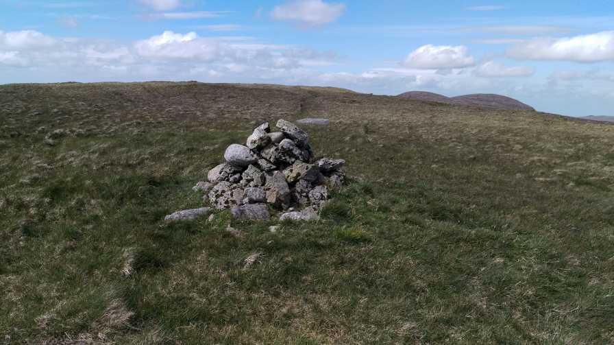
A fairly remote, nondescript top.
Summary created by Colin Murphy
2020-09-21 11:23:14
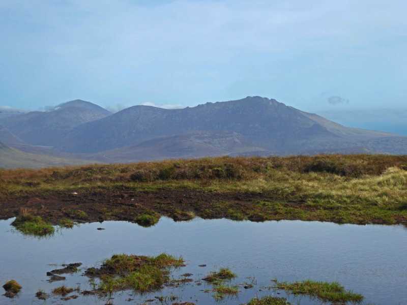
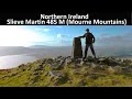
Picture: The view from near the summit.
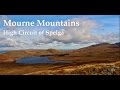
One approach is to start at the forest entrance at A (J216 237). Ascend Tievedockaragh and continue to follow Batt's Wall past the summit, down into the col. Continue along the wall (which is partly replaced by a wire fence in the col) until it starts rising again on the western slope of Shanlieve, point B (J237 228), the turn SSE, climbing for about 1km to take you up on to the broad area separating Shanlieve from Finlieve. The terrain in the area is uneven and covered in long grass and heather, and difficult to navigate. Then continue south up the gently rising slope for another 2km through an area marked by deep peat hags, to reach the summit, which is marked by a small pile of rocks. Extensive views all around of Carlingford Lough and and the Binnians in the distance.
By my calculation this is the 4th time I have had to complete my local 100, thankfully the pre 2014 remains the same. Although I have walked in this area many times over the years I could not say for certain if I visited the summit or not so, on a beautiful June afternoon, I rectified this. Parking at RedBog (J25177 17062) I accessed the summit via the track marked on the Activity Map, a nice easy ramble. Linkback: mountainviews.ie/summit/1414/comment/18135/
I started at Leitrim Lodge car park, went up past Pierce's Castle and clambered over to the Shanlieve side of Batt's Wall.
After passing Shanlieve's summit cairn I headed south to Finlieve. It was a humid day in the midst of a period of warm weather which made the terrain very dry apart from some muddy parts in the peat banks between Shanlieve and Finlieve.
I reached Finlieve's modest summit within an hour of leaving Shanlieve. Linkback: mountainviews.ie/summit/1414/comment/23588/
Use of MountainViews is governed by conditions and a privacy policy.
Read general information about the site. Opinions in material here are not necessarily endorsed by MountainViews.
Hillwalking is a risk sport. Information in comments, walks, shared GPS tracks or about starting places may
not be accurate for example as regards safety or access permission. You are responsible for your safety and your permission to walk.
See the credits and list definitions.


 Add a Place Comment for Finlieve, Fionnshliabh


 Our Facebook page.