Members and Supporters, the MountainViews Committee requests your help to meet the costs of the website and of other activities such as insured events or publications.
Feature count in area: 7, all in Cork,
OSI/LPS Maps: 80, 86, 87, 89
Highest Place: Knockshanawee 209m
Starting Places (5) in area South Cork: Ballincollop, Cooligboy Hill West, Doolieve East, Inniscarra, Timoleague Friary
Summits & other features in area South Cork: E: Doolieve: Doolieve 182.5m N: Garravagh: Garravagh North Top 164m N: Knocknaheeny: Knocknaheeny 161m N: Knockshanawee: Knockshanawee 209m S: Timoleague Hills: Ballincollop Hill 141m, Cooligboy Hill 144m, Slieveadrohid 201m
Note: this list of places may include island features such as summits, but not
islands as such.
Ballincollop Hill, 141mHill
Place Rating ..
, Cork County in Munster province, in Binnion Lists, Ballincollop Hill is the 1481th highest place in Ireland. Ballincollop Hill is the most southerly summit in the South Cork area.
Grid Reference W48800 41500,
OS 1:50k mapsheet 86 Place visited by: 24members, recently by: DeirdreM, Oscar-mckinney, Carolyn105, Kirsty, Jai-mckinney, Glanman2, dregish, Taisce, chelman7, Wildrover, Fergalh, Juanita, Daingean, CaminoPat, tommccarthy
I visited this place: NO (You need to be a logged-in member for this.)
Short or GPS IDs, 6 char: Bln141, 10 char: BlnclpHil Linkback: https://mountainviews.ie/summit/1358/
Gallery for Ballincollop Hill and surrounds
Summary
for Ballincollop Hill :
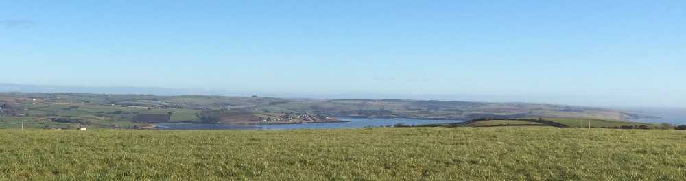
Views over Courtmac bay
Summary created by thomas_g
2014-01-17 17:17:53
Picture: Rather flat top restricts view
While I drove to within a few metres of the summit, it might be better to park at B'collop (W49128 41557) (room for 1 car). There is an interesting memorial cross at this location as well.
The summit is up a track and then over an electric! fence into a field where the track turns. The exact location of the summit is difficult to ascertain and the general flatness of the hill does restrict the view. I did try and upload my 3m 54s gps track, but apparently I didn't do enough 'activity'.
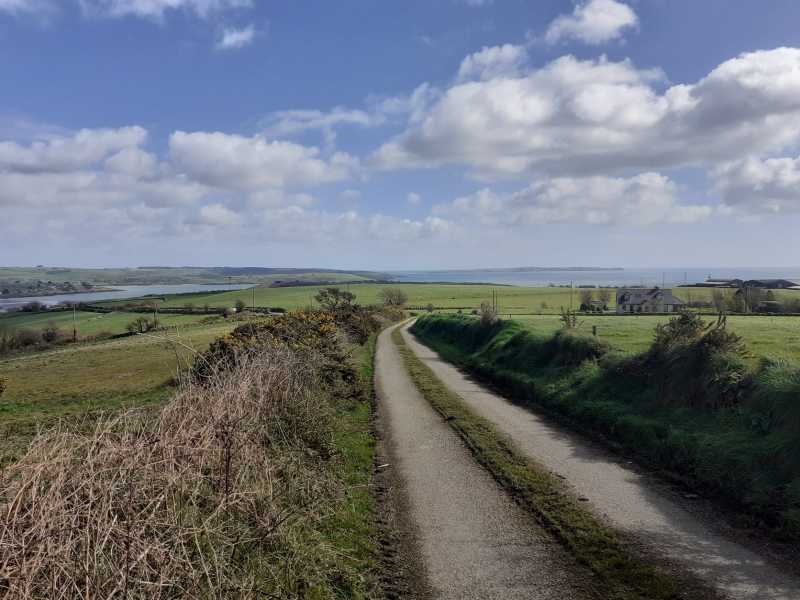
It's worth parking up in Courtmacsherry and walking up the country lanes to the top.
It's about a 6km round trip. Beautiful views on a clear day especially on the way back down.
I uploaded a GPX fie from where the actual peak seems to be. Linkback: mountainviews.ie/summit/1358/comment/24159/
Use of MountainViews is governed by conditions and a privacy policy.
Read general information about the site. Opinions in material here are not necessarily endorsed by MountainViews.
Hillwalking is a risk sport. Information in comments, walks, shared GPS tracks or about starting places may
not be accurate for example as regards safety or access permission. You are responsible for your safety and your permission to walk.
See the credits and list definitions.


 Our Facebook page.