This website uses cookies, which are small text files that the website puts on your device to facilitate operation. Cookies help us provide a better service to you. They are used to track general user traffic information and to help the website function properly.
Feature count in area: 15, all in Mayo,
OSI/LPS Maps: 23, 24, 31, 32
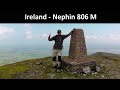
Highest Place: Nephin 806m
Starting Places (13) in area East Mayo: Bellanaderg Bridge, Cloondaff Church, Cuilkillew S, Glasheens River, Gortnadrehy South, Gortnadrehy West, L5709 Lugnamannaun River, Lough Ben, Loughanaveeny, Nephin CP Fiddaunduff, Nephin CP Forest Road, R312 Boghadoon, R312 Prughlish
Summits & other features in area East Mayo: E: Charlestown Hills: Knock Hill 213m, Mullaghanoe 234m N: Foxford Hills: Carranarah 197m, Gortnadrehy 143m NW: Nephin: Cuilkillew 130m, Nephin 806m, Tristia 322m NW: Pontoon Hills: Crucknaree 297m, Farbreiga 395m, Knockaglana 154m S: Kiltimagh Hills: Rush Hill 197m, Slieve Carn 262m W: Croaghmoyle: Burren 396m, Croaghmoyle 430m, Muckanagh Hill 220m
Note: this list of places may include island features such as summits, but not
islands as such.
Knockaglana, 154mHill
Place Rating ..
, Mayo County in Connacht province, in Binnion Lists, Knockaglana is the 1469th highest place in Ireland.
Grid Reference G20183 03310,
OS 1:50k mapsheet 31 Place visited by: 6members, recently by: eamonoc, sandman, Garmin, paddyhillsbagger, chalky, Fergalh
I visited this place: NO (You need to be a logged-in member for this.)
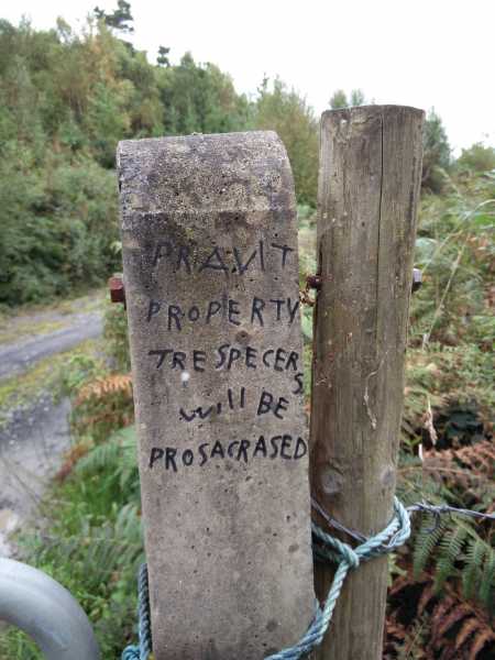
Not wishing to access the summit via the route mentioned in the previous comments the lane at A (G19667 02152) was my choice of accent, which allows easy walking up thru old homesteads to the summit . The sign on the gate post duly identified the property as Pravit and that Trespecers will be Prosacrased ......oh i would not like to be a Trespecer in Mayo. If you do wish to use this easy route you will not encounter any problems as we found the farmer very friendly. Linkback: mountainviews.ie/summit/1344/comment/18642/
Read Less
Read More
Short but tough Climb
by Fergalh
22 Mar 2014
Park at Healys pub (B (G20521 03751)) and proceed through woods to where the bracken and long boggy grass starts head upwards to summit. Wonderful views but tough climb to get there Linkback: mountainviews.ie/summit/1344/comment/15939/
Read Less
Read More
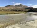
Picture: Lough Conn and Lough Cullin from near the summit.
Tough slog!
by paddyhillsbagger
5 Apr 2015
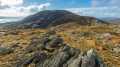
Crossing the road from Healys Pub, you immediately enter a very steep wooded jungle of undergrowth,rhododendron and rocky outcrops. If you manage to get through this there is then a rough heathery climb to the flat boggy top. The reward are the excellent views at the top. Linkback: mountainviews.ie/summit/1344/comment/17907/
Use of MountainViews is governed by conditions and a privacy policy.
Read general information about the site. Opinions in material here are not necessarily endorsed by MountainViews.
Hillwalking is a risk sport. Information in comments, walks, shared GPS tracks or about starting places may
not be accurate for example as regards safety or access permission. You are responsible for your safety and your permission to walk.
See the credits and list definitions.


 Our Facebook page.