This website uses cookies, which are small text files that the website puts on your device to facilitate operation. Cookies help us provide a better service to you. They are used to track general user traffic information and to help the website function properly.
Feature count in area: 14, all in Wexford,
OSI/LPS Maps: 61, 62, 68, 69, 76, 77, EW-B, EW-B
Highest Place: Slieveboy 420m
Starting Places (16) in area Wexford: Askamore Cemetery, Ballymore Wood, Clone Strand, Clonegal, Coolmelagh Forest CP, Cummer Wood South, Gibbet Hill West, Mary Neal's Spout, Mount St Benedict's School, R746 Half Way House, Scroughmore Cross W, Slieveboy NE, Slieveboy SE, St John's Church, Tarahill House, Vinegar Hill
Summits & other features in area Wexford: N: Bunclody: Kilmichael Hill 269.3m N: Bunclody : Gibbet Hill 315m, Kilcullen Hill 218m, Slieveboy 420m N: Enniscorthy : Oulart Hill 179m, Vinegar Hill 116.6m NE: Wexford East : Carrigroe Hill 232m, Tara Hill 253m S: Wexford South: Bree Hill 179m, Camaross Hill 181m, Forth Mountain 237m SW: New Ross Hills : Carrickbyrne Hill 233m, Lacken Hill 193m, Slievecoiltia 268.5m
Note: this list of places may include island features such as summits, but not
islands as such.
Kilcullen Hill, 218mHill
Place Rating ..
, Kilachdiarmid Hill, Wexford County in Leinster province, in no lists, Kilcullen Hill is the 1365th highest place in Ireland.
Grid Reference S91621 49114,
OS 1:50k mapsheet 68 Place visited by: 10members, recently by: MartaD, loftyobrien, Barry28213, Garmin, chalky, paddyhillsbagger, sandman, wicklore, eamonoc, Fergalh
I visited this place: NO (You need to be a logged-in member for this.)
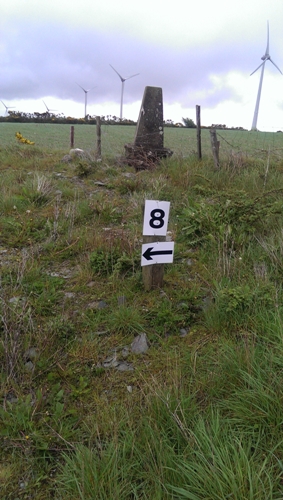
For what ever reason but more likely to allow for more efficent farming the trig has been moved app 40 meters from its original summit position.(A (S91621 49114)). Therefore for those who wish to visit the summit proper located in a tillage field for bagging purposes it would be advisable to do so in the winter months when the fields are fallow. Linkback: mountainviews.ie/summit/1268/comment/16061/
Read Less
Read More
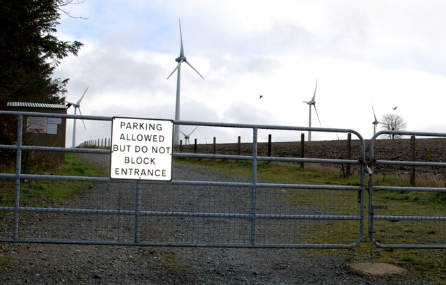
Picture: Do what it says on the sign please!
Easy Bag
by eamonoc
5 Apr 2014
Climbed Friday 4/4/2014, started at B (S90802 48481) at entrance road to Windfarm. simply follow this track uphill to highest point and Trig is on the right. Linkback: mountainviews.ie/summit/1268/comment/15969/
Use of MountainViews is governed by conditions and a privacy policy.
Read general information about the site. Opinions in material here are not necessarily endorsed by MountainViews.
Hillwalking is a risk sport. Information in comments, walks, shared GPS tracks or about starting places may
not be accurate for example as regards safety or access permission. You are responsible for your safety and your permission to walk.
See the credits and list definitions.


 Add a Place Comment for Kilcullen Hill


 Our Facebook page.