Donation Request 2024

DONATE
Members and Supporters, the MountainViews Committee requests your help to meet the costs of the website and of other activities such as insured events or publications.
You do not have to be logged in to donate.
Features
Nearby features appear when you click the map.
Declutter tracks on map.
Place Search
Video
X
Pub: by
Midlands SW Area , NE: Templederry Subarea
Feature count in area: 44, by county: Tipperary: 36, Limerick: 8, OSI/LPS Maps: 52, 53, 54, 58, 59, 60, 65, 66
Highest Place: Keeper Hill 691.6m

Starting Places (31) in area Midlands SW:
Ballincurra Hill South, Ballyhourigan Wood Loop Walk, Barnane Lodge, Castlewaller Wood Forest Road, Coillte Knockanroe, Commanealine Wood, Commaun Beg North, Cullaun South, Cummer South, Curreeny Wood, Doonane Forest Carpark, Foildhine Mulkeir Rivers, Glenaneagh Park, Glenstal Wood CP, Gortagarry Hill West, Greenan Cross, Knockadigeen Hill SW, Knockanora East, Knockanully, Knockaviltoge East, Knockfune Wood Bend, Knockmaroe Wood, Knockmehill South, Knockteige SW, Nicker, Raven's Rock, Ring Hill West, River Doonane, The Lookout, Tobernagreana, Upperchurch

Summits & other features in area Midlands SW:
Cen: Mauherslieve: Cummer 405m, Foilduff 400m, Knockmaroe 411m, Mauherslieve 543m
E: Upperchurch Hills: Knockalough 427m, Knockaviltoge 364m
N: Knockshigowna: Knockshigowna 212m
NE: Devilsbit: Benduff 455m, Black Hill 228m, Devilsbit Mountain 480m, Gortagarry 458m, Kilduff Mountain 445m, Knockanora 433m
NE: Templederry: Ballincurra Hill 403m, Commaun Beg 403m, Cooneen Hill 467m, Coumsallahaun 320m, Knockadigeen Hill 402m
NW: Arra Mountains: Corbally Hill 339m, Tountinna 457m
NW: Silvermine Mountains: Silvermine Mountains East Top 479m, Silvermine Mountains Far East Top 410m, Silvermine Mountains West Top 489m
SE: Hollyford Hills: Falleennafinoga 388m, Foildarg 440m, Glenaneagh 420m, Gortnageragh 418m, Knockastanna 444m, Knockbane 433m, Lackenacreena 413m, Ring Hill 426m, Tooreen 457m
SW: Slieve Felim: Cullaun 460m, Derk Hill 236m, Knockroe 204m, Knockseefin 235m, Slieve Felim 427m, Slieve Felim East Top 423m, Slieve Felim South Top 407m
W: Keeper Hill: Bleanbeg 368m, Boolatin Top 446.6m, Keeper Hill 691.6m, Knockane 411m, Knockfune 452m

Note: this list of places may include island features such as summits, but not islands as such.
Rating graphic.
Coumsallahaun, 320m Hill
Place Rating ..
, Tipperary County in Munster province, in Binnion Lists, Coumsallahaun is the 1113th highest place in Ireland.
Grid Reference R95195 66689, OS 1:50k mapsheet 59
Place visited by: 17 members, recently by: Moirabourke, Arcticaurora, Krzysztof_K, JohnRea, maryblewitt, LiamG1951, mlmoroneybb, sarahryanowen, FrankMc1964, wicklore, Fergalh, frankmc04, sandman, conormcbandon, paddyhillsbagger
I visited this place: NO (You need to be a logged-in member for this.)
Longitude: -8.071905, Latitude: 52.75161, Easting: 195195, Northing: 166689, Prominence: 109m,  Isolation: 2.7km
ITM: 595145 666730
Bedrock type: Greywacke, siltstone & grit, (Hollyford Formation)

  Short or GPS IDs, 6 char: Cmslhn, 10 char: Cmslhn

Linkback: https://mountainviews.ie/summit/1120/
Gallery for Coumsallahaun and surrounds
No summary yet for this place .
Member Comments for Coumsallahaun
Comment create / edit display placeholder

            MountainViews.ie picture about Coumsallahaun
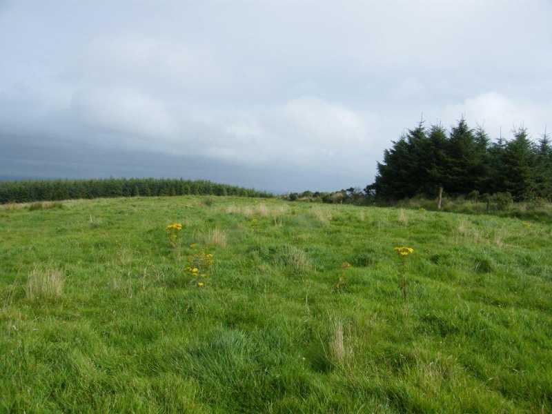
Picture: Summit area with large fence post nearby.
Rough ride!
by paddyhillsbagger 31 Aug 2014
Took the road Sth from Templederry, kept R at fork where the road climbed up the hill and became a rough unpaved dirt track. Not recommended if you value your car or have large ground clearance or 4x4. At crest of hill parked off-road at A (R956 667). Walked back down road 50m, clambered over field boundary and kept forest on my left. Another thick field boundary, head height with ferns, nettles and brambles, had to be crossed at end of forest where a boggy pasture was climbed Sth to reach a fence. Summit seems to be in the field 50m Nth of another clump of trees. Only summit detail is a large fence post by the forest. Linkback: mountainviews.ie/summit/1120/comment/17658/
Read Less
Read More
EDIT Point of Interest
text
Videos
(none available)
Recent Contributions
x
Conditions and Info
Use of MountainViews is governed by conditions and a privacy policy.
Read general information about the site.
Opinions in material here are not necessarily endorsed by MountainViews.
Hillwalking is a risk sport. Information in comments, walks, shared GPS tracks or about starting places may not be accurate for example as regards safety or access permission. You are responsible for your safety and your permission to walk.
See the credits and list definitions.

OSi logo
OSNI/LPS logo
Open Street Map
(Various variations used.)
British summit data courtesy:
Database of British & Irish Hills