Donation Request 2024
You do not have to be logged in to donate.
DONATE
Members and Supporters, the MountainViews Committee requests your help to meet the costs of the website and of other activities such as insured events or publications.You do not have to be logged in to donate.
Welcome to MountainViews
If you want to use the website often please enrol (quick and free) at top right.
If you want to use the website often please enrol (quick and free) at top right.
Overview

For more map options click on any overview map area or any detail map feature.
Detail Map Features
Showing 1 items:
Oughty Hill 333m,
Oughty Hill 333m,
Find Suggested Walks
Find hill, mountain, island, coastal feature.
Videos
Recent Contributions
 Get Notifications
Get Notifications
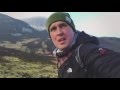
Lake District: Dale Head Horseshoe
Crocknasharragh: Impressive views on nitial ascent.
 Colin Murphy
Crocknasharragh: Fine views on ascent
 Colin Murphy
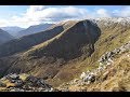
Lake District: Coledale Horseshoe
Cunnigar: Short trek to summit
 Fergalh
Longish walk to isolated top
 Colin Murphy
Westtown Hill: Tramore's Highest Point
 DeirdreM
Knockbrinnea West Top: Eflanagan on the Knockbrinneas
 eflanaga
Ascending the Knockbrinneas from the north.
 simon3
Knockbrinnea West Top: Larger Twin
 Collaborative entry
Lobawn Loop - Clockwise avoids any steep ascent! Easy stream crossing.
Knockaunanattin West Top: Views, loughs and a navigational aid.
 simon3
Conditions and Info
Use of MountainViews is governed by conditions and a privacy policy.
Read general information about the site.
Opinions in material here are not necessarily endorsed by MountainViews.
Hillwalking is a risk sport. Information in comments, walks, shared GPS tracks or about starting places may not be accurate for example as regards safety or access permission. You are responsible for your safety and your permission to walk.
See the credits and list definitions.
 Visit our Facebook page.
Video display
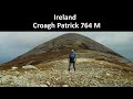
Croagh Patrick
Area S: Owenmore Subarea
Place count in area: 12,
OSI/LPS Maps: 30, 31, 37, 38, CBE, CBW, MSW
Highest place: Croagh Patrick, 764m
Maximum height for area: 764 metres,
Maximum prominence for area: 639 metres,
Places in area Croagh Patrick:
N: North Ridge:Ben Goram 559mBoheh Hill 219mCroagh Patrick 764mCrott Mountain 500mLugnademon 510mTeevenacroaghy 487m
S: Owenmore:Carrowrevagh 210mKnockakishaun 390mOughty Hill 333m
W: Louisburgh Hills:Balloor Hill 147mCarrowmore Hill 171mKinknock Hill 173m
Note: this list of places includes island features such as summits, but not islands as such.
Highest place:
Croagh Patrick, 764mPlaces in area Croagh Patrick:
N: North Ridge:
Ben Goram 559mBoheh Hill 219mCroagh Patrick 764mCrott Mountain 500mLugnademon 510mTeevenacroaghy 487mS: Owenmore:
Carrowrevagh 210mKnockakishaun 390mOughty Hill 333mW: Louisburgh Hills:
Balloor Hill 147mCarrowmore Hill 171mKinknock Hill 173mNote: this list of places includes island features such as summits, but not islands as such.

Bedrock type: Pelite, psammite, limestone, tuff, (Bouris Formation)
Oughty Hill is the 1090th highest place in Ireland. Oughty Hill is the second most southerly summit in the Croagh Patrick area.
Linkback: https://mountainviews.ie/summit/1109/
COMMENTS for Oughty Hill 1 of 1  Follow this place's comments

|
|
|
|
||
| MountainViews.ie, a Hill-walking Website for the island of Ireland. 2400 Summiteers, 1480 Contributors, maintainer of lists: Arderins, Vandeleur-Lynams, Highest Hundred, County Highpoints etc | |||