This website uses cookies, which are small text files that the website puts on your device to facilitate operation. Cookies help us provide a better service to you. They are used to track general user traffic information and to help the website function properly.
Feature count in area: 9, by county: Down: 5, Antrim: 4,
OSI/LPS Maps: 15, 20, 21
Highest Place: Divis 478m
Starting Places (2) in area Belfast Hills: Ballyherly Lough West, Castlemahon Mountain South East
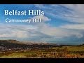
Summits & other features in area Belfast Hills: E: Belfast Hills East: Cairngaver 217m, Ouley Hill 186m, Scrabo Hill 160m N: Belfast Hills North: Carnmoney Hill 231.1m, Cave Hill 368m, Divis 478m, Slievetrue 312m SE: Strangford & Portaferry: Ballywhite Hill 101m, Castlemahon Mountain 128m
Note: this list of places may include island features such as summits, but not
islands as such.
Cave Hill, 368mHill Binn Uamha A name in Irish,
Place Rating ..
Ir. Binn Uamha [DUPN], ‘peak of the cave’Binn Mhadagáin an extra name in Irish, Antrim County in Ulster province, in no lists, Cave Hill is the second highest hill in the Belfast Hills area and the 1025th highest in Ireland. Cave Hill is the second most westerly summit in the Belfast Hills area.
Grid Reference J32336 79719,
OS 1:50k mapsheet 15 Place visited by: 93members, recently by: childminder05, cmcv10, bjgie, Florence, Jai-mckinney, Oscar-mckinney, Seamy13, moggy40, headspace, Paddym99, TommyMc, garybuz, markwallace, Pepe, reidyden
I visited this place: NO (You need to be a logged-in member for this.)
Longitude: -5.950682, Latitude: 54.648237, Easting: 332336, Northing: 379719,
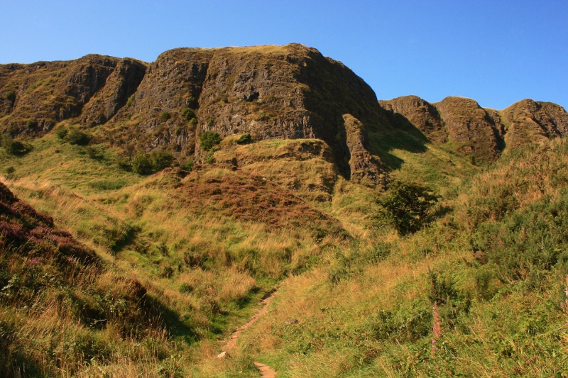
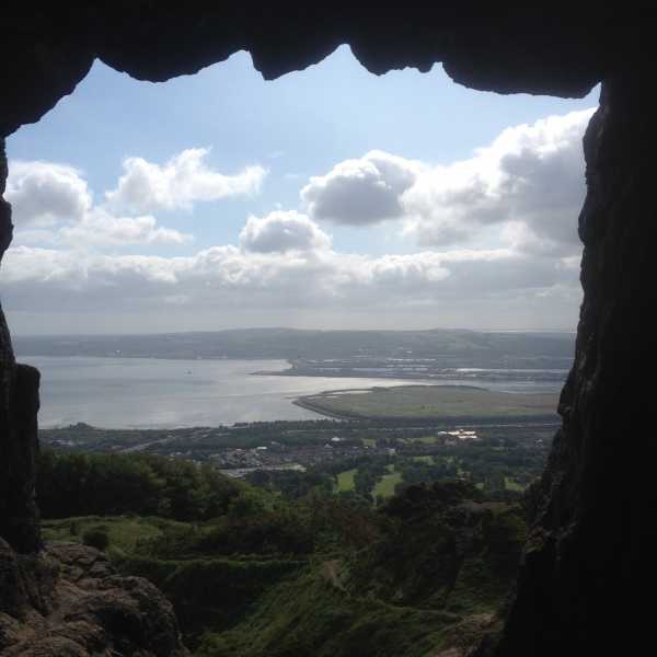
Prominence: 94m, Isolation: 3.5km ITM: 732256 879712 Bedrock type: Olivine basalt lava, (Lower Basalt Formation) Notes on name: Whilst Cave Hill is more than 100m lower than Divis, it is probably the best known and most striking of the Belfast Hills on account of its abrupt, craggy face. It is named after five caves which are visible in the cliff-face, some of which were occupied by hunter-gatherers in the Mesolithic era, approximately 7,000 years ago. A promontory fort at the cliff edge is known as McArt’s Fort, after Cormac Mac Airt, legendary king of Ireland. However, the true summit (for which the height and grid reference are cited here) is located several hundred metres west of the fort, but this spot does not have quite the same commanding view over Belfast Lough and the city. An alternative name for the hill is Binn Mhadagáin, after Madagán, a historical king of Ulster who died in AD 856.
Short or GPS IDs, 6 char: CvHl, 10 char: Cave Hill Linkback: https://mountainviews.ie/summit/1083/
Gallery for Cave Hill (Binn Uamha) and surrounds
Summary
for Cave Hill (Binn Uamha):
A short but rewarding climb
Summary created by Peter Walker, Harry Goodman
2023-07-25 15:58:22
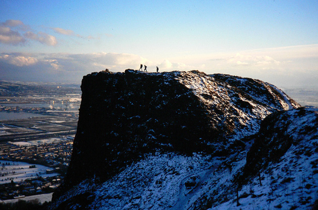
Picture: Approaching Mc Art
This route lies within Cave Hill Country Park and follows in the main good gravel or grass tracks. Start from a small car park just before Belfast Castle A (J330 791) and climb up the path on the left . At a junction go right and continue up through the trees bearing left at any further junctions to gain an open flat area with fine views down over Belfast Lough. Continuing on take the next path to the left and go clockwise around a steep-sided depression and passing below the largest cave . Climb steadily up to a cattle grid and fence and take the path going left. This leads up to the top of the hill and a large steep sided promontory dominating the view ahead. Though not the top of the hill this is the site of a former ancient defensive fort. At the point where the path passes a track going up left to the promontory, site of Mc Art's Fort, turn directly right of the main track and go WNW up a narrow but well defined rough path to the high point of the hill some 100 metres along and marked by a small but ancient cairn. On the way back down be sure to visit Mc Art's Fort for splendid views down over Belfast and, in good visability, out across County Dowm to the distant Mournes and Slieve Gullion.
An easier but slightly less aesthetic route can be had from a large car park on the Upper Hightown Road at B (J31067 79258). On a very clear path all the way it follows an almost level wooded line before a short sharp pull leads up to the edge of the escarpment from where an easy uphill ramble with expansive views to the east and south leads to McArt's Fort and the summit.
Nice to see Cave Hill, also known as Ben Madigan, making it on to the list. I climbed this in September 2013 on a hot, sunny afternoon from the car park at Belfast Castle. There were clear paths from here through the woods to the foot of the cliffs where the caves can be seen. I continued walking, bearing North of the cliffs, still on clear, well used paths which gave an easy route to the summit and McArt's Fort. There are expansive views from the top over Belfast, and I could make out Scrabo Tower and the Mournes through the haze. I continued Southwards along the top of the cliffs taking me on a circular route down the other end of the hill, through the woods and back to Belfast Castle. There was a multitude of paths in this part of the woods and it did get a bit confusing, but you almost inevitably reach the road to the castle at some point. Fortunately, there are plenty of hikers, dog walkers, joggers etc. around for directions if you're stuck, at least there were in the fine weather that day. Definitely worth a climb and inclusion here. Linkback: mountainviews.ie/summit/1083/comment/15769/
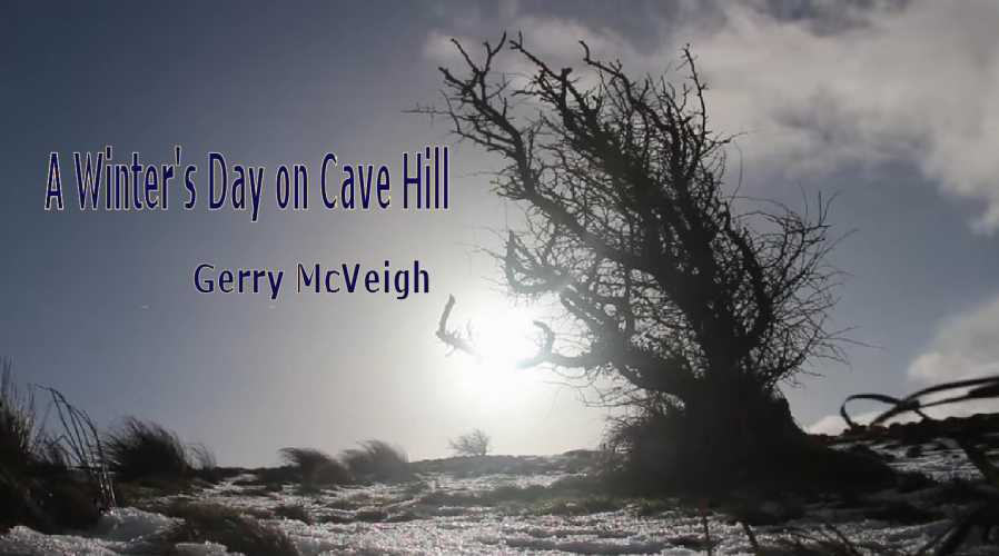
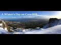
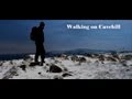
If you have any notion of heading up Cave Hill you really need to watch Gerry McVeigh's YouTube film - A Winter's Day on Cave Hill. Now I better tell you that this is ART from beginning to end. It's just beautifully filmed. The guy is getting better and better. The filming which took place on New Year's Eve involves acute observation and careful composition.
A Winter's Day on Cave Hill https://www.youtube.com/watch?v=Lyb0-wn5M_A
Meanwhile for something completely different. Belfasti Tours have produced an old fashioned info film full of archaeology, history and interesting facts. Called Napoleon's Nose by the locals, Dean Swift was inspired by the shape of a giant's head on the hill to write Gulliver's Travels. Numerous Stone Age artifacts have been found on the hill, including flint arrowheads. The summit cairn is believed to be a neolithic burial mound 5000 years old. The remains of several ringforts (raths) can be traced on the hill. A stone cashel on the summit used to house both families and their livestock. There are five ancient man made caves on the hill from which its name derives. Wolfe Tone and his supporters met at the summit to pledge their troth to the cause of Ireland. MacAirt's summit fort can still be seen. It was the site of the coronation seat of the O'Neills of Clandeboye.
Parking at the Cave Hill Country Park car park on the Upper Hightown Road B (J31067 79258) allowed an easy ramble to the summit at C (J32336 79719) adjacent to Mc Arts Fort. Fantastic park with great views and in the future as i drive thru Belfast i will always have the memory not only of Cave Hill but also some of the previous 999. Linkback: mountainviews.ie/summit/1083/comment/18376/
Use of MountainViews is governed by conditions and a privacy policy.
Read general information about the site. Opinions in material here are not necessarily endorsed by MountainViews.
Hillwalking is a risk sport. Information in comments, walks, shared GPS tracks or about starting places may
not be accurate for example as regards safety or access permission. You are responsible for your safety and your permission to walk.
See the credits and list definitions.


 Our Facebook page.