Donation Request 2024

DONATE
Members and Supporters, the MountainViews Committee requests your help to meet the costs of the website and of other activities such as insured events or publications.
You do not have to be logged in to donate.
Features
Nearby features appear when you click the map.
Declutter tracks on map.
Place Search
Video
X
Pub: by
North East Midlands Area , SE: Boyne Valley Subarea
Feature count in area: 24, by county: Cavan: 7, Westmeath: 5, Meath: 5, Monaghan: 3, Leitrim: 1, Louth: 1, Longford: 2, OSI/LPS Maps: 26, 27, 27A, 28, 28A, 28B, 34, 35, 36, 41
Highest Place: Cornasaus 339m

Starting Places in area North East Midlands:

None for this area

Summits & other features in area North East Midlands:
Cen: Ballyjamesduff: Aghalion Hill 249m
Cen: Oldcastle: Mullaghmeen 258m, Slieve Na Calliagh 276m, Spire of Lloyd 131m, The Hill of Mael 241m
E: Kingscourt: Carrickleck Hill 173m
N Cen: Cavan Town: Shantemon 218m, Slieve Glah 320m, Tievenanass 261m
NE: Ballybay: Bunnanimma 268m
NE: Carrickmacross: Corduff 243m
NE: Castleblaney: Mullyash Mountain 317m
NE: Cen Bailieborough: Cornasaus 339m, Taghart South 290m
NW Cen: Arva: Bruse Hill 260m
NW: Aughavas: Lugganammer 190m
S Cen: Crookedwood: Cruckboeltane 199m, Knockeyon 214m
S: Westmeath South West: Knockastia 200m
SE: Boyne Valley: Hill of Slane 160.4m, Mount Oriel 251m, Tara 155m
W: Ardagh: Bawn Mountain 200m
W: Drumlish: Corn Hill 278m

Note: this list of places may include island features such as summits, but not islands as such.
Rating graphic.
Mount Oriel, 251m Hill Sliabh Collann A name in Irish,
Place Rating ..
(poss. Ir. Sliabh Collann [PDT], 'mountain of the height'), Louth County in Leinster province, in Binnion Lists, Mount Oriel is the 1284th highest place in Ireland. Mount Oriel is the most easterly summit in the North East Midlands area.
Grid Reference N98164 83284, OS 1:50k mapsheet 36
Place visited by: 72 members, recently by: Jai-mckinney, Oscar-mckinney, Dee68, Carolyn105, Glanman2, annem, trostanite, dregishjake, briankelly, abcd, dregish, TommyV, arderincorbett, wtrs, TommyMc
I visited this place: NO (You need to be a logged-in member for this.)
Longitude: -6.51134, Latitude: 53.79001, Easting: 298164, Northing: 283284, Prominence: 176m,  Isolation: 8.4km, Has trig pillar
ITM: 698089 783300
Bedrock type: Black mudstone, siltstone, greywacke, (Rathkenny Formation)
Notes on name: Mount Oriel is located above the village of Collon (collann, 'height'). In the Book of Ballymote (late 14th century), its name is given as Sliabh Collain or Sliabh Leitreach, the latter meaning 'mountain of the wet slope'. It is the highest point in a range of hills on the Louth/Meath border which was anciently called Sliabh Breagha. Those peaks on the Louth side of the border are known in English as the Ferrard Hills, from the name of the local barony. Oriel is a very ancient name denoting a population group, the Airghialla, whose territory extended at its height all the way from North Louth to the vicinity of Derry in a diagonal band across Ulster. However, it was later much reduced and the name Oriel came to be used as a by-name for Co. Louth. The application of the English name Mount Oriel to this hill seems even more modern. It may be linked to the title of Baron Oriel of Ferrard, granted to John Foster, whose residence was at Collon, in 1821.
  Short or GPS IDs, 6 char: MntOrl, 10 char: MntOrl

Linkback: https://mountainviews.ie/summit/1002/
Gallery for Mount Oriel (Sliabh Collann) and surrounds
No summary yet for this place .
Member Comments for Mount Oriel (Sliabh Collann)
Comment create / edit display placeholder

            MountainViews.ie picture about Mount Oriel (<em>Sliabh Collann</em>)
Picture: A serene scene
wicklore on Mount Oriel
by wicklore 2 May 2009
I took a side trip to Mount Oriel as I headed up to the Cooley peninsula yesterday. I followed paulocon’s directions and turned at the Campus garage in the village of Collon. 2 miles up this road brings you to the service lane (A (N977 831)) which heads up to the top of the hill. I was able to drive up the service lane to the gate which leads out onto the summit field. The summit is a grassy field with six masts and service buildings around its perimeter. In the field were frolicking lambs, and several large deciduous trees dot the landscape. The trig pillar (B (N981 832)) is atop a large barrow, with another smaller barrow next to it. Because Mount Oriel is relatively isolated there are expansive views across the plains to the south and east. Views to the north were somewhat restricted by some trees and communications towers at the edge of the field. If you can ignore the encroaching forest of masts the summit is actually a nice place with a peaceful feeling to it.

I came across an explanation for the name ‘Oriel’ on http://www.mythicalireland.com/highman/places-mount-oriel.html. They say that it comes from ‘Ór Giall’, the "golden hostages", an ancient kingdom which stretched from Louth to Donegal. They say Mount Oriel is the highest of the "Ferrard Hills". Ferrard (fear ard) means ‘High Man’, and apparently there is a gigantic outline of a warrior called the High Man wielding a sword spread across the Meath/Louth landscape. The image is outlined by the road network in the area. The website mythicalireland.com shows this image. Just click on 'High Man' at the top of the page. Apparently much of the area covered by the High Man can be seen from the summit of Mount Oriel. They also say Mount Oriel is lined up with the Hill of Slane, Realtoge and Tara. Isn’t it amazing what powerful mythology could lie behind such an obscure hill! Linkback: mountainviews.ie/summit/1002/comment/3742/
Read Less
Read More

            MountainViews.ie picture about Mount Oriel (<em>Sliabh Collann</em>)
Picture: The view over to the Cooleys from Mount Oriel. Note the cows closing in, shortly before they started
Beware of the livestock!
by csd 11 Jul 2010
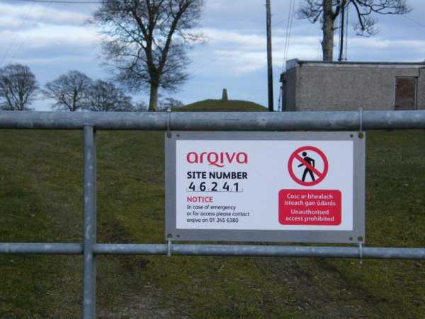
Following in wicklore's footsteps, I accessed Mount Oriel from the same service track mentioned in his comment. Note that I wouldn't take a normal family car up this track, as some of the potholes are now quite deep and the track is becoming quite eroded in places. There isn't really anywhere to park on the main road, so perhaps a better idea might be to park in Collon and walk up from there to make something of a walk of the experience.

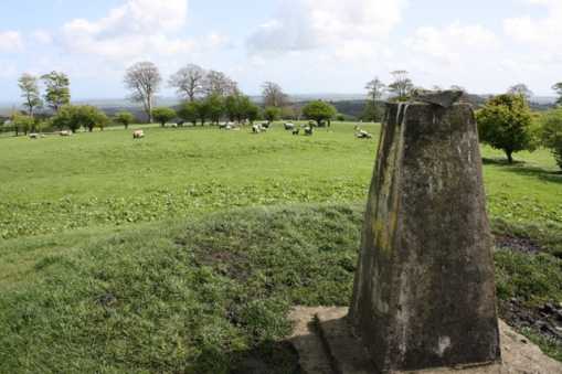
Cows had replaced the frolicking lambs of wicklore's serene scene, and not thinking much of it, I went through the gate and up to the trig pillar. The bovines seemed to be paying me a lot more attention to me than I'd ever experienced previously, and before I knew it I was surrounded by a group of increasingly agitated and aggressive cows. GPS reading taken, and after firing a quick few shots off on the camera, I beat a retreat, which quickly deteriorated into a panicked rout, with me being knocked off my feet by the most aggressive of the cows.

I managed to escape relatively unscathed, leaping over the fence with greater energy than I would have thought possible, but the whole incident was quite frightening, all the more because it was so unexpected. If there are any cattle farmers reading this, after you've finished chuckling at me, the hapless townie being chased off the land by a herd of cows, I'd be interested to hear if this is a common occurance. I don't normally walk through livestock fields anyway, so wouldn't have a whole lot of experience of cows close-up. I certainly won't be doing it again! Linkback: mountainviews.ie/summit/1002/comment/5933/
Read Less
Read More

Only when it's a clear day
by Pepe 14 Jun 2015
Parked near the service lane entrance, room for maybe two cars on the grass verge. Thankfully the cattle mentioned in another comment were in an enclosed field and not at the suummit! The sheep were back around the trig - a simple walk of maybe 15 minutes max from the car to trig and back. Worth it for the views, despite the trees and masts. For this reason would recommend it only on a day when the air is good and the horizons clear. Linkback: mountainviews.ie/summit/1002/comment/18118/
Read Less
Read More

            MountainViews.ie picture about Mount Oriel (<em>Sliabh Collann</em>)
Picture: Access via phone call?
paddyhillsbagger on Mount Oriel
by paddyhillsbagger 16 Mar 2010
Just a warning to fellow walkers. Took this snap on 5th March with Mount Oreil trig tantalisingly close behind shut gate. There were workmen nearby so I asked about access and was given the go-ahead so didn't ring the number. Not sure what the official response will be.
Lovely views across to Cooley where I'd done Slieve Foye earlier in the day. Linkback: mountainviews.ie/summit/1002/comment/4510/
Read Less
Read More

            MountainViews.ie picture about Mount Oriel (<em>Sliabh Collann</em>)
Picture: Mount Oriel
paulocon on Mount Oriel
by paulocon 8 Oct 2008
Being the closest peak to me that's listed on MountainViews, it's somewhere I am pretty familiar with. Mount Oriel is less a mountain, more a big ugly hill that is home to several communications towers and masts. The hill is accessible by heading West at the petrol station in the village of Collon, County Louth (on the main Dublin/Derry Road). The masts are visible on the right-hand side around 1/4 of a mile up the road. The peak is accessed via a short walk (5 minutes) over the service laneway at the top of the hill. The Cooley Mountains are visible from the top but the view is pretty average. Not worth a visit unless you are looking for an easy and quick way to up your 'summit count'. Linkback: mountainviews.ie/summit/1002/comment/3347/
Read Less
Read More
EDIT Point of Interest
text
Videos
(none available)
Recent Contributions
x
Conditions and Info
Use of MountainViews is governed by conditions and a privacy policy.
Read general information about the site.
Opinions in material here are not necessarily endorsed by MountainViews.
Hillwalking is a risk sport. Information in comments, walks, shared GPS tracks or about starting places may not be accurate for example as regards safety or access permission. You are responsible for your safety and your permission to walk.
See the credits and list definitions.

OSi logo
OSNI/LPS logo
Open Street Map
(Various variations used.)
British summit data courtesy:
Database of British & Irish Hills