Guestuser: Login or enrol?
- Home
- Main Display
- Main Display (Old)
- Find a Walk
- Display INTRODUCTION
- DONATE
- Click below for your
profile & contributions
guestuser- New
- Tracks, Walks
- Challenge
- Community
- Lists & Logs
- Popular Lists:
- County Highpoints
- Range & Area Highpoints
- Local 100
- Highest Hundred
- Vandeleur-Lynams
- Arderins
- Carns
- Best rated
- Irish 900 up
- Irish Island
- Munros
- All Lists
- Shorter Irish
- County Highpoints
- Range & Area Highpoints
- Highest Hundred
- Local 100
- Local 100 (pre2014)
- Local Historical Cultural
- Best rated
- Irish 900 up
- Larger Irish
- Arderins
- Arderin Begs
- Arderins + Arderin Begs
- Vandeleur-Lynams
- Vandeleur-Lynams + Arderins
- Carns
- Binnions
- Highest 50 per Province
- Island Features
- Irish Island
- Coastal Hills
- Irish 600 up
- Irish 500 up
- British
- Munros
- British 600 up
- British 500-600
- British Marilyns
- Comprehensive
- All Irish summits
- All Irish features
- All British summits
- All Britain+ Ireland
- Special
- Analysis List
- Simple Irish Listings
- Simple Irish & British Listings
-
- More
- Motley Views
Welcome to MountainViews
If you want to use the website often please enrol (quick and free) at top right.OverviewFor more map options click on any overview map area or any detail map feature.Detail Map FeaturesShowing 1 items:
Tory Island 83m,Find Suggested Walks
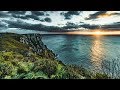
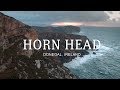
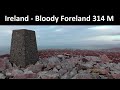
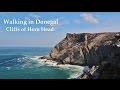
Find hill, mountain, island, coastal feature.Videos
Recent Contributions
 Get Notifications
Dún Briste: You must be joking
Letterettrin - a perspective on the N Connemara peaks
Doonvinalla E Top: Portacloy Cliff Walk
Knocklettercuss: Ascend via the spur
Kilbrony Park Ramble
Erris Head Hill: Fantastic loop
Burren: Black Head Loop
Aghaglasheen: Highest point on the peninsula
Knocknakilton & Cummeen, Dingle Penninsula
Silvermines Hydro Project
Blackstairs Mountain: Good access and a great viewpoint above a patchwork quilt
Croaghnageer and Croghanirwore
Conditions and Info
Use of MountainViews is governed by conditions and a privacy policy.
Read general information about the site.
Opinions in material here are not necessarily endorsed by MountainViews.
Hillwalking is a risk sport. Information in comments, walks, shared GPS tracks or about starting places may not be accurate for example as regards safety or access permission. You are responsible for your safety and your permission to walk.
See the credits and list definitions.Video displayDonegal Islands AreaPlace count in area: 60, OSI/LPS Maps: 1, 10, 11, 12, 13, 2, 3, 6, 7
Highest place: Gull Island, 95m
Places in area Donegal Islands:Allagh Island 8mAn Bhuidéal 45mAn tOileán leathan 20mBo Island 13mCalf Island (1) 5mCruit Island 32mEdernishree 11mEdernish 11mEighter Island 24mFall Island 11mGola Island 68mGarvan Isles Green Isle 16mGarvan Isles Middle Isle 5mGarvan Isles White Isle 5mGlashedy Island 35mGo Island 5mGull Island 95mIllanarva 5mIllancarragh 20mIllancrone SE 5mIllannanaff 11mIllanngall 23mIniscoo 15mInishal 6mInishbarnog 16mInishbeg 22mInishbofin (1) 33mInishcoole 13mInishdooey 38mInishduff 22mInisheane 5mInishfree Lower 25mInishfree Upper 14mInishillintry 21mInishinny (1) 27mInishinny (2) 16mInishkeel 19mInishkeeragh (1) 6mInishmeal 5mInishmeane 33mInishsirrer 23mInishtrahull 49mIsland Reagh 12mIsland Roy 15mMullaghtan 10mDuck Island (1) 5mRathlin O'Birne Island 26mRoaninish 9mRutland Island 20mTor Beg 5mTorglass 25mTor More 35mToralayden 84mTorhonadoogha 20mTornacolpagh Island 21mTory Island 83mTramore Point 5mTullyillan 11mTullavane Island 5mUmfin Island 42m
Note: this list of places includes island features such as summits, but not islands as such.
Donegal County in Ulster Province, in Irish Islands List
Landing grid ref.: B85600 46400
Reachable "On Foot " YHeight: 83m OS 1:50k Mapsheet: 1 Grid Reference: B87702 46130
Place visited by 29 members. Recently by: mcrtchly, NualaB, paulbrown, nupat, Geo, Wilderness, miriam, adam.mann, Fergalh, sarahryanowen, bryanjbarry, pdtempan, mrmikelennon, jlk, LaurannaIsland visited by 48 members. I have visited this place: NO (You need to be a logged-in member to change this.)I have visited this island: NO (You need to be a logged-in member to change this.)Longitude: -8.19422, Latitude: 55.261955 , Easting: 187702, Northing: 446130 , Has trig pillar
ITM: 587654 946108 , GPS IDs, 6 char: TryIsl, 10 char: TryIslnd
Linkback: https://mountainviews.ie/island/2020/COMMENTS for Tory Island (Toraigh) 1 of 1  Follow this place's comments
 Height layer: © MapTiler

MountainViews.ie, a Hill-walking Website for the island of Ireland. 2500 Summiteers, 1480 Contributors, maintainer of lists such as: Arderins, Vandeleur-Lynams, Highest Hundred, County Highpoints etc

 TommyV
 glencree
 TommyV
 TommyV
 TommyV
 TommyV
 Collaborative entry
 Peter Walker
 Visit our Facebook page.