Members and Supporters, the MountainViews Committee requests your help to meet the costs of the website and of other activities such as insured events or publications.
Colin Murphy: Track/5059 in area near Agow Top, Dartry Mountains (Ireland)
Gentle climbing, mostly up faint trail.
Ascent: 472m,
Length: 7.9km,
Creator time taken: 2h16m
Descent: 478m,
Time predicted from Naismith's rule: 2h 23m + breaks
Click here to rate track
PlacesStart at G87064 44073, Agow Top, end at Start
Track Rating ..
[RWD version 1 ]
Setting out I had intended to include both Agow & Aganny, but as the weather deteriorated, I decided to abandon my trek at Agow where conditions were pretty grim. The starting point has enough space for a couple of cars.
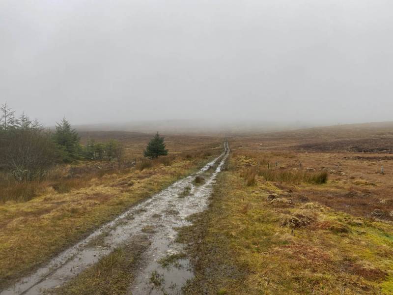
Farm track
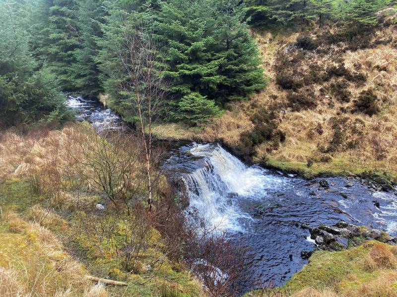
Continue up the farm track, which was very wet and muddy on the day I did it in March. It rises very gently up through woods and then on to open hillside and continues for almost 1.5km and is enlivened by a bubbling stream and a decent waterfall.
Waterfall
At the point where you see an old wall running perpendicular to the track on the left, with a short tree growing alongside it, leave the track and head directly up the grassy slope.
Leave the track here.
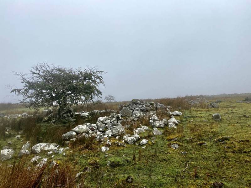
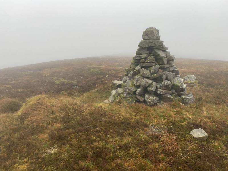
You should be able to pick up a faint trail running parallel to a tiny stream – this continues on and off all the way to the summit, which is a further 2km to the north, the slope gentle and the going underfoot pretty walkable. You will also pass what looks like a small, ancient circular structure, and a pointy marker cairn along the way. A tall cairn marks the highpoint.
Summit cairn
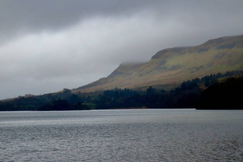
A couple of hours up and down. Back at your car, it is worth making a small detour off the R280 to the viewing point for Glenade Lough, which is just a couple of minutes’ drive.
Glenade Lough with Keeloges in the background.
Editing Details for track/5059
NOTE: ALL information such as Ascent, Length and Creator time taken etc should be regarded as approximate. The creator's comments are opinions and may not be accurate or still correct.
Your time to complete will depend on the speed of the slowest plus break time and your mode of transport.
NOTE: It is up to you to ensure that your route is appropriate for you and your party to follow bearing in mind all factors such as safety, weather conditions, experience and access permission.
Uploaded on: Thu, 21 Mar 2024 (17:10:03), Linkback: https://mountainviews.ie/track/5059/
* Note: A GPS Height in the elevation profile is sourced from the device that recorded the track. An "SRTM" height is derived from a model of elevations for parts of the earth. More detail
Use of MountainViews is governed by conditions and a privacy policy.
Read general information about the site. Opinions in material here are not necessarily endorsed by MountainViews.
Hillwalking is a risk sport. Information in comments, walks, shared GPS tracks or about starting places may
not be accurate for example as regards safety or access permission. You are responsible for your safety and your permission to walk.
See the credits and list definitions.


 Our Facebook page.