If you want to use the website often please enrol (quick and free) at top right.

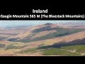
Croaghgorm 674m, Lavagh More 671m, Ardnageer 642m, Croaghbane 641m, Ardnageer SW Top 626m, Croaghgorm South-West Top 597m, Croaghgorm East Top 594m, Glascarns Hill 578.3m, Croaghnageer 569.1m, Gaugin Mountain 565m,


 Get Notifications
Mount Kennedy: Red kites in the blue sky
 hibby
hibby
Half Glencoaghan
Belmore from NW - SOUTH route CLOSED
Arroo Mountain: Arroo from E, partial drive in
Knocklettragh: Knockletragh from North - school report
Carrane from SSW
Carricktriss Gorse: Safe access to this hill no longer seems possible
 TommyMc
Binnion: Tullagh Bay and Rockstown Harbour
 Jim_Brady
Knocklettragh from north
Crocknapeast: Long walk up windfarm roads.
 Collaborative entry
Arroo from east
Donations Drive, now finished.
Use of MountainViews is governed by conditions and a privacy policy.
Read general information about the site.
Opinions in material here are not necessarily endorsed by MountainViews.
Hillwalking is a risk sport. Information in comments, walks, shared GPS tracks or about starting places may not be accurate for example as regards safety or access permission. You are responsible for your safety and your permission to walk.
See the credits and list definitions.
 Visit our Facebook page.
 Length: 12.7km, Creator time taken: 7h 3m, Ascent: 597m,
Descent: 697m
Places: Start at G9592694106, Glascarns Hill, Croaghbane, Cruach an Bhearnais, end at G9723087059 7.2km S from Start
Logged as completed by 1

This walk starts from the good parking at a disused national school and starts on the Bluestacks Way. Near the early bridge we encountered a gate with a no access sign. This was puzzling because there were Bluestacks Way marker poles before and after the gate. We decided to press on. Later on members of our party came back this way and encountered the farmer, who did not seem concerned.
However it would be possible to bypass this no access completely by starting at Gaugin Mountain starting point as used in track/2209/
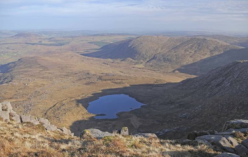
As you rise there is a series of false summits before you reach Glascarns Hill at 578m. There were two possible highest points for Glascarns so we surveyed both and found that the most northerly was 248mm higher than the more southerly. The height we got therefore is 578.3m with prominence 28.7m. The latter was much higher than the previous estimated of 20m, but not quite enough to make Glascarns an Arderin.
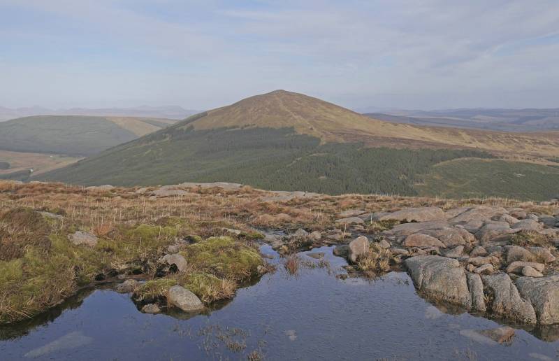
Pressing on to Croaghbane in good weather with little wind, no rain and some wintry sun we could see into the valley of the Owendoo river. Croaghbane we measured at 640.9m, changing nothing in its status.
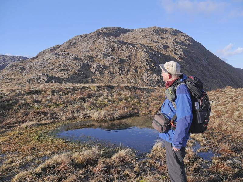
From Croaghbane we went SE along the ridge. Be careful not to go west along the wrong ridge unless you want to go to Ardnageer.
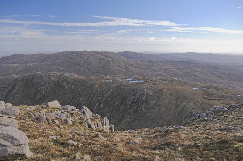
There is a big notch in the ridge towards Croaghbarnes then.
Wend your way through various loughs to reach Croaghbarnes. Measurement showed this to be 498.8m so confirming that it is not an Arderin.
We continued on to the Corrabbler river valley. It as easy enough to get down, but the going was slow on wet trackless terrain beside the river. We mostly stayed to the right bank looking down the stream.
Ford
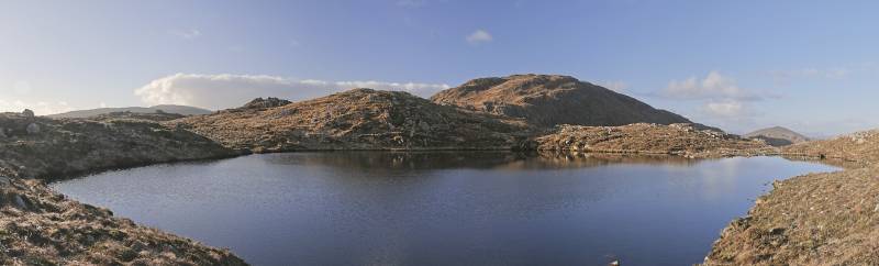
When we reached the outflow of Lough Belshade we found it to be very substantial and we needed to ford it, getting our feet properly wet.
There was then a longish, wetly dismal walk down to where we had a car parked near Edergole.
Nevertheless, overall a great day of good views, light wind and mostly good going.
NOTE: ALL information such as Ascent, Length and Creator time taken etc should be regarded as approximate. The creator's comments are opinions and may not be accurate or still correct.
Your time to complete will depend on your speed plus break time and your mode of transport. For walkers: Naismith's rule, an approximate though often inaccurate estimate, suggests a time of 3h 32m + time stopped for breaks
NOTE: It is up to you to ensure that your route is appropriate for you and your party to follow bearing in mind all factors such as safety, weather conditions, experience and access permission.
* Note: A GPS Height in the elevation profile is sourced from the device that recorded the track. An "SRTM" height is derived from a model of elevations for parts of the earth. More detail![]()
|
|
|
||
| MountainViews.ie, a Hill-walking Website for the island of Ireland. 2400 Summiteers, 1480 Contributors, maintainer of lists: Arderins, Vandeleur-Lynams, Highest Hundred, County Highpoints etc | |||