This website uses cookies, which are small text files that the website puts on your device to facilitate operation. Cookies help us provide a better service to you. They are used to track general user traffic information and to help the website function properly.
eamonoc: Track/4791 in area near Cruach an Bhearnais, Bluestack Mountains (Ireland)
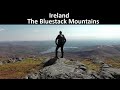
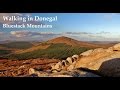
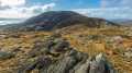
A tough outing in the Central Bluestack Mountains
Ascent: 820m,
Length: 15.6km,
Creator time taken: 5h21m
Descent: 799m,
Time predicted from Naismith's rule: 4h 29m + breaks
Click here to rate track
PlacesStart at Edergole Farm (Edergole) G97231 87070, Croaghbarnes, Meenanea, Cronamuck, end at Start
Track Rating ..
[RWD version 1 ]
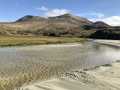
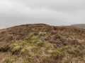
This route begins at some farm buildings up a minor road at the Northern end of Lough Eske, no parking issues. initially followed a farm tack uphill beside the Corraber River, this soon petered out and gave way to a really muddy boggy track heading towards Lough Belshade, had a tricky river crossing and headed towards Croaghbarnes over some very rough terrain, From Coraghbarnes Meenanea and Cornamuck lay to the north, the nearly 3.8km trek to both was over some very rough ground, heading back from Meenanea , i opted to head along the valley floor underneath Croaghbarnes, a fair old slog. Headed back to river and crossed again getting feet wet and followed rough muddy tract back along river to starting point. This was one of the toughest walks I have done in the Bluestack Mountains, plenty of wilderness and a huge sense of remotness about this area, not for the fainthearted.
Editing Details for track/4791
NOTE: ALL information such as Ascent, Length and Creator time taken etc should be regarded as approximate. The creator's comments are opinions and may not be accurate or still correct.
Your time to complete will depend on the speed of the slowest plus break time and your mode of transport.
NOTE: It is up to you to ensure that your route is appropriate for you and your party to follow bearing in mind all factors such as safety, weather conditions, experience and access permission.
Uploaded on: Sat, 28 Jan 2023 (13:32:59), Linkback: https://mountainviews.ie/track/4791/
* Note: A GPS Height in the elevation profile is sourced from the device that recorded the track. An "SRTM" height is derived from a model of elevations for parts of the earth. More detail
Use of MountainViews is governed by conditions and a privacy policy.
Read general information about the site. Opinions in material here are not necessarily endorsed by MountainViews.
Hillwalking is a risk sport. Information in comments, walks, shared GPS tracks or about starting places may
not be accurate for example as regards safety or access permission. You are responsible for your safety and your permission to walk.
See the credits and list definitions.


 Our Facebook page.