This website uses cookies, which are small text files that the website puts on your device to facilitate operation. Cookies help us provide a better service to you. They are used to track general user traffic information and to help the website function properly.
jgfitz: Track/4058 in area near Dublin/Wicklow (Ireland)
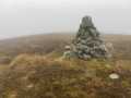
Old Downs Hill
Ascent: 259m,
Length: 10.3km,
Creator time taken: 2h56m
Descent: 254m,
Time predicted from Naismith's rule: 2h 30m + breaks
Click here to rate track
PlacesStart at Altidore Wood Entrance (Altidore) O24147 08288, Downs Hill, end at Start
Track Rating ..
[RWD version 1 ]
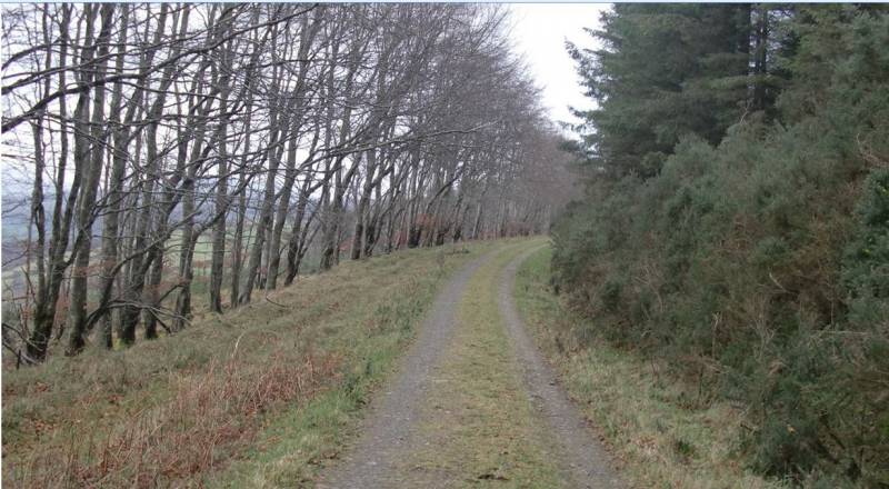
We first hiked this track in 2017 from The Grove Bar, Drummin, spot point 0 265 096. This is accessed from N11 north-bound only at the Delgany exit which is also signposted for Drummin. The only issue with this approach is the 1.5 km road walk on Old Downs Road (L5401) before commencing the hike proper. Our second attempt was from O 241 083, the same starting point as this current above-described track, but we headed up west of the current track, from roughly O 244 089 to 0 246 100 before joining the current track and then looping back to the trailhead. However, being the month of January 2018, it was very muddy on the way up through the passageway. Probably a good hike in the summer months. The current track is the all-weather version (as is the version from The Grove Bar), being on a good track the whole way. It is recommended that it be taken clockwise as this presents the better view. The trailhead is still signposted "Kilpedder Rifle Range" even though that has been defunct for many years. There is parking for 3 - 4 cars. Although we weren't blocking the entrance, a passing motorist asked us to move from the entrance because, he said, a large articulated vehicle was on the way and needed more access space. It never appeared. Methinks the locals might like to keep this hidden gem secret so that the narrow road will not become congested with parked cars. For the alternative option, there is ample parking near The Grove Bar.
Wicklow's "Dark Hedges" on Old Downs Hill
Editing Details for track/4058
NOTE: ALL information such as Ascent, Length and Creator time taken etc should be regarded as approximate. The creator's comments are opinions and may not be accurate or still correct.
Your time to complete will depend on the speed of the slowest plus break time and your mode of transport.
NOTE: It is up to you to ensure that your route is appropriate for you and your party to follow bearing in mind all factors such as safety, weather conditions, experience and access permission.
Uploaded on: Fri, 8 Mar 2019 (13:02:12), Linkback: https://mountainviews.ie/track/4058/
* Note: A GPS Height in the elevation profile is sourced from the device that recorded the track. An "SRTM" height is derived from a model of elevations for parts of the earth. More detail
Use of MountainViews is governed by conditions and a privacy policy.
Read general information about the site. Opinions in material here are not necessarily endorsed by MountainViews.
Hillwalking is a risk sport. Information in comments, walks, shared GPS tracks or about starting places may
not be accurate for example as regards safety or access permission. You are responsible for your safety and your permission to walk.
See the credits and list definitions.


 Our Facebook page.