You do not have to be logged in to donate.
If you want to use the website often please enrol (quick and free) at top right.

 Get Notifications
Lake District: Dale Head Horseshoe
Crocknasharragh: Impressive views on nitial ascent.
 Colin Murphy
Crocknasharragh: Fine views on ascent
 Colin Murphy
Lake District: Coledale Horseshoe
Cunnigar: Short trek to summit
 Fergalh
Longish walk to isolated top
 Colin Murphy
Westtown Hill: Tramore's Highest Point
 DeirdreM
Knockbrinnea West Top: Eflanagan on the Knockbrinneas
 eflanaga
Ascending the Knockbrinneas from the north.
 simon3
Knockbrinnea West Top: Larger Twin
 Collaborative entry
Lobawn Loop - Clockwise avoids any steep ascent! Easy stream crossing.
Knockaunanattin West Top: Views, loughs and a navigational aid.
 simon3
Use of MountainViews is governed by conditions and a privacy policy.
Read general information about the site.
Opinions in material here are not necessarily endorsed by MountainViews.
Hillwalking is a risk sport. Information in comments, walks, shared GPS tracks or about starting places may not be accurate for example as regards safety or access permission. You are responsible for your safety and your permission to walk.
See the credits and list definitions.
 Visit our Facebook page.
 Length: 17.3km, Creator time taken: 6h21m, Ascent: 418m,
Descent: 451m
Places: Start at Lon -14.3885, Lat 28.1104, end at Lon -14.3525, Lat 28.0496 7.6km SE from Start
Logged as completed by 1

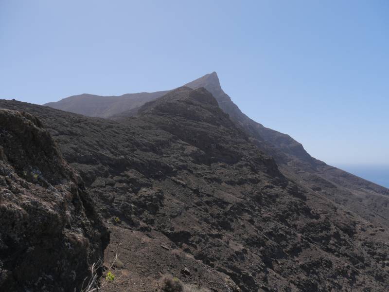
Using the Fuerteventura bus service, Tiadhe, we set out from Morro Jable on route 111 to Cofete. The bus left at 10am, as advertised, but it had around 20 places and these were full by 9:45. Stay in line. The bus driver was affable but it is first in line, first served.
The bus drive itself is a minor experience. It has to drive over the mountain range far further to the west, where there is a brief stop to take pictures. Then it goes along a 6km long rough road along the north side of the ridge before getting to Cofete.
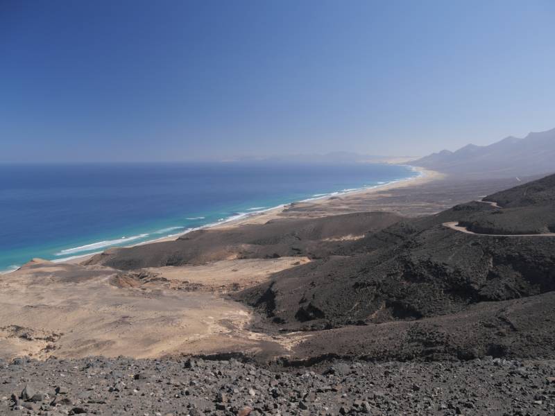
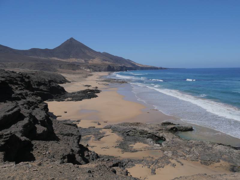
The mountains form an arc rising from the west and heading towards the east. They start lowish, rise to a height of over 800m just east of Cofete and then gradually sink again. Once there was a giant stratovolcano here, around 26km wide centred under what is now the sea off the coast of Cofete. It is thought that its sides reached around 1500m around 17 million years ago. Now what is left is just part of the ridge with Pico de la Zarza at 806m being the highest point.
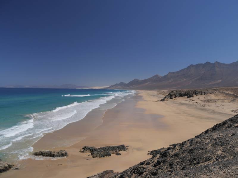
The road and col from Morro Jablo is just to the east of Montaña Aguda. Beyond there the beach stops.
Cofete has a coffee shop which also serves food which is a great place to get out of the sun and to get liquid replacement. Your enemy on trip like this is dehydration.
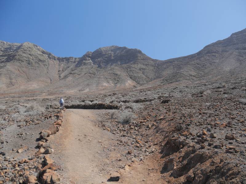
After leaving Cofete you come to the climb over the ridge. The route is tortuous though well maintained and reaches around 350m at the Degollada de Cofete and then into the Gran Valle gradually decending towards the south and Morro Jable, cafes and shelter.
NOTE: ALL information such as Ascent, Length and Creator time taken etc should be regarded as approximate. The creator's comments are opinions and may not be accurate or still correct.
Your time to complete will depend on your speed plus break time and your mode of transport. For walkers: Naismith's rule, an approximate though often inaccurate estimate, suggests a time of 4h 10m + time stopped for breaks
NOTE: It is up to you to ensure that your route is appropriate for you and your party to follow bearing in mind all factors such as safety, weather conditions, experience and access permission.
* Note: A GPS Height in the elevation profile is sourced from the device that recorded the track. An "SRTM" height is derived from a model of elevations for parts of the earth. More detail![]()
|
|
|
||
| MountainViews.ie, a Hill-walking Website for the island of Ireland. 2400 Summiteers, 1480 Contributors, maintainer of lists: Arderins, Vandeleur-Lynams, Highest Hundred, County Highpoints etc | |||