If you want to use the website often please enrol (quick and free) at top right.

 Get Notifications
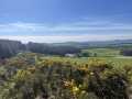
Mount Kennedy: Red kites in the blue sky
 hibby
hibby
Half Glencoaghan
Belmore from NW - SOUTH route CLOSED
Arroo Mountain: Arroo from E, partial drive in
Knocklettragh: Knockletragh from North - school report
Carrane from SSW
Carricktriss Gorse: Safe access to this hill no longer seems possible
 TommyMc
Binnion: Tullagh Bay and Rockstown Harbour
 Jim_Brady
Knocklettragh from north
Crocknapeast: Long walk up windfarm roads.
 Collaborative entry
Arroo from east
Donations Drive, now finished.
Use of MountainViews is governed by conditions and a privacy policy.
Read general information about the site.
Opinions in material here are not necessarily endorsed by MountainViews.
Hillwalking is a risk sport. Information in comments, walks, shared GPS tracks or about starting places may not be accurate for example as regards safety or access permission. You are responsible for your safety and your permission to walk.
See the credits and list definitions.
 Visit our Facebook page.
 Length: 15.4km, Creator time taken: 5h 4m, Ascent: 769m,
Descent: 713m
Places: Start at Lon -14.3295, Lat 28.05, end at Lon -14.323, Lat 28.0546 817m NE from Start
Logged as completed by 1

The start is from near the Ventura Shopping Centre itself near one of the roundabouts on the FV2. Going east out of town it is the last roundabout with beach rather than buildings to the seaward side.
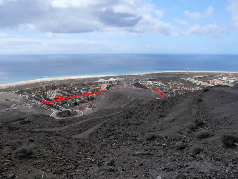
You ascend a steep urban road beside the large Barceló Jandía complex, turning left on relatively level road as shown in the photo. Follow the road there as it swings round and comes to an informal carpark as also shown in the picture. Thereafter and for much of the route there is dirt road.
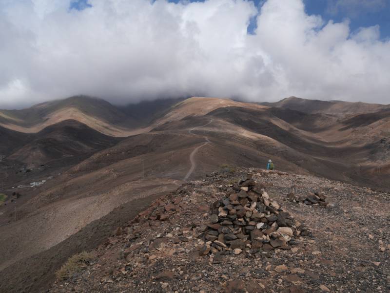
There is a minor summit called Talahijas 242m. The main track skirts this to the east however we went to the top from where much of the route up is visible. In our case there was cloud shown in the photo down to perhaps 650-700m, which, naturally, cleared after we had reached the top and were well on our way down.
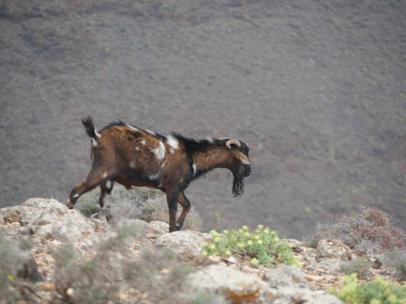
Great care is being taken in the natural park to preserve wild fauna and flora. Though it is clear that the fauna (goats) tend to eat the flora so that it never really establishes itself.
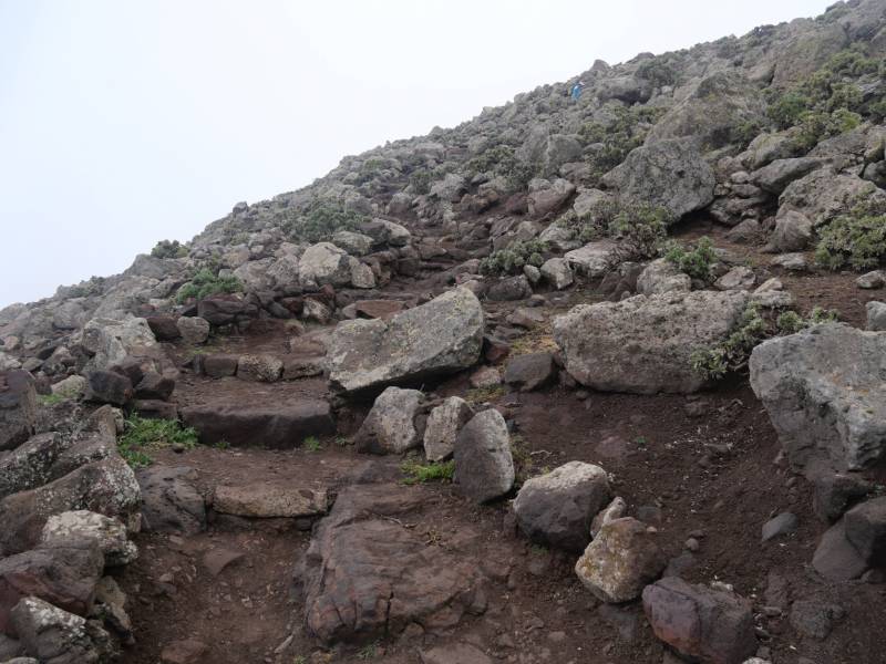
As you near the top the track becomes a narrow rough but effective maintained path. The area of the top is fenced off presumably for environmental/ ecological reasons.
Unfortunately we have to report that a determined effort has been made to prevent access to the ridges east and west of Zarza both of which look interesting. This has the effect of making the trip a straight up and down affair. There is always a balance between environmental measures and walker access. While we don't have all the facts, we can say that the restrictions deter a more interesting circular routes.
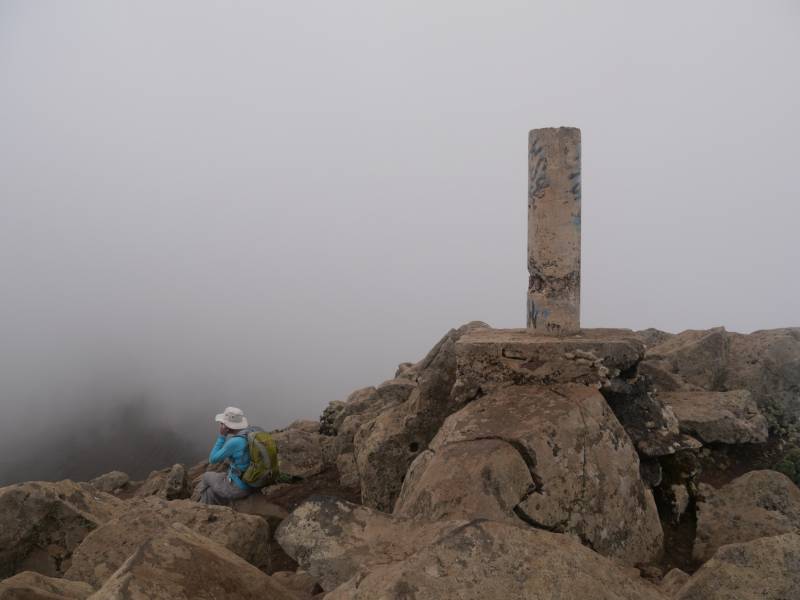
The actual summit has a trig pillar. Unfortunately we can't share with you the fabulous view we had hoped to find of the west and windward side of the peninisula, due to the cloud.
All in all a great leg stretch but one which is seriously constrained to a straight up and down which makes it monotonous.
We couldn't get the views however the cloud made the walking a great deal easier in the warm climate.
NOTE: ALL information such as Ascent, Length and Creator time taken etc should be regarded as approximate. The creator's comments are opinions and may not be accurate or still correct.
Your time to complete will depend on your speed plus break time and your mode of transport. For walkers: Naismith's rule, an approximate though often inaccurate estimate, suggests a time of 4h 21m + time stopped for breaks
NOTE: It is up to you to ensure that your route is appropriate for you and your party to follow bearing in mind all factors such as safety, weather conditions, experience and access permission.
* Note: A GPS Height in the elevation profile is sourced from the device that recorded the track. An "SRTM" height is derived from a model of elevations for parts of the earth. More detail![]()
|
|
|
||
| MountainViews.ie, a Hill-walking Website for the island of Ireland. 2400 Summiteers, 1480 Contributors, maintainer of lists: Arderins, Vandeleur-Lynams, Highest Hundred, County Highpoints etc | |||