This website uses cookies, which are small text files that the website puts on your device to facilitate operation. Cookies help us provide a better service to you. They are used to track general user traffic information and to help the website function properly.
Feature count in area: 12, all in Mayo,
OSI/LPS Maps: 30, 31, 37, 38, CBE, CBW, MSW
Highest Place: Croagh Patrick 764m
Starting Places (19) in area Croagh Patrick: Balloor, Ben Goram Road, Bracklagh, Carrowmore Hill South, Carrowrevagh Lough, Cregganbaun, Keelkill North, Kilgeever Wood, Killeennimat Burial Ground, Kinknock, Laghta Eighter, Laghta Eighter Hill NE, Murrisk Fishermans Monument, National Famine Memorial, Old Head, Paddy's Place, Prospect Lough Road, Sruhaunpollanoughty, St Patricks Church
Summits & other features in area Croagh Patrick: N: North Ridge: Ben Goram 559m, Boheh Hill 219m, Croagh Patrick 764m, Crott Mountain 500m, Lugnademon 510m, Teevenacroaghy 487m S: Owenmore: Carrowrevagh 210m, Knockakishaun 390m, Oughty Hill 333m W: Louisburgh Hills: Balloor Hill 147m, Carrowmore Hill 171m, Kinknock Hill 173m
Note: this list of places may include island features such as summits, but not
islands as such.
Crott Mountain, 500mMountain An Chrot A name in Irish,
Place Rating ..
Ir. An Chrot [logainm.ie], ‘the hump’, Sliabh Buí, Mayo County in Connacht province, in Arderin Lists, Crott Mountain is the 572nd highest place in Ireland.
Grid Reference L92933 80451,
OS 1:50k mapsheet 31 Place visited by: 192members, recently by: Carolineswalsh, mountainmike, Oscar-mckinney, Carolyn105, srr45, Arcticaurora, paulbrown, Wes, TommyMc, abcd, GerSomers, andalucia, Taisce, chelman7, eoghancarton
I visited this place: NO (You need to be a logged-in member for this.)
Longitude: -9.62428, Latitude: 53.762794, Easting: 92933, Northing: 280451,
Prominence: 74m, Isolation: 0.8km ITM: 492905 780467 Bedrock type: Pelite, psammite, limestone, tuff, (Bouris Formation) Notes on name: previously Croagh Patrick Far East Top on MountainViews
Short or GPS IDs, 6 char: CrtMnt, 10 char: CrtMntn Linkback: https://mountainviews.ie/summit/457/
Gallery for Crott Mountain (An Chrot) and surrounds
Summary
for Crott Mountain (An Chrot):
Quiet Arderin at the east end of the Croagh Patrick ridge.
Summary created by simon3
2011-06-07 13:08:15
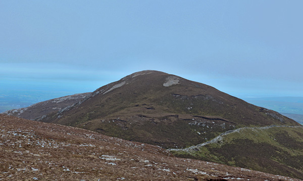
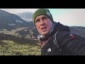
Picture: Croagh Patrick Far East Top: View from the west.
Like all of the summits on this EW ridge it has a magnificent view of the islands of Clew Bay, the Achill to Nephin skyline and the south Mayo mountains such as Mweelrea. You can start at around Pros Rd (L9494 8095). There is a limited amount of parking around. Follow the waymarked way until you reach a stile allowing access to the heather covered upland at around A (L9443 8030)
The summit has low heather on the top and a small cairn of stones. It is easy to walk over largely untracked ground to its eastern neighbour, Croagh Patrick East top.
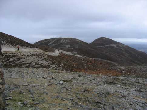
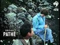
Picture: View of East Top from saddle of Croaghpatrick
david bourke on Crott Mountain
by david bourke
22 Jan 2007
Sunday 21st January 2007 Arrived in Murrisk with a view to climb Croaghpatrick. After a night of heavy rain and hailstones the summit was already white. On the ascent we encountered some nasty showers thought thankfully none lasted too long. For the final 100 metres the path was covered in snow. It took just one and a half hours to make the climb. After a quick flask of tea we descended to the saddle and instead of going straight down to the car park we opted to continue east along the ridge. and climbed up to East Top. My GPS reading showed a hight of 502m and coordinates of N 53* 45.767' W 009*37.456' or IG ref B (L92933 80451) It was a pleasant walk from the saddle and involved a climb of a mere 70m. The terrain is very different to Croaghpatrick itself as it is covered in grass. After a few minutes stop to enjoy the wonderful views of the now visible Clew Bay we descended the 70m once more. Between East top and the saddle lies another small summit which we decided to climb and at the top my GPS showed a height of 494m just 6m short of the majical figure of 500! Enough climbing for today! 1200m total so we headed down to the car park and on to Westport Quay for very welcome dinner before returning home. Linkback: mountainviews.ie/summit/457/comment/2592/
Read Less
Read More
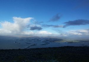
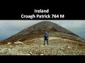
Picture: Clew Bay from Croagh Patrick FE Top
Colin Murphy on Crott Mountain
by Colin Murphy
10 Dec 2007
If you fancy a long day's walking and some very rewarding views, this top can be the first in a ridge of 3, the second being Croagh Patrick of course followed by Ben Goram. As David Bourke suggested, take the normal path up from Murrisk and then veer east at the saddle along a very narrow track (called the Pilgrim's Path). The day we went up it was pretty clear but rain from the previous few days had rendered the track a mudbath and itsonly use really was a line to follow. It petered out near a wall around the summit and the final ascent is straight up through the heather (though steep it is relatively easy). Pray to St Patrick for a clear day...because the views are tremendous. Linkback: mountainviews.ie/summit/457/comment/2917/
Read Less
Read More
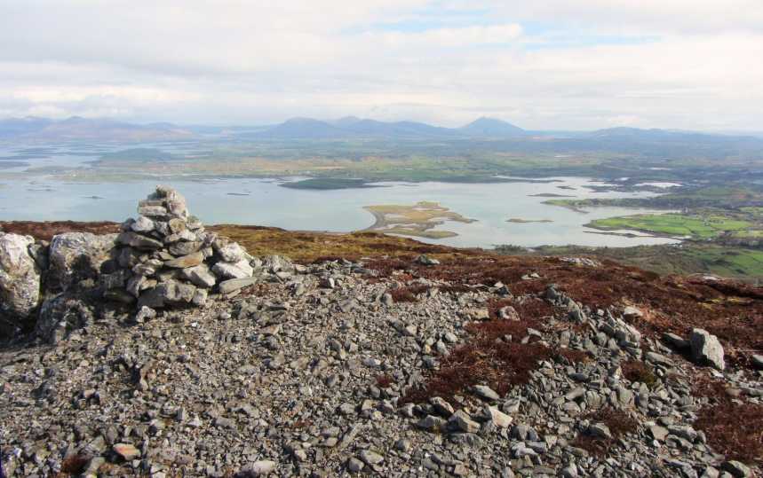
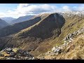
Picture: Looking NE from the eastern rim
Extraordinary Views of Clew Bay and beyond
by CaptainVertigo
4 May 2016
If you ascend Crott it will be well worth your while to go to the eastern end of the plateau. The rim is perched on very steep ground and you will have unrestricted views to the east overlooking Westport and its hinterland. The vista is quite stunning and can be easily achieved by starting at Pros Rd (L9494 8095) (limited parking) and following the Western Way right along the south of the mountain and up to the summit and then back to the eastern rim. There would be no point in launching a full frontal assault on the eastern cliff, although I did descend that way with great caution (Track 3229). Linkback: mountainviews.ie/summit/457/comment/18516/
Use of MountainViews is governed by conditions and a privacy policy.
Read general information about the site. Opinions in material here are not necessarily endorsed by MountainViews.
Hillwalking is a risk sport. Information in comments, walks, shared GPS tracks or about starting places may
not be accurate for example as regards safety or access permission. You are responsible for your safety and your permission to walk.
See the credits and list definitions.


 Our Facebook page.