This website uses cookies, which are small text files that the website puts on your device to facilitate operation. Cookies help us provide a better service to you. They are used to track general user traffic information and to help the website function properly.
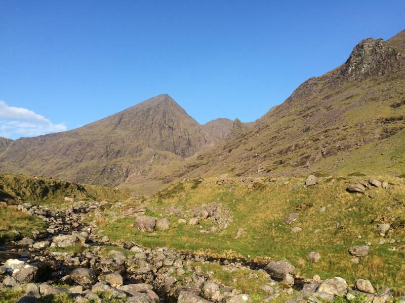
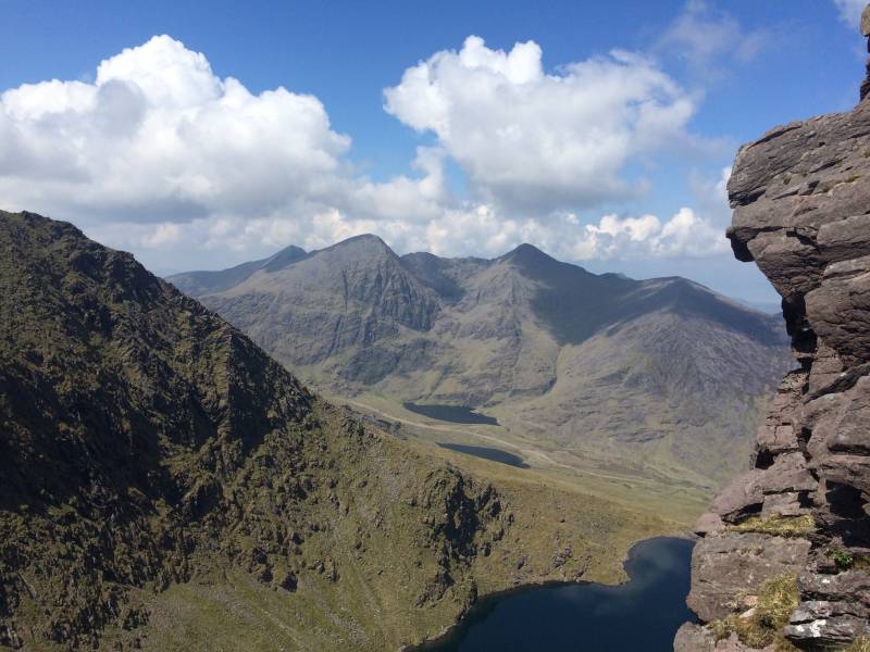
conormcbandon: Track/4398 in area near Hag's Tooth, MacGillycuddy's Reeks (Ireland)
A circuit of the Reeks
Ascent: 2971m,
Length: 35.1km,
Creator time taken: 14h 6m
Descent: 3001m,
Time predicted from Naismith's rule: 11h 59m + breaks
Click here to rate track
PlacesStart at Cronins Yard (Cronins) V83585 87289, Hag's Tooth, Knockbrinnea East Top, Knockbrinnea West Top, Beenkeragh, The Bones Peak, Carrauntoohil, Cnoc na Toinne, Cnoc an Chuillinn, Cnoc an Chuillinn East Top, Maolán Buí, Knocknapeasta, The Big Gun, Cruach Mhór, Cnoc an Bhráca, Cnoc na dTarbh, Purple Mountain, Purple Mountain NE Top, Shehy Mountain, Tomies Mountain, Tomies Mountain North Top, Strickeen, end at Start
Track Rating ..
[RWD version 1 ]
A big day out on the reeks and the eastern side of the gap of Dunloe taking advantage of the fabulous weather. I cannot understand how most peoples' main only objective is Carrauntohill and the magnificent eastern Reeks are rarely visited. I encountered very few people on this route on a Sunday apart from the immediate area around Carrauntohill and the Devil's Ladder. My descent into the gap of Dunloe from the Reeks was not ideal and there must be a more appropriate route. While crossing over Purple, Shehy and Tomies mountains I could hear the rumble of thunder to the east possibly coming from very dark clouds sitting over the Paps. It helped to speed up my crossing and descent off the mountains. I had planned to have dinner in Kate Kearney's cottage but was running late and couldn't afford the diversion. The ascent up Strickeen was quite slow after the long day.
Editing Details for track/4398
NOTE: ALL information such as Ascent, Length and Creator time taken etc should be regarded as approximate. The creator's comments are opinions and may not be accurate or still correct.
Your time to complete will depend on the speed of the slowest plus break time and your mode of transport.
NOTE: It is up to you to ensure that your route is appropriate for you and your party to follow bearing in mind all factors such as safety, weather conditions, experience and access permission.
Uploaded on: Tue, 27 Oct 2020 (22:45:16), Linkback: https://mountainviews.ie/track/4398/
* Note: A GPS Height in the elevation profile is sourced from the device that recorded the track. An "SRTM" height is derived from a model of elevations for parts of the earth. More detail
Use of MountainViews is governed by conditions and a privacy policy.
Read general information about the site. Opinions in material here are not necessarily endorsed by MountainViews.
Hillwalking is a risk sport. Information in comments, walks, shared GPS tracks or about starting places may
not be accurate for example as regards safety or access permission. You are responsible for your safety and your permission to walk.
See the credits and list definitions.


 Our Facebook page.