This website uses cookies, which are small text files that the website puts on your device to facilitate operation. Cookies help us provide a better service to you. They are used to track general user traffic information and to help the website function properly.
muddyboots: Track/4301 in area near Knockeirky South Top, Caha Mountains (Ireland)
Bang for your Buck!
Ascent: 468m,
Length: 3.4km,
Creator time taken: 1h50m
Descent: 262m,
Time predicted from Naismith's rule: 1h 27m + breaks
Click here to rate track
PlacesStart at Canshanavoe South (Cn'avoe) V82868 52719, Knockeirky South Top, end at V82345 53355, 823m NW from Start
Track Rating ..
[RWD version 1 ]
Best done as a solo trip as hard to link with other routes. Parked in a layby and walked up road to a gate. Climbed over and went slightly left of the mountain to use the "greenways' so classic of the Caha moutains. These are green areas sandwiched between
Follow "greenways" on the left. Looking North
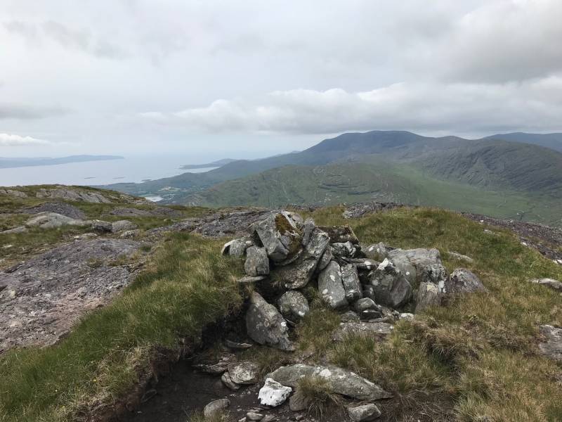
the often signficiant drops of redsandstone. Going up I went straight up which involved some scrambling.Fantastic views all directions. Small summit cairn. I descended on a more "gentle' slope by following the water course, initially staying to the right of it then crossing once became less steep and contoured around the lower slopes. Great day out!
Editing Details for track/4301
NOTE: ALL information such as Ascent, Length and Creator time taken etc should be regarded as approximate. The creator's comments are opinions and may not be accurate or still correct.
Your time to complete will depend on the speed of the slowest plus break time and your mode of transport.
NOTE: It is up to you to ensure that your route is appropriate for you and your party to follow bearing in mind all factors such as safety, weather conditions, experience and access permission.
Uploaded on: Wed, 10 Jun 2020 (13:10:22), Linkback: https://mountainviews.ie/track/4301/
* Note: A GPS Height in the elevation profile is sourced from the device that recorded the track. An "SRTM" height is derived from a model of elevations for parts of the earth. More detail
Use of MountainViews is governed by conditions and a privacy policy.
Read general information about the site. Opinions in material here are not necessarily endorsed by MountainViews.
Hillwalking is a risk sport. Information in comments, walks, shared GPS tracks or about starting places may
not be accurate for example as regards safety or access permission. You are responsible for your safety and your permission to walk.
See the credits and list definitions.


 Our Facebook page.