If you want to use the website often please enrol (quick and free) at top right.

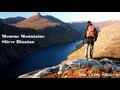
Slieve Donard 849m, Slieve Commedagh 767m, Slieve Binnian 745.9m, Slieve Bearnagh 739m, Slievelamagan 702.2m, Slieve Meelbeg 701.9m, Slieve Meelmore 687m, Slieve Binnian North Tor 682.5m, Slieve Bearnagh North Tor 680m, Slieve Binnian North Top 678m,
 Get Notifications
A visit to Tievummera via its South East spur.
 simon3
Croagh Patrick's ridge to the east, visited from the south.
Ben Creggan: Craggy summit with long descending spur to the east.
 Collaborative entry
Teevenacroaghy: Misty Achill.
 simon3
Dorinish More: Shapely islands in Clew Bay, Co Mayo.
 simon3
Crott Mountain: Quiet Arderin at the east end of the Croagh Patrick ridge.
 Collaborative entry
Teevenacroaghy: A heathery ridge bump with good views.
 Collaborative entry
Teevenacroaghy: A clear day on the Hill
 three5four0
Madeira: From Pico Arieiro to Pico Ruivo
Madeira: Coastal/Cliff walk to the Eastern Edge
Madeira: Descent from Monte to Funchal
Hag's Tooth: This might hurt
 No1Grumbler
Use of MountainViews is governed by conditions and a privacy policy.
Read general information about the site.
Opinions in material here are not necessarily endorsed by MountainViews.
Hillwalking is a risk sport. Information in comments, walks, shared GPS tracks or about starting places may not be accurate for example as regards safety or access permission. You are responsible for your safety and your permission to walk.
See the credits and list definitions.
 Visit our Facebook page.
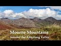
 Length: 19.4km, Creator time taken: 39h11m, Ascent: 1157m,
Descent: 1155m
Places: Start at J3450521922, Cove Mountain, Slievelamagan, Slieve Binnian North Tor, Slieve Binnian, end at Start
Logged as completed by 2

This track reflects the route of an Ulster Mountain Pursuit Challenge (MPC). The MPC is a weekend-long hiking and camping event, and there is one held in each province every year. The 2019 Ulster MPC was held in the Mourne Mountains on the weekend of 11th-13th October 2019. The MPC is a Scouting Ireland event which tests both navigational and lightweight camping skills, as well as giving scouts an opportunity to implement Leave no Trace principles. 21 teams of 4 scouts participated, with each team supported by an adult leader. The role of the leader is to provide background supervision and guidance, but it is the scouts who must conduct the navigation using compass and map to plot out and follow a series of coordinates across the official route. A series of checkpoints staffed by MPC coordinators ensure that teams are making good progress and are safe and accounted for. The coordinators also conduct on-the-spot exercises to test scouts’ navigational knowledge, distant feature recognition ability, understanding of how to orient the map, and demonstrating competence in how to take and follow a compass bearing. It is a fairly gruelling test of both mental and physical stamina while navigating purely by map and compass. I took the opportunity to quietly capture the route on my GPS to share a great route which young people undertook with anywhere from 9-15kg of gear strapped to their backs!
The route started at 8pm at the Carrick Little car park. Full gear checks were followed by a 2-hour night hike in to the first campsite below Cove Mountain alongside the river. Open fires are prohibited so lightweight trangia stoves were used to make tea and warm up various meals. I counted 66 tents at one point, but with teams arriving up until 12:30am the figure was probably closer to 75 tents.
Teams are dispatched at intervals and we were the second team out the following morning. Our campsite was completely cleared and checked before we commenced an easy hike along the track below Cove Mountain. This took us far up into the valley to the river junction. A clear morning gave us wonderful views all around. These views expanded as we undertook the very wet and steep haul up to the col between Cove Mountain and Slieve Beg. From the col it was another tiring and steep haul up to the summit of Cove. Continued good weather ensured that the emerging views were able to be appreciated in all their glory.
From Cove it was a straightforward climb down to the col with Slieve Lamagan. The climb up to Lamagan, although a similar amount of ascent as the climb up to Cove, was by consensus an easier climb. Perhaps this was due to a slightly less demanding slope, or perhaps it was because we were adapting to the merciless weights we were toting on our backs. Lamagan arrived relatively quickly and a well-deserved lunch break was taken. What might only take someone with a day pack a couple of hours to achieve had taken our group laden down with tents and food etc 3.5 hours. The next objective loomed large to the south – Slieve Binnian. In a hollow on its northwest slopes we espied Binnian Lough which was to be our campsite for the night. However Binnian Lough was still many weary hours away from the summit of Slieve Lamagan. One rather naïve scout looked hopefully around and asked ‘where’s the next hill we have to climb?’ I nodded towards the distant hulk of Binnian, its jagged tors silhouetted against the sun behind. The scout looked down the slope of Lamagan expecting to see the next ‘hill’ somewhere down there, before his eyes travelled across to Binnian and slowly climbed up its massive bulk. ‘You’re joking’ he managed to splutter. ‘Look on the positive side’, I replied, ‘ we’ve now passed the point where it’s quicker to keep going forward than retrace our steps!’.
I was once told that Slieve Lamagan comes from the Irish lamh agus gluin (hands and knees). The given MountainViews place name translation ‘creeping/crawling mountain’ reflects the same general idea which is the notion that one must literally crawl on hands and knees up the southern slope of Slieve Lamagan. We were lucky that we were travelling in the other direction, but we still found the descent down to the col with Binnian to be very long and tiring. It took about an hour for the 300m descent, with another checkpoint waiting for us in the col to test the scouts’ knowledge of magnetic variation and the geological formation of tors.
The climb up to the checkpoint at Slieve Binnian North Tor was long and tiring, but was alleviated by both intermittent manmade ‘stairs’ and the breath-taking constantly expanding views. We looked on in amazement as two men jogged down the slope, each carrying a bicycle on their shoulder, and we marvelled at two other men who strolled past in their Sunday best. Perhaps the weariness and burdens we carried skewed our perception, but there was a clear disparity between us, decked out head to toe in Gore-Tex and technical clothing and boots, and these two gentlemen in their polished leather shoes and blazers. Perhaps we were just feeling that they took away from our sense of adventure, hardship and achievement?
The North Tor checkpoint was another welcome respite, although another round of ‘name that summit’ and ‘give me a bearing to Lough Shannagh’ was endured before we were released. The back castles and the main Binnian summit arrived relatively quickly, but the final few metres ascent to Binnian was the hardest of the day. Mercifully the checkpoint was brief and we soon followed the Mourne Wall down before branching off for the slog through the bog to reach our campsite at Binnian Lough. We reached the lake at 6:30pm which was almost 9 hours after we set off from our camp below Cove Mountain that morning. However our walking time was punctuated with many stops to check navigation, undergo assessments and to take the frequent breaks required when carrying such heavy rucksacks.
Sunday morning contrasted sharply with the beautiful Saturday evening sunset. Dense cloud and persistent rain pattered off both raingear and tents as we dismantled camp. The scouting method attention to detail was apparent as over 100 scouts and leaders left the campsite in pristine condition. One could even argue we left it in better condition as we routinely pick up rubbish left behind by other visitors to the mountains. Another slog of around 80 minutes took us back down to the Annalong Track and back to Carrick Little car park. The overall route was around 20km in length in total. The good weather we had on the Saturday had afforded long-reaching and clear views of many of the surrounding Mourne Mountains. Our route also ensured good access to water at both of the camping sites. 
My own pack was 22kg when I set out and the challenge now is to reduce this down to around 12kg for my next MPC. It’s amazing how many grams could be culled by using plastic ‘sporks’ instead of metal cutlery, or aluminium tent pegs instead of heavier metal ones. Also sourcing drinking water ‘on the go’ saves 1kg for every litre not carried from the start. However while scouts get the luxury of splitting the weight load of tents, food and cooking gear between them, the leaders must carry everything they need on their own so there’s no way to completely avoid the necessity, as The Pogues put it to ‘hump tent and peg’ around the hills!
NOTE: ALL information such as Ascent, Length and Creator time taken etc should be regarded as approximate. The creator's comments are opinions and may not be accurate or still correct.
Your time to complete will depend on your speed plus break time and your mode of transport. For walkers: Naismith's rule, an approximate though often inaccurate estimate, suggests a time of 5h 49m + time stopped for breaks
NOTE: It is up to you to ensure that your route is appropriate for you and your party to follow bearing in mind all factors such as safety, weather conditions, experience and access permission.
* Note: A GPS Height in the elevation profile is sourced from the device that recorded the track. An "SRTM" height is derived from a model of elevations for parts of the earth. More detail![]()
|
|
|
||
| MountainViews.ie, a Hill-walking Website for the island of Ireland. 2400 Summiteers, 1480 Contributors, maintainer of lists: Arderins, Vandeleur-Lynams, Highest Hundred, County Highpoints etc | |||