Guestuser: Login or enrol?
- Home
- Main Display
- Main Display (Old)
- Find a Walk
- Display INTRODUCTION
- DONATE
- Click below for your
profile & contributions
guestuser- New
- Tracks, Walks
- Challenge
- Community
- Lists & Logs
- Popular Lists:
- County Highpoints
- Range & Area Highpoints
- Local 100
- Highest Hundred
- Vandeleur-Lynams
- Arderins
- Carns
- Best rated
- Irish 900 up
- Irish Island
- Munros
- All Lists
- Shorter Irish
- County Highpoints
- Range & Area Highpoints
- Highest Hundred
- Local 100
- Local 100 (pre2014)
- Local Historical Cultural
- Best rated
- Irish 900 up
- Larger Irish
- Arderins
- Arderin Begs
- Arderins + Arderin Begs
- Vandeleur-Lynams
- Vandeleur-Lynams + Arderins
- Carns
- Binnions
- Highest 50 per Province
- Island Features
- Irish Island
- Coastal Hills
- Irish 600 up
- Irish 500 up
- British
- Munros
- British 600 up
- British 500-600
- British Marilyns
- Comprehensive
- All Irish summits
- All Irish features
- All British summits
- All Britain+ Ireland
- Special
- Analysis List
- Simple Irish Listings
- Simple Irish & British Listings
-
- More
- Motley Views
Welcome to MountainViews
If you want to use the website often please enrol (quick and free) at top right.OverviewFor more map options click on any overview map area or any detail map feature.Detail Map FeaturesFind Suggested Walks
Find hill, mountain, island, coastal feature.Videos
 Recent Contributions
 Get Notifications
Cairnpapple Hill: Head for Ballinacrieff Hill
Lanzarote, Puerto del Carmen Stroll
Crocknasleigh: short hill with long views
Knocknacloghoge: Knocknaclochoge in the early summer
Burren: Black Head Loop
Ballaghnabehy Top: Easily reached Dartry with great views
Letterettrin - a perspective on the N Connemara peaks
Donnell's Hill: Great views of the Comeraghs
Kilbrony Park Ramble
Knocklettercuss: Ascend via the spur
Dún Briste: You must be joking
Knocknakilton & Cummeen, Dingle Penninsula
Conditions and Info
Use of MountainViews is governed by conditions and a privacy policy.
Read general information about the site.
Opinions in material here are not necessarily endorsed by MountainViews.
Hillwalking is a risk sport. Information in comments, walks, shared GPS tracks or about starting places may not be accurate for example as regards safety or access permission. You are responsible for your safety and your permission to walk.
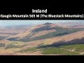
See the credits and list definitions.Video displayDonegal East Area S: Castlefinn Hills SubareaPlace count in area: 12, OSI/LPS Maps: 11, 12, 6, 7
Highest place: Culliagh SE Top, 369m
Maximum height for area: 369 metres, Maximum prominence for area: 241 metres,
Places in area Donegal East:
N: Raphoe:Binnion Hill 190mDooish Mountain 266mHigh Bank 171mMongorry Hill 284m
NW: Letterkenny Hills:Ballystrang 292mCark Mountain 364mCulliagh SE Top 369mGregory Hill 336mKnockbrin 259m
S: Castlefinn Hills:Croaghan Hill 217mFearns Hill 231mMeenavally 219m
Note: this list of places includes island features such as summits, but not islands as such.
Donegal County in Ulster Province, in Binnion List, Marble, quartzite, psammite; graphitic Bedrock
Height: 219m OS 1:50k Mapsheet: 6, 11 Grid Reference: H17517 97943
Place visited by 23 members. Recently by: MichaelG55, mountainmike, Colin Murphy, madfrankie, wintersmick, ronanmckee, trostanite, conormcbandon, dino, dregish, paddyhillsbagger, AntrimRambler, BigFly, mark-rdc, Harry GoodmanI have visited this place: NO (You need to be a logged-in member to change this.)Longitude: -7.728225, Latitude: 54.828972 , Easting: 217517, Northing: 397943 Prominence: 124m, Isolation: 9.2km
ITM: 617462 897932 , GPS IDs, 6 char: Mnvly, 10 char: Meenavally
Bedrock type: Marble, quartzite, psammite; graphitic, (Aghyaran & Killygordon Limestone Formation)
Meenavally is the 1364th highest place in Ireland.
Linkback: https://mountainviews.ie/summit/1263/COMMENTS for Meenavally 1 of 1  Follow this place's comments
 Height layer: © MapTiler

MountainViews.ie, a Hill-walking Website for the island of Ireland. 2500 Summiteers, 1480 Contributors, maintainer of lists such as: Arderins, Vandeleur-Lynams, Highest Hundred, County Highpoints etc

 Fergalh
 Collaborative entry
 glencree
 Collaborative entry
 glencree
 DeirdreM
 TommyV
 TommyV
 Visit our Facebook page.