Donation Request 2024
You do not have to be logged in to donate.
DONATE
Members and Supporters, the MountainViews Committee requests your help to meet the costs of the website and of other activities such as insured events or publications.You do not have to be logged in to donate.
Welcome to MountainViews
If you want to use the website often please enrol (quick and free) at top right.
If you want to use the website often please enrol (quick and free) at top right.
Overview

For more map options click on any overview map area or any detail map feature.
Detail Map Features
Showing 6 items:
Murren Hill 227m, Drumavohy Hill 153m,
2165, 9km
2534, 3km
3124, 3km
2537, 1km
Murren Hill 227m, Drumavohy Hill 153m,
Tracks:
Find Suggested Walks
Find hill, mountain, island, coastal feature.
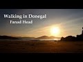
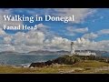
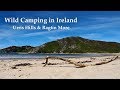
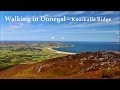
Videos
Recent Contributions
 Get Notifications
Get Notifications
Lake District: Dale Head Horseshoe
Crocknasharragh: Impressive views on nitial ascent.
 Colin Murphy
Lake District: Coledale Horseshoe
Cunnigar: Short trek to summit
 Fergalh
Longish walk to isolated top
 Colin Murphy
Westtown Hill: Tramore's Highest Point
 DeirdreM
Knockbrinnea West Top: Eflanagan on the Knockbrinneas
 eflanaga
Ascending the Knockbrinneas from the north.
 simon3
Knockbrinnea West Top: Larger Twin
 Collaborative entry
Lobawn Loop - Clockwise avoids any steep ascent! Easy stream crossing.
Knockaunanattin West Top: Views, loughs and a navigational aid.
 simon3
Ireland's County Second Summits
 murphysw
Conditions and Info
Use of MountainViews is governed by conditions and a privacy policy.
Read general information about the site.
Opinions in material here are not necessarily endorsed by MountainViews.
Hillwalking is a risk sport. Information in comments, walks, shared GPS tracks or about starting places may not be accurate for example as regards safety or access permission. You are responsible for your safety and your permission to walk.
See the credits and list definitions.
 Visit our Facebook page.
Video display
Donegal North
Area E: Fanad Subarea
Place count in area: 9,
OSI/LPS Maps: 2
Highest place: Knockalla, 363m
Maximum height for area: 363 metres,
Maximum prominence for area: 328 metres,
Places in area Donegal North:
Cen: Rosguill:Crocknasleigh 163mGaniamore 207m
E: Fanad:Cashelmore 149mKnockalla 363mMurren Hill 227mCrockdonnelly 152mCraigcannon 357mDrumavohy Hill 153m
W: Horn Head:Croaghnamaddy 252m
Note: this list of places includes island features such as summits, but not islands as such.
Highest place:
Knockalla, 363mPlaces in area Donegal North:
Cen: Rosguill:
Crocknasleigh 163mGaniamore 207mE: Fanad:
Cashelmore 149mKnockalla 363mMurren Hill 227mCrockdonnelly 152mCraigcannon 357mDrumavohy Hill 153mW: Horn Head:
Croaghnamaddy 252mNote: this list of places includes island features such as summits, but not islands as such.

An Mhoirinn')
Bedrock type: Whitish quartzite with pebble beds, (Slieve Tooey Quartzite Formation)
The highest hill on Fanad N of Knockalla. The name of the hill appears to be connected with the townland of An Mhoirinn/Murren in Clondavaddog parish. The initial B- of the genitive may seem anomolous, given that the nominative has M-, but these are the forms which have been collected locally. OWEN: You know that old limekiln beyond Con Connie Tim's pub, the place we call the Murren? – do you know why it's called the Murren? (MANUS does not answer.) I've only just discovered. It's a corruption of Saint Muranus. It seems Saint Muranus had a monastery somewhere about there at the beginning of the seventh century. And over the years the name became shortened to the Murren. Very unattractive name, isn't it? I think we should go back to the original – Saint Muranus. What do you think? The original's Saint Muranus. Don't you think we should go back to that? (No response. OWEN begins writing the name into the Name-Book.) (Brian Friel, Translations, Faber & Faber, 1981) Cnoc na Boirne is the 1343th highest place in Ireland.
Linkback: https://mountainviews.ie/summit/1024/
COMMENTS for Murren Hill (Cnoc na Boirne) 1 of 1  Follow this place's comments

|
|
|
|
||
| MountainViews.ie, a Hill-walking Website for the island of Ireland. 2400 Summiteers, 1480 Contributors, maintainer of lists: Arderins, Vandeleur-Lynams, Highest Hundred, County Highpoints etc | |||