This website uses cookies, which are small text files that the website puts on your device to facilitate operation. Cookies help us provide a better service to you. They are used to track general user traffic information and to help the website function properly.
BrianKennan: Track/4582 in area near Great Sugar Loaf, Wicklow (Ireland)
Glenview, Great Sugarloaf, Sugarlump, Little Sugarloaf loop
Ascent: 742m,
Length: 14.3km,
Creator time taken: 4h54m
Descent: 723m,
Time predicted from Naismith's rule: 4h 6m + breaks
Click here to rate track
PlacesStart at Glenview Hotel (GlView H) O25453 11885, Great Sugar Loaf, Little Sugar Loaf, end at Start
Track Rating ..
[RWD version 1 ]
This trail is full of optional elements. Setting out from the carpark of the Glenview hotel, you have the option of coffee in the hotel lounge or on the patio overlooking the glen. The trail starts along a quiet road and then cuts up on a trail to the Great Sugarloaf.
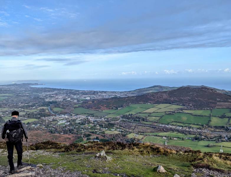
View from summit of Great Sugarloaf facing North
The trail provides the option of circumnavigating the peak if you prefer to avoid the summit.
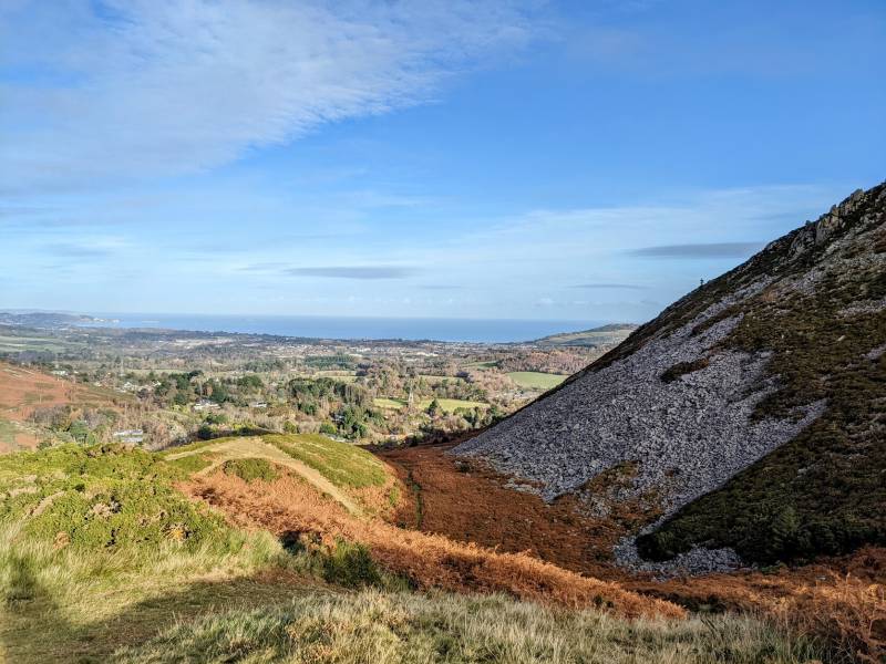
Decending the Northern side of the Great Sugarloaf
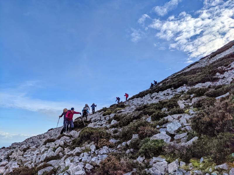
Similarly, there's a spur that will take you to the top of the Sugarlump, or you can take the trail around it.
North-West slope of the "Sugarlump"
The trail then snakes around through a sheltered hollow (great spot for a snack) and then meets the road and presents the option of the footbridge or the road bridge to cross to the Little Sugarloaf. After the climb along a quiet road and mountain trail, the Little Sugarloaf offers arguably better views than the Great Sugarloaf and is a very worthwhile climb.
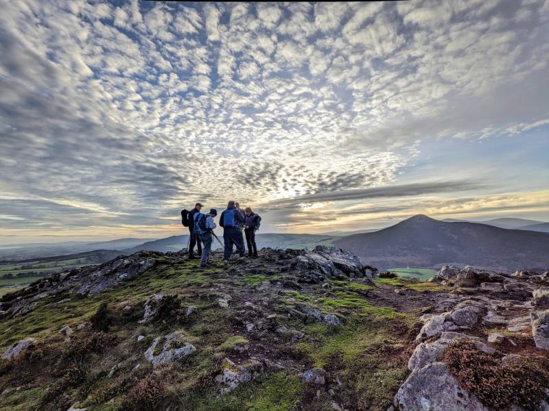
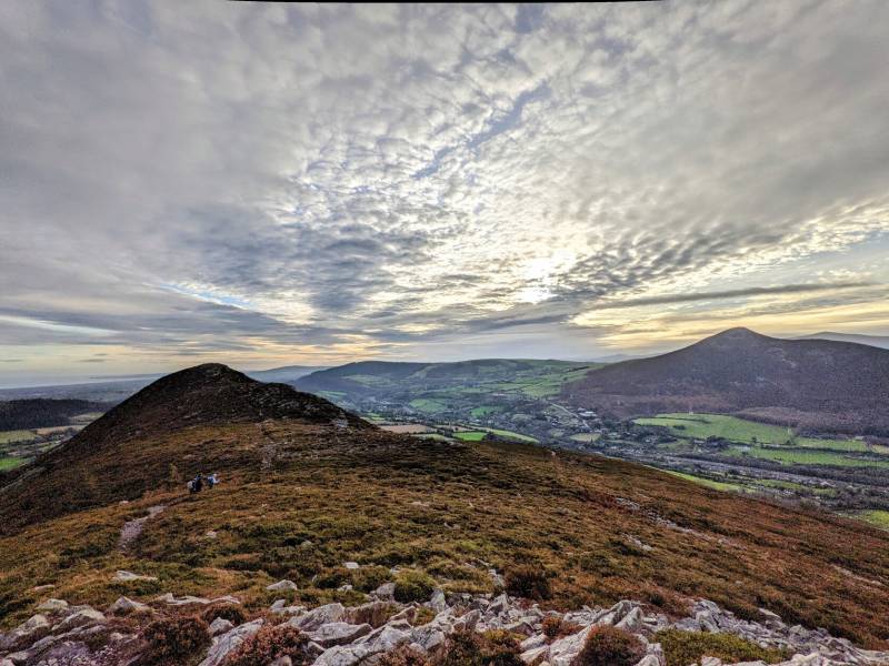
View at the summit of Little Sugarloaf, with Great Sugarloaf in background
The return to the Glenview crosses a couple of private farms, so please take care to keep the noise down, close the gates after you, and show gratitude and respect as you pass by the private homes.
Looking West from the summitof Little Sugarloaf
Editing Details for track/4582
NOTE: ALL information such as Ascent, Length and Creator time taken etc should be regarded as approximate. The creator's comments are opinions and may not be accurate or still correct.
Your time to complete will depend on the speed of the slowest plus break time and your mode of transport.
NOTE: It is up to you to ensure that your route is appropriate for you and your party to follow bearing in mind all factors such as safety, weather conditions, experience and access permission.
Uploaded on: Sat, 4 Dec 2021 (18:51:33), Linkback: https://mountainviews.ie/track/4582/
* Note: A GPS Height in the elevation profile is sourced from the device that recorded the track. An "SRTM" height is derived from a model of elevations for parts of the earth. More detail
Use of MountainViews is governed by conditions and a privacy policy.
Read general information about the site. Opinions in material here are not necessarily endorsed by MountainViews.
Hillwalking is a risk sport. Information in comments, walks, shared GPS tracks or about starting places may
not be accurate for example as regards safety or access permission. You are responsible for your safety and your permission to walk.
See the credits and list definitions.


 Our Facebook page.