This website uses cookies, which are small text files that the website puts on your device to facilitate operation. Cookies help us provide a better service to you. They are used to track general user traffic information and to help the website function properly.
march-fixer: Track/4401 in area near Carrig Mountain, Wicklow (Ireland)
Keadeen Mountain Walk
Ascent: 315m,
Length: 9.1km,
Creator time taken: 2h36m
Descent: 228m,
Time predicted from Naismith's rule: 2h 20m + breaks
Click here to rate track
PlacesStart at Keadeen Trailhead (Keadeen TH) S98423 89578, Carrig Mountain, Keadeen Mountain, end at S97135 90020, 1.4km W from Start
Track Rating ..
[RWD version 1 ]
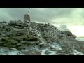
Finding a quiet spot at weekends can be a challenge. Parked in the forest enterance at Ballinabarny Gap. Only a couple of cars there already. The day was mild and calm but with low cloud cover. The track starts by either climbing up the bank of the car-park or walking in about 80m and switching back on the left along a rough track. This opens out at the boundary fence to a good grass track leading straight up to Keadeen. Rather than cover the same path on the return journey we contoured off to the left at the brow of the hill heading for Carrig Mountain. There is a lone tree standing out on the slope which helps if you aim to keep it close on your right-hand side. When you reach the saddle you will meet the distinct track that runs between Carrig and Keadeen. Head over to the left until you reach the cairn built on the grass bank to your right. Head back north and follow the track all the way to the top of Keadeen. It is a gentle climb made all the easier by the contour to Carrig first which negated the slog straight up to Keadeen. There is some rough shelter on top which helps should there be some rough weather. We then headed down south east following the existing track until we reached the saddle. Rather than cover the same ground again, we branched north east over heather and contoured down to meet up with a forest access track. As the cloud lifted the views to the north from here were truly spectacular. There is a new 5-bar gate marking the entry to the forest track. It is just a nice saunter straight back to the car.
Editing Details for track/4401
NOTE: ALL information such as Ascent, Length and Creator time taken etc should be regarded as approximate. The creator's comments are opinions and may not be accurate or still correct.
Your time to complete will depend on the speed of the slowest plus break time and your mode of transport.
NOTE: It is up to you to ensure that your route is appropriate for you and your party to follow bearing in mind all factors such as safety, weather conditions, experience and access permission.
Uploaded on: Tue, 1 Dec 2020 (12:50:06), Linkback: https://mountainviews.ie/track/4401/
* Note: A GPS Height in the elevation profile is sourced from the device that recorded the track. An "SRTM" height is derived from a model of elevations for parts of the earth. More detail
Use of MountainViews is governed by conditions and a privacy policy.
Read general information about the site. Opinions in material here are not necessarily endorsed by MountainViews.
Hillwalking is a risk sport. Information in comments, walks, shared GPS tracks or about starting places may
not be accurate for example as regards safety or access permission. You are responsible for your safety and your permission to walk.
See the credits and list definitions.


 Our Facebook page.