This website uses cookies, which are small text files that the website puts on your device to facilitate operation. Cookies help us provide a better service to you. They are used to track general user traffic information and to help the website function properly.
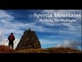
Peter Walker: Track/4117 in area near Dart Mountain, Sperrin Mountains (Ireland)
Dart & Sawel
Ascent: 635m,
Length: 16.3km,
Creator time taken: 2h13m
Descent: 570m,
Time predicted from Naismith's rule: 4h 19m + breaks
Click here to rate track
PlacesStart at Sperrin Heritage Centre W H59785 93186, Dart Mountain, Sawel, end at H64432 95054, 5km E from Start
Track Rating ..
[RWD version 1 ]
(Note: the time is bonkers, and the ascent isn't right either, but hey, at least the distance is correct. And it ended back at the start...I'm not Jeff Goldblum in 'The Fly'. So, it was 2hr 59mins with 764m of ascent, which is still quite brisk and lightweight).
Generally my time on the hill is spent in more aesthetically pleasing places than the Sperrins, but needs must when the weather forecast suggests it's the location least likely to see you plucked from the ground by the wind before being plonked back down in the land of Oz. So, Dart & Sawel it was.
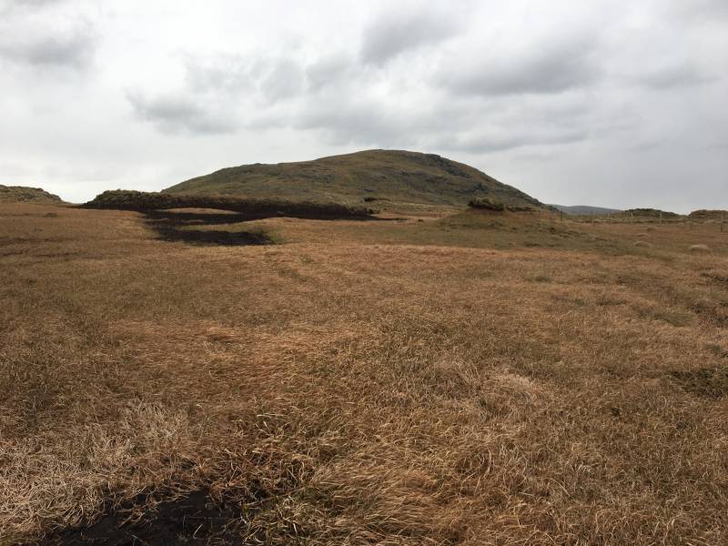
The approach to Dart
I left the car just west of the Heritage Centre on the B47 where there's plenty of room on the south side of the road. Using gerrym's comment for Dart, I continued west for a few hundred metres before turning right up a rough little lane, taking to the open hillside (well, there's a few fences but it's easy going by Sperrin standards) when this levelled off. Dart is generally conspicuous ahead, and a steady plod brought it underfoot in fairly short order. This is the most conventionally rugged of the Sperrins; indeed, I think I even had to put my hand down onto rock for balance on two (very brief) occasions.
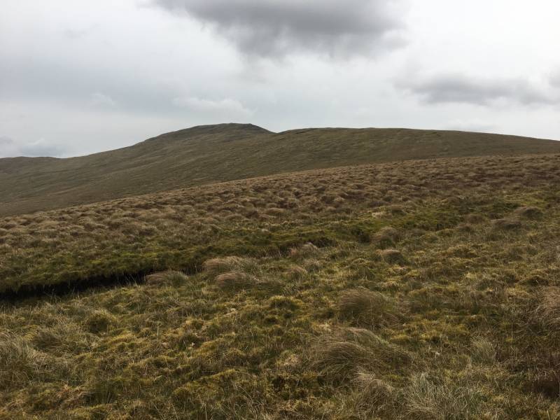
Mullaghclogha from Dart
It was apparent on the summit that just because the wind was forecast to be less severe here than elsewhere didn't mean that it wasn't windy; indeed the chill could best be described as 'chilling'. So very few formalities were observed before striding onwards. It's a short descent to the col, where there's some more traditional Sperrin terrain on offer.
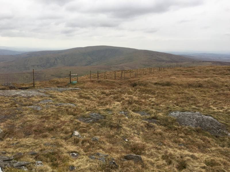
Dart from the col under Sawel
That said, the longer climb up Sawel is still pretty benign, and the top is underfoot sooner than you might expect given the height discrepancy between the two mountains.
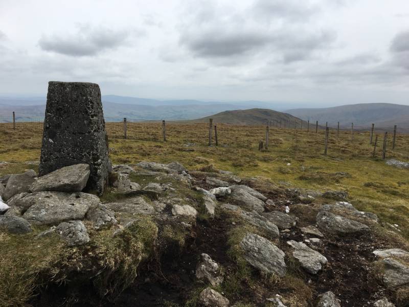
The summit of Sawel
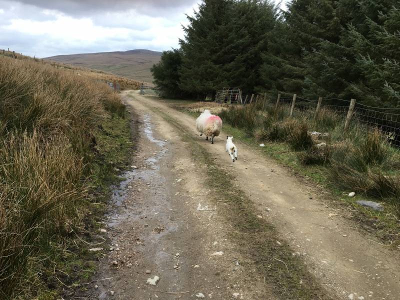
It was properly nithering on the summit, so I made it like gangbusters down the blunt ridge heading east to the road near the County Rock. Rather than following said tarmac back down to the B47 I picked up the track leading down the east side of the Binleana Burn followed by the west side of the Gleneirin Burn. This eventually led to a farmyard just above the main road, where a farmer and his lad were preparing to bring some sheep up the hill. Out of politeness I checked if I was ok to continue, whereupon I was told with a big grin to go back up to the road at the top...comedy pleasantries over, he told me it was grand and just make sure to close his gate to the main road. Splendid bloke.
Lambing season...
It's about 4km back along the road to the start with a nasty crosswind to annoy and the constant threat of traffic and blind corners to keep you honest (and alert).
Editing Details for track/4117
NOTE: ALL information such as Ascent, Length and Creator time taken etc should be regarded as approximate. The creator's comments are opinions and may not be accurate or still correct.
Your time to complete will depend on the speed of the slowest plus break time and your mode of transport.
NOTE: It is up to you to ensure that your route is appropriate for you and your party to follow bearing in mind all factors such as safety, weather conditions, experience and access permission.
Uploaded on: Mon, 15 Apr 2019 (19:46:56), Linkback: https://mountainviews.ie/track/4117/
* Note: A GPS Height in the elevation profile is sourced from the device that recorded the track. An "SRTM" height is derived from a model of elevations for parts of the earth. More detail
Use of MountainViews is governed by conditions and a privacy policy.
Read general information about the site. Opinions in material here are not necessarily endorsed by MountainViews.
Hillwalking is a risk sport. Information in comments, walks, shared GPS tracks or about starting places may
not be accurate for example as regards safety or access permission. You are responsible for your safety and your permission to walk.
See the credits and list definitions.


 Our Facebook page.