This website uses cookies, which are small text files that the website puts on your device to facilitate operation. Cookies help us provide a better service to you. They are used to track general user traffic information and to help the website function properly.
simon3: Track/3638 in area near Slieve Snaght, Inishowen (Ireland)
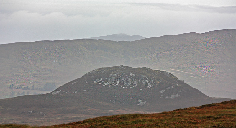
Inishowen Slieve Snaght from the north.
Ascent: 515m,
Length: 9.3km,
Creator time taken: 4h35m
Descent: 618m,
Time predicted from Naismith's rule: 2h 43m + breaks
Click here to rate track
PlacesStart at Golan Bridge Track (Golan Tr) C42498 41978, Slieve Snaght, Slieve Main, end at Moor House (Moor H) C39134 37338, 5.7km SW from Start
Track Rating ..
[RWD version 1 ]
This linear walk route starts from the north and includes the two Arderins and one Vandeleur-Lynam in the area. It starts up what looks like a Land Commission road developed for traditional turf cutting, which still takes pla
Early view west to Barnan More, mid ground.
ce. The track was created
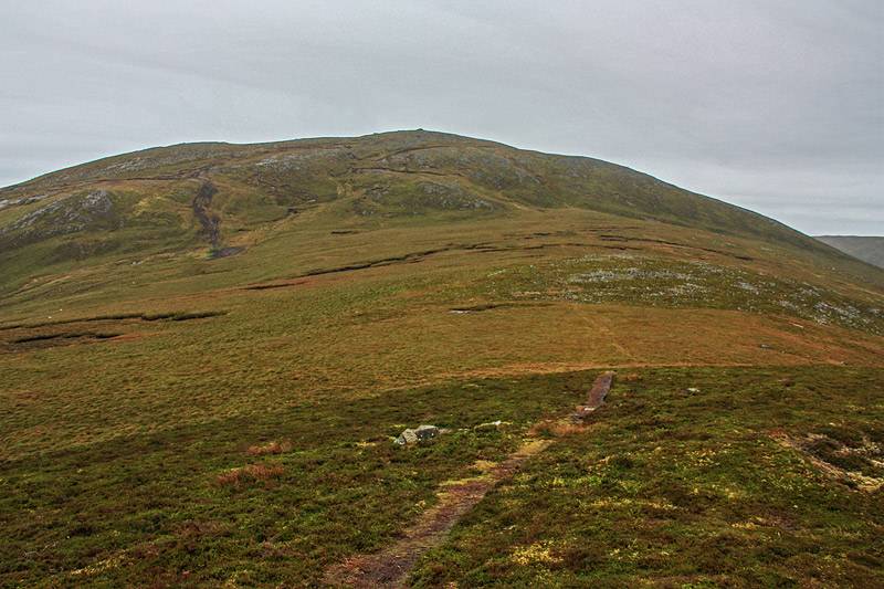
Slieve Main from Slieve Snaght.
during a Mountaineering Ireland organised walk in Oct 2017 led by a very knowledgeable local club member who told us that much of the land we were walking on was commonage in which he had rights. For a comparatively short walk it makes very good use of the land. In the shared track you will note that the first part of the track, from the public road, was fast. What actually happened was that the party of 14 travelled on a trailer usually used for sheep, pulled by a farmers vehicle. I kid you not. A first for me anyway. The route proceeds first over Slieve Snaght scene of the 1825 experiments with limelight used for long distance measurements of the positions of mountains for the early ordnance survey. It then goes on to Slieve Main and back to the public road.
Editing Details for track/3638
NOTE: ALL information such as Ascent, Length and Creator time taken etc should be regarded as approximate. The creator's comments are opinions and may not be accurate or still correct.
Your time to complete will depend on the speed of the slowest plus break time and your mode of transport.
NOTE: It is up to you to ensure that your route is appropriate for you and your party to follow bearing in mind all factors such as safety, weather conditions, experience and access permission.
Uploaded on: Mon, 16 Oct 2017 (10:44:21), Linkback: https://mountainviews.ie/track/3638/
* Note: A GPS Height in the elevation profile is sourced from the device that recorded the track. An "SRTM" height is derived from a model of elevations for parts of the earth. More detail
Use of MountainViews is governed by conditions and a privacy policy.
Read general information about the site. Opinions in material here are not necessarily endorsed by MountainViews.
Hillwalking is a risk sport. Information in comments, walks, shared GPS tracks or about starting places may
not be accurate for example as regards safety or access permission. You are responsible for your safety and your permission to walk.
See the credits and list definitions.


 Our Facebook page.