Donation Request 2024
You do not have to be logged in to donate.
DONATE
Members and Supporters, the MountainViews Committee requests your help to meet the costs of the website and of other activities such as insured events or publications.You do not have to be logged in to donate.
Welcome to MountainViews
If you want to use the website often please enrol (quick and free) at top right.
If you want to use the website often please enrol (quick and free) at top right.
Overview

For more map options click on any overview map area or any detail map feature.
Detail Map Features
Find Suggested Walks
Find hill, mountain, island, coastal feature.
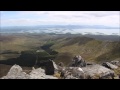
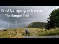
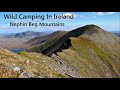
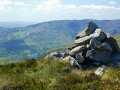
Videos

Recent Contributions
 Get Notifications
Get Notifications
Knockaunanattin West Top: Impressive defile start leads to airy ridgeline.
 Peter Walker
Near Church Mountain, Wicklow (Ireland)
Carran NE Top: Approach via wind farm tracks
 Collaborative entry
Long Island: No sign of the Great Gatsby
 Fergalh
Keeloges-Aganny loop
 Colin Murphy
Knockree: Reasonably clear path to summit
 hibby
hibby
Little Sugar Loaf: Windy at the top
 hibby
hibby
Great option for a day hike over Slieve Carr (inspired by Irish Peaks)
Aganny Top: Approach from SW
 Colin Murphy
Bynack More, A'Choinneach and Bynack Beg
 billbaggins
Keeloges: Go and enjoy.
 Collaborative entry
Slieve Carr: Great option for a day hike over Slieve Carr (inspired by Irish Pea
 nupat
nupat
Conditions and Info
Use of MountainViews is governed by conditions and a privacy policy.
Read general information about the site.
Opinions in material here are not necessarily endorsed by MountainViews.
Hillwalking is a risk sport. Information in comments, walks, shared GPS tracks or about starting places may not be accurate for example as regards safety or access permission. You are responsible for your safety and your permission to walk.
See the credits and list definitions.
 Visit our Facebook page.
Video display
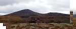
Nephin Begs
Area Cen: Glennamong Subarea
Place count in area: 28,
OSI/LPS Maps: 22, 23, 30, 31, CBW, EW-ACC, EW-WNN, EW-WNS
Highest place: Slieve Carr, 721m
Maximum height for area: 721 metres,
Maximum prominence for area: 646 metres,
Places in area Nephin Begs:
Cen: Glennamong:Bengorm 582mBengorm NW Top 468mCorranabinnia 716mCorranabinnia SW Top 687mGlennamong 628mGlennamong East Top 415mTirkslieve 401m
Cen: Nephin Beg:Aroher Hill 285mLettertrask 279mNephin Beg 627mNephin Beg South Top 410m
E: Birreencorragh:Birreencorragh 698mBirreencorragh South Top 564mBirreencorragh West Top 551mBuckoogh 588mBullaunmore 388mKnockaffertagh 517mMount Eagle 427mSrahmore 186mSrahrevagh North 282m
NW: Slieve Carr:Bunmore 243mSheeanmore 282mSlieve Alp 329mSlieve Carr 721mTawnyanruddia 531m
SW: Maunthomas:Claggan Mountain NE Top 501mMaumthomas NE Top 440mMaumthomas SW Top 477m
Note: this list of places includes island features such as summits, but not islands as such.
Highest place:
Slieve Carr, 721mPlaces in area Nephin Begs:
Cen: Glennamong:
Bengorm 582mBengorm NW Top 468mCorranabinnia 716mCorranabinnia SW Top 687mGlennamong 628mGlennamong East Top 415mTirkslieve 401mCen: Nephin Beg:
Aroher Hill 285mLettertrask 279mNephin Beg 627mNephin Beg South Top 410mE: Birreencorragh:
Birreencorragh 698mBirreencorragh South Top 564mBirreencorragh West Top 551mBuckoogh 588mBullaunmore 388mKnockaffertagh 517mMount Eagle 427mSrahmore 186mSrahrevagh North 282mNW: Slieve Carr:
Bunmore 243mSheeanmore 282mSlieve Alp 329mSlieve Carr 721mTawnyanruddia 531mSW: Maunthomas:
Claggan Mountain NE Top 501mMaumthomas NE Top 440mMaumthomas SW Top 477mNote: this list of places includes island features such as summits, but not islands as such.

Bedrock type: Psammitic schists, quartzites, (Anaffrin Formation)
Bengorm NW Top is the 670th highest place in Ireland.
Linkback: https://mountainviews.ie/summit/556/
COMMENTS for Bengorm NW Top (An Bhinn Ghorm (mullach thiar thuaidh)) 1 of 1  Follow this place's comments

|
|
|
|
||
| MountainViews.ie, a Hill-walking Website for the island of Ireland. 2400 Summiteers, 1480 Contributors, maintainer of lists: Arderins, Vandeleur-Lynams, Highest Hundred, County Highpoints etc | |||