This website uses cookies, which are small text files that the website puts on your device to facilitate operation. Cookies help us provide a better service to you. They are used to track general user traffic information and to help the website function properly.
Feature count in area: 12, all in Louth,
OSI/LPS Maps: 29, 36, EW-CLY
Highest Place: Slieve Foye 587m
Starting Places (24) in area Cooley Mountains: Annaloughan Loop Walk CP, Beck's Lane, Cadger's Bridge, Carlingford Car Park, Carlingford Greenway, Clermont Junction, Clermont Pass Bridge, Corna Mucklagh House, Deserted Village, Feede South, Flagstaff Viewing Point, Foxes Rock SW, Glenmore Tain Way, Grange Cross, Long Woman's Grave, Lower Faughil Road, Slieve Foye Viewing Point, Slievefoy Forest CP, Slievenagloch N, Spellickanee Mid, St Oliver's Park, The Ben Rock, The Lumpers, Two Mile River CP
Summits & other features in area Cooley Mountains: N: Cooley North: Anglesey Mountain 421m, Carnavaddy 475m, Clermont 444m, Clermont Carn 510m, Clermont Carn NE Top 448m S: Cooley South: Barnavave 350m, Slieve Foye 587m, Slieve Foye North-West Top 548.1m, Slievenaglogh 310m, The Eagles Rock 530m, The Foxes Rock 404m, The Ravens Rock 457m
Note: this list of places may include island features such as summits, but not
islands as such.
The Eagles Rock, 530.0mMountain
Place Rating ..
, Louth County in Leinster province, in Arderin Lists, The Eagles Rock is the third highest mountain in the Cooley Mountains area and the 476th highest in Ireland. The Eagles Rock is the third highest point in county Louth.
Grid Reference J15856 13190,
OS 1:50k mapsheet 29&36A Place visited by: 157members, recently by: TipsyDempy, Padraigin, michaelseaver, davidrenshaw, MeabhTiernan, Magic, Carolineswalsh, knightsonhikes, ElaineM76, Kaszmirek78, Jai-mckinney, Oscar-mckinney, Moirabourke, JohnHoare, SenanFoley
I visited this place: NO (You need to be a logged-in member for this.)
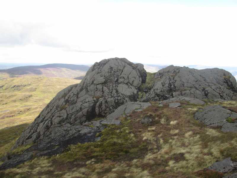
Picture: Eagles Rock from the Slieve Foye approach
A short but sweet scramble
by IainT
16 Aug 2017
One of the few Irish summits that needs the use of hands by the easiest route. Those happy with exposure can get a good airy scramble (grade 2, pushing 3 maybe), by slanting left up an obvious ramp from the col with the main ridge of Slieve Foye. Step off the top of a huge flake and up lovely rough slabs above. Don't fall off! Linkback: mountainviews.ie/summit/1461/comment/19687/
Read Less
Read More
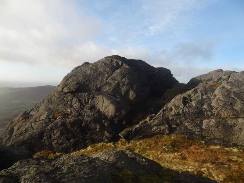
Picture: Looking back to Eagle's Rock while heading to Slieve Foye.
Slippery when wet!
by hivisibility
16 Dec 2015
I took this snap looking back at Eagle's Rock while heading towards Slieve Foye's NW top. Om approaching from Raven's Rock summit you descend from the Eagle down the small cleft you can see towards the right of the rock formation. If you want to claim the summit a bit of a scramble is involved to attain the peak, but care should be taken if the surface is wet or there are strong winds to counter, as there's enough of a drop to cause damage. By taking your time you should be ok. Marvellous views to be had from the summit. Linkback: mountainviews.ie/summit/1461/comment/18408/
Use of MountainViews is governed by conditions and a privacy policy.
Read general information about the site. Opinions in material here are not necessarily endorsed by MountainViews.
Hillwalking is a risk sport. Information in comments, walks, shared GPS tracks or about starting places may
not be accurate for example as regards safety or access permission. You are responsible for your safety and your permission to walk.
See the credits and list definitions.


 Our Facebook page.