Cookies.
This website uses cookies, which are small text files that the website puts on your device to facilitate operation. Cookies help us provide a better service to you. They are used to track general user traffic information and to help the website function properly.
Features
Nearby features appear when you click the map.
Declutter tracks on map.
Place Search
Video
X
Pub: by
Wicklow Area , NE: Vartry Subarea
Feature count in area: 115, by county: Wicklow: 108, Kildare: 4, Wexford: 2, Carlow: 3, of which 1 is in both Wexford and Wicklow, of which 1 is in both Carlow and Wicklow, OSI/LPS Maps: 28B, 55, 56, 61, 62, AWW, EW-DM, EW-LG, EW-WE, EW-WS
Highest Place: Lugnaquilla 924.7m

Starting Places (205) in area Wicklow:
1916 Memorial Car Park, Aghavannagh Ow Bridge, Aghowle Wood, Altidore Wood Entrance, Annacurra National School, Annalecka Bridge, Asbawn Brook L8350, Aughrim National School, Ballard Road, Ballinabarny Gap, Ballinagappoge Bridge Layby, Ballinagappoge Mountain Hairpin, Ballinagore, Ballinahinch Wood, Ballinastoe MBT CP, Ballinastraw South, Ballineddan Upr Fork, Ballinfoyle Upr Cross, Ballycoog, Ballycreen Brook Bridge, Ballycumber, Ballycumber Bridge, Ballycumber Lane, Ballycumber Wicklow Way, Ballylerane, Ballylow Bridge, Ballylusk Quarry, Ballymanus Lane, Ballymoyle Shooting Lodge, Ballynultagh Gap, Ballynultagh Lane, Ballyreagh Wood, Ballyross Forest, Ballysmuttan Long Stone, Baravore, Barnbawn South, Barranisky North, Barranisky West, Bohilla Land Roundabout, Bohilla Lane Mid, Boranaraltry Bridge, Bray Harbour, Brewel West, Brittas Bay North CP, Buckroney Sand Dunes CP, Bus Terminus, Camera Hill Track Cross, Castletimon Wood North, Clara Vale, Clone House Road, Clonegal, Cloon Wood Cp, Coate Bridge, Coolballintaggart Ledge, Coolbawn House Lane, Cransillagh Brook , Crone Wood CP, Crossbridge, Crossoona Rath, Cummer Wood South, Curtlestown Wood CP, Deputy's Pass CP, Derralossary Church, Derry River Bridge, Devil's Glen CP, Devil's Glen Wood, Djouce Wood Calary, Djouce Wood Lake, Djouce Wood Long Hill, Donard, Donnelly's Lane Car Sales, Drumgoff Forest, Dunranhill North, Dunranhill SE, Dunranhill South, Dwyer McAllister Cottage CP, Enniskerry, Fentons Pub, Fitzsimons Park GAA, unuseableFlemings Footbridge Glen Rd, Gap Pub, Gap Road, Glen Beach CP, Glen of the Downs CP, Glenbride Lane, Glenbride Lodge, Glencree Reconciliation, Glendalough, Glenealy GAA, Glenmacnass Tonelagee CP, Glenmalure Hostel, Glenmalure Lodge, Glenmalure Waterfall, Glenview Hotel, Gowle House, Great Sugar Loaf CP, Grove Bar, Heffernans Well Wood, Hill View, Hollywood Glen, JB Malone CP, Johnnie Fox Pub, Keadeen NE trail, Keadeen Trailhead, Kevins Way Footbridge, Kilbride Army Camp Entrance, Kilcandra South, Kilcommon View, Killalongford Wood, Kilmacrea Cross Roads, Kilranelagh House Gate, Kilruddery Car Park, Kilruddery Cottages, Kings River, Kippure Bridge, Kippure Estate, Kippure Transmitter Gate, Knickeen Cross, Knocknaboley Lane Leeraghs Bog, Knocknaboley Lane Stone Cottage, Knockrath Little, Knockree west, Kyle Loop North, Lackan Wood S, Lake Dr Fraughan Brook, Lake Drive, Lake Park Cross, Lake View Pub, Laragh Free Car Park, Laragh NSch, Lead Mines CP, Liffey Bridge, Liffey Head Bridge, Lough Bray Lower, Lough Bray Upper, Lough Tay North Viewing Point, Lough Tay Wicklow Way CP, Luglass Lane L97561, Lugnagun Track, Macreddin Village, Mangans Lane, Military Road Carrigshouk Hill, Military Road Inchavore River Nth, Military Road Inchavore River Sth, Military Road NW Lough Tay, Military Road Ballyboy Bridge, Military Road Cloghoge Brook, Military Road Croaghanmoira, Military Road Fananierin, Military Road LaraghWicklow Way, Military Road Slieve Maan, Monspolien Bridge, Moortown House, Mountain Rescue HQ, Muskeagh Little Wood, Nahanagan Lough NE, Novara Avenue, Bray, Oiltiagh Brook Knickeen, Old Bridge Cross, Old Bridge Scouts , Old Wicklow Way entrance, Paddock Hill SE, Pier Gates CP, Powerscourt Waterfall CP, Putland Road, Quintagh East, Raheen Park CP, Raheenleagh East, Railway Walk CP, Rathdrum Railway Station, Rednagh Wood, Rocky Valley, Roundwood, Sally Gap, Sally Gap N, Seefin Trailhead, Seskin SE, Shankill Tributary Bridge, Shay Elliott, Sheepshanks Bridge, Shillelagh, Slievecorragh Track, Slievefoore South, Sraghoe Brook, St John's Church, St Kevins Chair, St Kevins Church, St Kevins Way R756, Stone Circle Bridge, Stookeen South, Stranahely Wood, Stranakelly Cross Roads, Tallyho, Templeboden, Tithewer, Tomcoyle L, Tomriland Wood, Toor Brook, Trooperstown Hill Access, Turlough Hill CP, Upper Lake CP, Vallymount GAA CP, Vartry Reservoir Upper, Zellers Pub

Summits & other features in area Wicklow:
Cen: Glendalough North: Brockagh Mountain 556.9m, Brockagh Mountain NW Top 549.5m, Brockagh Mountain SE Top 471.7m, Camaderry East Top 677.3m, Camaderry Mountain 698.6m, Conavalla 734m, Tomaneena 682.4m
Cen: Glendalough South: Carriglineen Mountain 456.6m, Cullentragh Mountain 510m, Derrybawn Mountain 476.1m, Kirikee Mountain 474.5m, Lugduff 653.2m, Lugduff SE Top 638m, Mullacor 660.7m, Trooperstown Hill 430m
N Cen: Tonelagee: Carrignagunneen 561m, Fair Mountain 571.2m, Stoney Top 713.7m, Tonelagee 815.8m, Tonelagee E Top 668m, Tonelagee South-East Top 545.8m
NE: Bray & Kilmacanogue: Bray Head Hill 238.9m, Carrigoona Commons East 242m, Downs Hill 372.9m, Great Sugar Loaf 501.2m, Little Sugar Loaf 342.4m
NE: Djouce: Djouce 725.5m, Knockree 342.1m, Maulin 570m, Tonduff 642m, Tonduff East Top 593m, War Hill 684.8m, White Hill 631.1m
NE: Fancy: Ballinafunshoge 480m, Kanturk 527.4m, Knocknacloghoge 532.4m, Luggala 593.3m, Robber's Pass Hill 508.9m, Scarr 640m, Scarr North-West Top 559.8m, Sleamaine 430m
NE: Vartry: Ballinacorbeg 336m, Ballycurry 301m, Dunranhill 342m, Mount Kennedy 365.9m
NW: Blessington: Carrigleitrim 408m, Lugnagun 446.2m, Slieveroe 332m, Sorrel Hill 599.5m
NW: Mullaghcleevaun: Black Hill 602.2m, Carrigshouk 572.5m, Carrigvore 682.4m, Duff Hill 720.8m, Gravale 719m, Moanbane 703m, Mullaghcleevaun 846.7m, Mullaghcleevaun East Top 796m, Silsean 698m
S: Aughrim Hills: Cushbawn 400m, Killeagh 249m, Moneyteige North 427m, Preban Hill 389m
S: Croaghanmoira: Ballinacor Mountain 529.3m, Ballycurragh Hill 536m, Ballyteige 447m, Carrickashane Mountain 508m, Croaghanmoira 662.3m, Croaghanmoira North Top 579.5m, Fananierin 426m, Slieve Maan 547.8m, Slieve Maan North Top 546.1m
S: Croghan Kinsella: Annagh Hill 454m, Croghan Kinsella 606m, Croghan Kinsella East Top 562.1m, Slievefoore 414m
S: Shillelagh Hills: Lakeen 357m, Monaughrim 206m, Seskin 344m, Stookeen 420m
S: Tinahely Hills: Ballycumber Hill 429.7m, Eagle Hill 296m, Muskeagh Hill 398.2m
SE: Wicklow South East: Ballinastraw 284m, Ballyguile Hill 188m, Barranisky 280m, Carrick Mountain 381m, Collon Hill 238m, Kilnamanagh Hill 217m, Westaston Hill 270m
W: Baltinglass: Ballyhook Hill 288m, Baltinglass Hill 382m, Carrig Mountain 571m, Carrigeen Hill 298m, Cloghnagaune 385m, Corballis Hill 258m, Keadeen Mountain 653m, Spinans Hill 409m, Spinans Hill SE Top 400m, Tinoran Hill 312m
W: Cen Lugnaquilla: Ballineddan Mountain 652.3m, Benleagh 689m, Camenabologue 758m, Camenabologue SE Top 663m, Cloghernagh 800m, Corrigasleggaun 794.6m, Lugnaquilla 924.7m, Slievemaan 759.7m
W: Donard: Brewel Hill 222m, Church Mountain 544m, Corriebracks 531m, Lobawn 636m, Slievecorragh 418m, Sugarloaf 552m, Table Mountain 701.7m, Table Mountain West Top 563m

Note: this list of places may include island features such as summits, but not islands as such.
Rating graphic.
Ballycurry, 301m Hill
Place Rating ..
, Wicklow County in Leinster province, in no lists, Ballycurry is the 1160th highest place in Ireland.
Grid Reference O25000 00100, OS 1:50k mapsheet 56
Place visited by: 28 members, recently by: moggy40, hibby, Kaszmirek78, Grumbler, Ansarlodge, Dee68, Beti13, srr45, loftyobrien, abcd, briankelly, Glanman2, pinchy, mountainmike, eugeneryan959
I visited this place: NO (You need to be a logged-in member for this.)
Longitude: -6.137278, Latitude: 53.037265, Easting: 325000, Northing: 200100, Prominence: 94m,  Isolation: 2.5km
ITM: 724921 700133
Bedrock type: Greywacke & quartzite, (Bray Head Formation)

  Short or GPS IDs, 6 char: Blycry, 10 char: Ballycurry

Linkback: https://mountainviews.ie/summit/1141/
Gallery for Ballycurry and surrounds
No summary yet for this place .
Member Comments for Ballycurry
Comment create / edit display placeholder

            MountainViews.ie picture about Ballycurry
The curious cow
by Colin Murphy 27 May 2019
As I ascended the hill, a few wary cows were keeping a cautious eye on me, including this one particularly curious girl. Linkback: mountainviews.ie/summit/1141/comment/20537/
Read Less
Read More

            MountainViews.ie picture about Ballycurry
Picture: Up the mossy path
Success under fire
by hibby 3 Mar 2024
I identified a promising route on the map - a road leading up to the communication mast, avoiding all the briars and gorse. On arrival I found a locked gate with "no trespassing" signs and a phone number. I called the number to request permission, apologising for calling on a Sunday morning. The person was very nice but was only involved in the works at the comms mast and not in a position to give permission to cross the land. He gave me the name of the landowner, who lives across the road, but I had no way to contact that person.

Giving up on that plan, I drove around to the recommended starting point T'Coyle (O25133 00804)
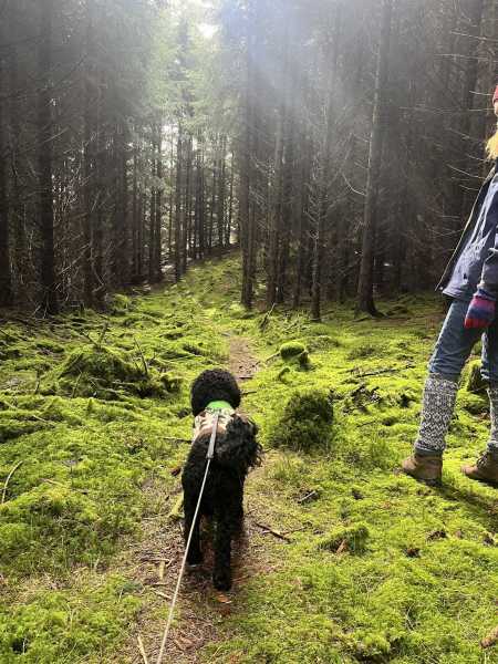
. We walked up the forest track for approximately 500 metres, then when the track started to slope downwards, we turned right at about 
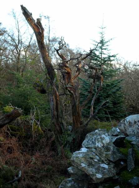
A (O25204 00535) and made our way up a steep firebreak. Having gained about 40 metres of height, we crossed a mossy path and continued up through the mature forest towards the summit.

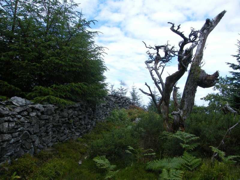
Arriving at the comms masts, we followed the line of the stone wall in a SW direction a short distance to the summit at B (O25038 00102).

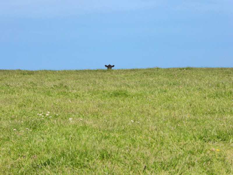
On our way up through the forest, we were assailed by the sound of gunfire, and wrongly assumed that there were hunters in the forest and that we were at risk of getting shot. (It turned out that the sound of gunfire was from a clay-pigeon shooting facility across the valley and we were not in any danger, but at the time we were quite concerned.)

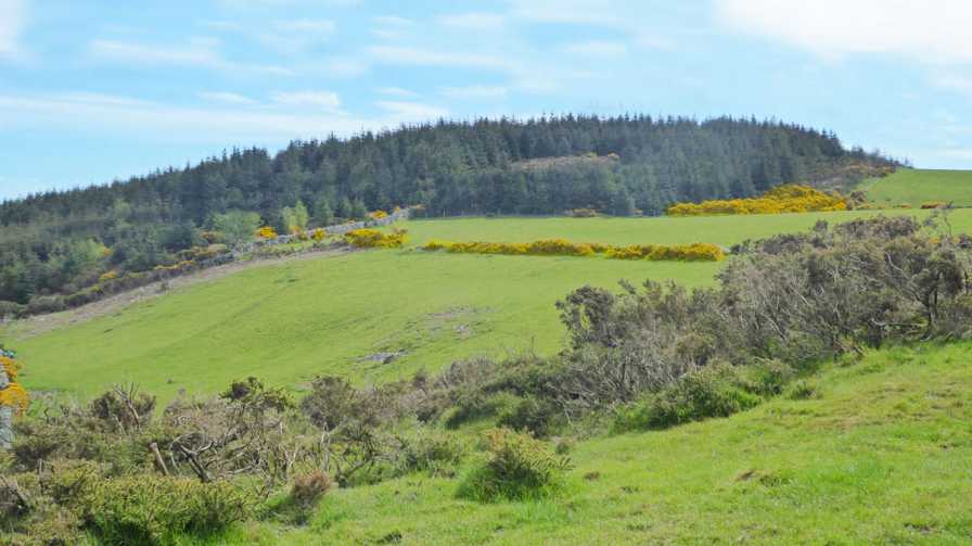
This concern prompted a decision to descend by a different route, following the line of the other stone wall WNW. Crossing the wall, we walked along the edge of fields to a gate at the top of a track down to Carrowbawn farm, where we met the owner. He was friendly and cheerful but did point out that we were trespassing.

So, success in reaching the summit, which was by no means a foregone conclusion. Success, too, in finding a route where we didn't have to contend with any gorse or briars. Our route was mainly through fairly open, mature forestry. However, access may be a consideration. Linkback: mountainviews.ie/summit/1141/comment/24148/
Read Less
Read More

            MountainViews.ie picture about Ballycurry
Picture: This tree looks how I felt after the climb
Meeting of the Walls
by eamonoc 3 Mar 2014
Fri 28/2/2014. Done in the company of Fergalh, intrepid Binnion Basher, started at T'Coyle (O25133 00804) forest entrance with large boulders on roadside R764. Enough room to park two cars here, headed up newly constructed forest path for about 100mts and took smaller path to the right, the entrance to this path is cluttered with cut trees. Followed this path which is fairly overgrown for about 100mts when it forks took the left fork going slightly uphill onto a more overgrown track until the edge of the mature forest is reached, there is a fence going steeply uphill to the left, headed up beside the fence over some very rough ground, was able to make uphill progress despite gorse, briars and trees. Had to go into forest on left on a couple of occasions as the way forward was blocked by said gorse and briars. Eventually made it to a well made stonewall and into open fields beyond, went up in a leftward direction through two fields and a gate to a small communications mast. Went around mast enclosure to the right and followed another stone wall uphill beside a small plantation, high point reached where three stonewalls met. views not great here, Dunran Hill could be seen to the north. Linkback: mountainviews.ie/summit/1141/comment/15890/
Read Less
Read More

            MountainViews.ie picture about Ballycurry
Picture: Ballycurry summit
Furze and grass curry
by Colin Murphy 16 May 2019
I accidentally went up the wrong track with this one (at DnHill SE (O246 008)), and ended up at a collection of large farm buildings with the name 'Carrowbawn' emblazoned on the side. I looked about for someone to ask permission but could find no one so took a chance and continued up the track. This ended at a gate and a green pasture speckled with furze bushes in all their yellow glory and I could see Ballycurry a few hundred metres to the east. Crossed the pasture leading up taking me to the north of the summit (on far right in photo) and then managed to clamber over a fence leaving me a relatively short bit of battle with the forest to reach the summit. I returned the way I'd come, still not meeting anyone, and was back in my car 50 minutes after leaving. Only recommended if you're willing to ask permission from someone. Linkback: mountainviews.ie/summit/1141/comment/20525/
Read Less
Read More

            MountainViews.ie picture about Ballycurry
Picture: Nothing to see here!
Hard work - for a twisty tree!
by paddyhillsbagger 6 Aug 2015
If it wasn't for eamonc's directions I doubt I'd make it to the top. A lot of forest bashing is required to reach the top which has no views! List tickers only - or masochists. Linkback: mountainviews.ie/summit/1141/comment/18232/
Read Less
Read More
EDIT Point of Interest
text
Videos


Users Online
Hjonna, mountainmike
Guests online: 263
Recent Contributions
x
Conditions and Info
Use of MountainViews is governed by conditions and a privacy policy.
Read general information about the site.
Opinions in material here are not necessarily endorsed by MountainViews.
Hillwalking is a risk sport. Information in comments, walks, shared GPS tracks or about starting places may not be accurate for example as regards safety or access permission. You are responsible for your safety and your permission to walk.
See the credits and list definitions.

OSi logo
OSNI/LPS logo
Open Street Map
(Various variations used.)
British summit data courtesy:
Database of British & Irish Hills