Welcome to MountainViews
If you want to use the website often please enrol (quick and free) at top right.
If you want to use the website often please enrol (quick and free) at top right.
Overview

For more map options click on any overview map area or any detail map feature.
Detail Map Features
Find Suggested Walks
Find hill, mountain, island, coastal feature.
Videos
Recent Contributions
 Get Notifications
Get Notifications
Donations Drive, now finished.
Binnion: Tullagh Bay and Rockstown Harbour
 Jim_Brady
Mulnanaff: Longish walk up windfarm road.
 Collaborative entry
Crocknapeast: Long walk up windfarm roads.
 Collaborative entry
Double bag mostly on windfarm tracks.
 Colin Murphy
Good, relatively easy double bag
 Colin Murphy
Binbane NE Top: Simple bag from its neighbouring top.
 Collaborative entry
Binbane: Steepish approach to relatively easy Carn.
 Collaborative entry
Lake District: Dale Head Horseshoe
Crucknaree: Magnificent views!
 paddyhillsbagger
Lake District: Coledale Horseshoe
Dunranhill: Sika deer and sitka spruce
 hibby
hibby
Conditions and Info
Use of MountainViews is governed by conditions and a privacy policy.
Read general information about the site.
Opinions in material here are not necessarily endorsed by MountainViews.
Hillwalking is a risk sport. Information in comments, walks, shared GPS tracks or about starting places may not be accurate for example as regards safety or access permission. You are responsible for your safety and your permission to walk.
See the credits and list definitions.
 Visit our Facebook page.
Video display
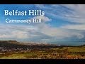
Belfast Hills
Area E: Belfast Hills East Subarea
Place count in area: 9,
OSI/LPS Maps: 15, 20, 21
Highest place: Divis, 478m
Maximum height for area: 478 metres,
Maximum prominence for area: 380 metres,
Places in area Belfast Hills:
E: Belfast Hills East:Cairngaver 217mOuley Hill 186mScrabo Hill 160m
N: Belfast Hills North:Carnmoney Hill 231.1mCave Hill 368mDivis 478mSlievetrue 312m
SE: Strangford & Portaferry:Ballywhite Hill 101mCastlemahon Mountain 128m
Note: this list of places includes island features such as summits, but not islands as such.
Highest place:
Divis, 478mPlaces in area Belfast Hills:
E: Belfast Hills East:
Cairngaver 217mOuley Hill 186mScrabo Hill 160mN: Belfast Hills North:
Carnmoney Hill 231.1mCave Hill 368mDivis 478mSlievetrue 312mSE: Strangford & Portaferry:
Ballywhite Hill 101mCastlemahon Mountain 128mNote: this list of places includes island features such as summits, but not islands as such.

Bedrock type: Sandstone, ()
Scrabo Hill offers magnificent views of North Down, including Strangford Lough and the Ards Peninsula. It was long considered a fairy hill with its own fairy guardian named Mac an Eantoin. Scrabo Tower, designed by Sir Charles Lanyon, was built on the summit of the hill as a memorial to the third Marquis of Londonderry. With its turrets, it is prominent in views around Belfast and North Down. A hill-fort is situated on the top of this prominent hill and traces of a number of hut-groups can be seen below the summit (Archaeological Survey of County Down 147, 179). The quarries at Scrabo are amongst the most important in Ulster and are of considerable antiquity since Grey Abbey was built with Scrabo sandstone in the late 12th century. The Natural Stone Database (www.stonedatabase.com) lists no less than 109 historic buildings built with Scrabo sandstone, including Belfast Castle, Belfast Royal Academy and the Albert Clock. Scrabo Hill is the 1457th highest place in Ireland.
Linkback: https://mountainviews.ie/summit/1489/
COMMENTS for Scrabo Hill (Screabach) 1 of 1  Follow this place's comments

|
|
|
|
||
| MountainViews.ie, a Hill-walking Website for the island of Ireland. 2400 Summiteers, 1480 Contributors, maintainer of lists: Arderins, Vandeleur-Lynams, Highest Hundred, County Highpoints etc | |||