- Home
- Main Display
- Main Display (Old)
- Find a Walk
- Display INTRODUCTION
- DONATE
- Click below for your
profile & contributions
guestuserOverviewFor more map options click on any overview map area or any detail map feature.Detail Map FeaturesShowing 11 items:
Cooneen Hill 467m, Cummer 405m, Commaun Beg 403m, Coumsallahaun 320m,Tracks:2563, 9km 4094, 7km 2322, 5km 5032, 5km 1960, 5km 2705, 4km 2704, 3km Find Suggested Walks
Find hill, mountain, island, coastal feature.Videos
(none available)Users Online:
abeach
Guests online: 624Recent Contributions
 Get Notifications
Carrauntoohil: Above the Clouds: 360 Degree Cloud Inversion
Mangerton & Stoompa
Carrauntoohil: Above the Clouds: 360 Degree Cloud Inversion
Seefin Mountain West Top: Great paths, closed boardwalk
Broaghnabinnia West Ridge and Stumpa Duloigh Traverse
Proctor High Mark: A rocking stone not a rolling one
A tough but rewarding day
Proctor High Mark: Find the gaps in the walls to find the highpoint
Clapham High Mark: Find the gaps in the walls to find the highpoint
Interesting route around Trooperstown, Wicklow.
Parson's Pulpit: Short trek to summit through Burren type landscape
Cahas Surveying: Changes to Arderins etc
Conditions and Info
Use of MountainViews is governed by conditions and a privacy policy.
Read general information about the site.
Opinions in material here are not necessarily endorsed by MountainViews.
Hillwalking is a risk sport. Information in comments, walks, shared GPS tracks or about starting places may not be accurate for example as regards safety or access permission. You are responsible for your safety and your permission to walk.
See the credits and list definitions.Video displayColin Murphy: Track 5032 in area near Commaun Beg, Midlands SW (Ireland)Uninspiring hill accessed by forest tracks Length: 5.1km, Creator time taken: 1h40m, Ascent: 400m,
Descent: 397m
Places: Start at R9100965414, Commaun Beg, end at Start
Logged as completed by 1
 A fairly straightforward climb mostly up forest tracks. There is parking for several cars at a Coillte forest entrance at the starting point. Follow the winding trail up for about 2km, barely gaining any height, passing multiple small streams.When you are about 500m to the SW of the summit, go right at a fork and follow this track as it skirts the south of the top.
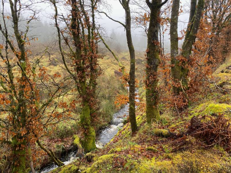
Winter colour and multiple small streams. Pass a small, abandoned quarry on left and just past this watch for a rough forest ride ascending towards the top.
The disused quarry. Follow this – there is a narrow channel cut into the rough ground that makes the going somewhat easier. Most of the climbing is done in these last few hundred metres. The highpoint is marked by a pile of rocks with a rotten pole in the centre. Return by same route.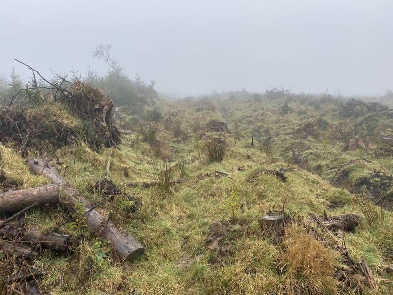
The rough forest ride. 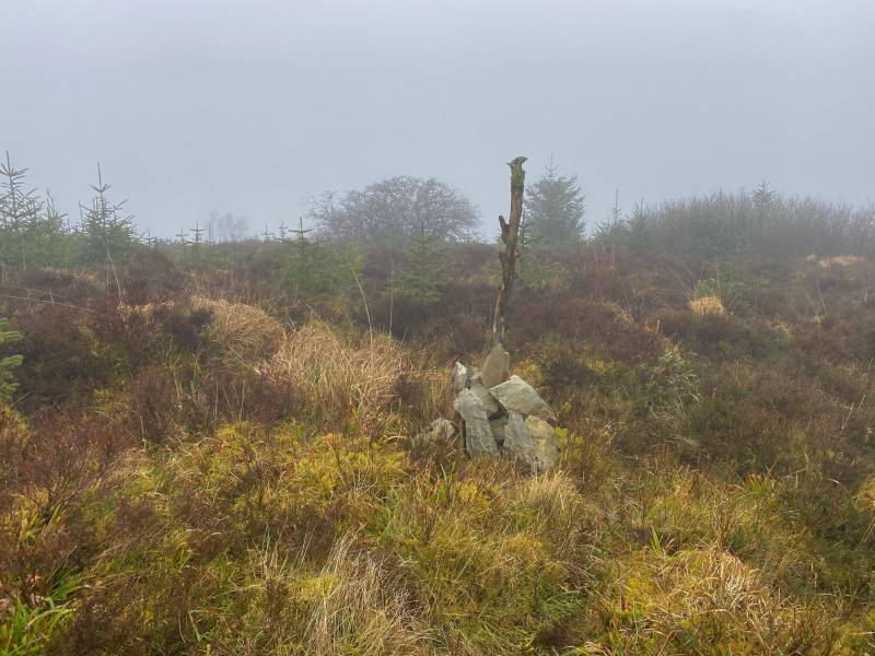
Highpoint COMMENTSNo comments uploaded yet.NOTE: ALL information such as Ascent, Length and Creator time taken etc should be regarded as approximate. The creator's comments are opinions and may not be accurate or still correct.
Your time to complete will depend on your speed plus break time and your mode of transport. For walkers: Naismith's rule, an approximate though often inaccurate estimate, suggests a time of 1h 42m + time stopped for breaks
NOTE: It is up to you to ensure that your route is appropriate for you and your party to follow bearing in mind all factors such as safety, weather conditions, experience and access permission.
* Note: A GPS Height in the elevation profile is sourced from the device that recorded the track. An "SRTM" height is derived from a model of elevations for parts of the earth. More detail


MountainViews.ie, a Hill-walking Website for the island of Ireland. 2400 Summiteers, 1480 Contributors, maintainer of lists: Arderins, Vandeleur-Lynams, Highest Hundred, County Highpoints etc

 Lauranna
 Lauranna
 Leatra
 Fergalh
 billbaggins
 Fergalh
 Fergalh
 Fergalh
 simon3
 Visit our Facebook page.