- Home
- Main Display
- Main Display (Old)
- Find a Walk
- Display INTRODUCTION
- DONATE
- Click below for your
profile & contributions
guestuser- New
- Tracks, Walks
- Challenge
- Community
- Lists & Logs
- Popular Lists:
- County Highpoints
- Range & Area Highpoints
- Local 100
- Highest Hundred
- Vandeleur-Lynams
- Arderins
- Carns
- Best rated
- Irish 900 up
- Irish Island
- Munros
- All Lists
- Shorter Irish
- County Highpoints
- Range & Area Highpoints
- Highest Hundred
- Local 100
- Local 100 (pre2014)
- Local Historical Cultural
- Best rated
- Irish 900 up
- Larger Irish
- Arderins
- Arderin Begs
- Arderins + Arderin Begs
- Vandeleur-Lynams
- Vandeleur-Lynams + Arderins
- Carns
- Binnions
- Highest 50 per Province
- Island Features
- Irish Island
- Coastal Hills
- Irish 600 up
- Irish 500 up
- British
- Munros
- British 600 up
- British 500-600
- British Marilyns
- Comprehensive
- All Irish summits
- All Irish features
- All British summits
- All Britain+ Ireland
- Special
- Analysis List
- Simple Irish Listings
- Simple Irish & British Listings
-
- More
- Motley Views
Welcome to MountainViews
If you want to use the website often please enrol (quick and free) at top right.OverviewFor more map options click on any overview map area or any detail map feature.Detail Map FeaturesFind Suggested Walks
Find hill, mountain, island, coastal feature.Videos

Recent Contributions
 Get Notifications
Rathinny: Short steep trek to summit
Knocksink after 2025 Storm Éowyn - Important Change.
Great Sugar Loaf: Old friend
Coolmore: Follow the way of the cross
Near Lugduff SE Top, Wicklow (Ireland)
Lake District: South of Helvellyn
Benwiskin South Top: Sunrise view from Diarmuid and Gráinne’s cave, Gleniff Hors
Lake District: West of Crummock Water
Carran: Several approachs
Camlough Mountain: Along the beaten track
Lake District: High Stile Ridge
Mount Oriel: Now a very unfriendly place
Conditions and Info
Use of MountainViews is governed by conditions and a privacy policy.
Read general information about the site.
Opinions in material here are not necessarily endorsed by MountainViews.
Hillwalking is a risk sport. Information in comments, walks, shared GPS tracks or about starting places may not be accurate for example as regards safety or access permission. You are responsible for your safety and your permission to walk.
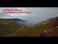
See the credits and list definitions.Video displayCaptainVertigo: Track 2894 in area near Slieveanorra, Antrim Hills (Ireland)Slieveanorra AA2 Length: 4.2km, Creator time taken: 44m34s, Ascent: 200m,
Descent: 228m
Places: Start at D1440727766, Slieveanorra, end at D1404727367 537m SW from Start
Logged as completed by 1
 No.2 of my four Antrim Arderins, Slieveanorra is sadly crowned by an Eiffel Tower, and has two very fine roads leading to its summit.
I finished AA1(Knocklayd) half an hour earlier, had a quick bit of breakfast and drove to Sliveanorra. I am not madly enthusiastic about mountains with roads and towers, so maybe it was as well that it was hidden behind a dense cloud. Short and...short
Here are the AA stats:
No.1 Knockloyd.... http://mountainviews.ie/track/2883/ Ascent 369m Distance 4.4km
No.2 Slieveanorra.http://mountainviews.ie/track/2894/ Ascent 200m Distance 4.2km
No.3 Slievenanee..http://mountainviews.ie/track/2895/ Ascent 140m Distance 3.3km
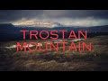
No.4 Trostan..........http://mountainviews.ie/track/2896/ Ascent 325m Distance 5.8km
Total Antrim Arderins................................................................1034m Distance 17.7mCOMMENTSNo comments uploaded yet.NOTE: ALL information such as Ascent, Length and Creator time taken etc should be regarded as approximate. The creator's comments are opinions and may not be accurate or still correct.
Your time to complete will depend on your speed plus break time and your mode of transport. For walkers: Naismith's rule, an approximate though often inaccurate estimate, suggests a time of 1h 10m + time stopped for breaks
NOTE: It is up to you to ensure that your route is appropriate for you and your party to follow bearing in mind all factors such as safety, weather conditions, experience and access permission.
* Note: A GPS Height in the elevation profile is sourced from the device that recorded the track. An "SRTM" height is derived from a model of elevations for parts of the earth. More detail Height layer: © MapTiler

MountainViews.ie, a Hill-walking Website for the island of Ireland. 2500 Summiteers, 1480 Contributors, maintainer of lists such as: Arderins, Vandeleur-Lynams, Highest Hundred, County Highpoints etc

 Fergalh
 hibby
hibby
 Fergalh
 BrianKennan
 Mountain_Mac
 Collaborative entry
 Colin Murphy
 Visit our Facebook page.