You do not have to be logged in to donate.
If you want to use the website often please enrol (quick and free) at top right.

 Get Notifications
Lake District: Dale Head Horseshoe
Crocknasharragh: Impressive views on nitial ascent.
 Colin Murphy
Crocknasharragh: Fine views on ascent
 Colin Murphy
Lake District: Coledale Horseshoe
Cunnigar: Short trek to summit
 Fergalh
Longish walk to isolated top
 Colin Murphy
Westtown Hill: Tramore's Highest Point
 DeirdreM
Knockbrinnea West Top: Eflanagan on the Knockbrinneas
 eflanaga
Ascending the Knockbrinneas from the north.
 simon3
Knockbrinnea West Top: Larger Twin
 Collaborative entry
Lobawn Loop - Clockwise avoids any steep ascent! Easy stream crossing.
Knockaunanattin West Top: Views, loughs and a navigational aid.
 simon3
Use of MountainViews is governed by conditions and a privacy policy.
Read general information about the site.
Opinions in material here are not necessarily endorsed by MountainViews.
Hillwalking is a risk sport. Information in comments, walks, shared GPS tracks or about starting places may not be accurate for example as regards safety or access permission. You are responsible for your safety and your permission to walk.
See the credits and list definitions.
 Visit our Facebook page.
 Length: 13.8km, Creator time taken: 5h21m, Ascent: 759m,
Descent: 755m
Places: Start at Lon -14.3118, Lat 28.0716, end at Start
Logged as completed by 1

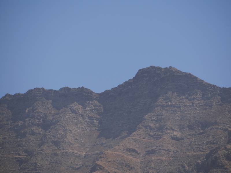
The well publicised route up PIco de la Zarza, 806m the highest point on Fuerteventura, starts from Morro Jable. This is an alternative start from the Butihondo area to the east near to the end of the FV2.
Around half the route is different from the better known route, and it much quieter. On my trip I only saw one person on the lower parts of the route, while there were scores if not hundreds on the upper part
shared with the main route.
The start is at a bridge under the FV2 as shown. This leads to a series of roads and a way around Monte Aguda. The entire area appears to have been an abandoned, large scale development.
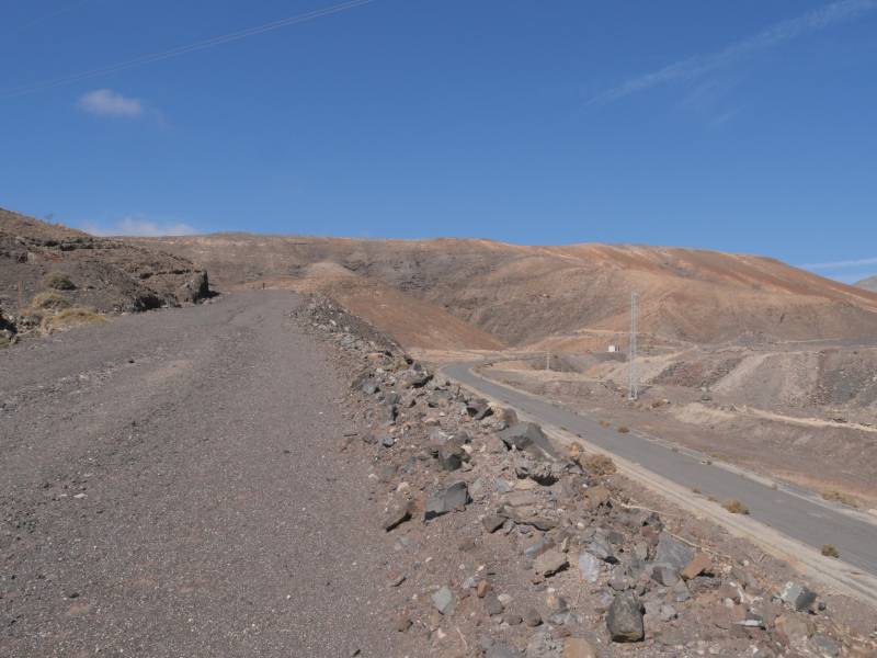
The way up and around M. Aguda goes along a road that gradually peters out. You come to a col full of what appears to be an artificial mound of greyish gravel. This is probably mine tailings or perhaps the cover over landfill. Whatever it is, it is perfectly walkable and there is a visible track leading uphill towards the NW and the highlands.
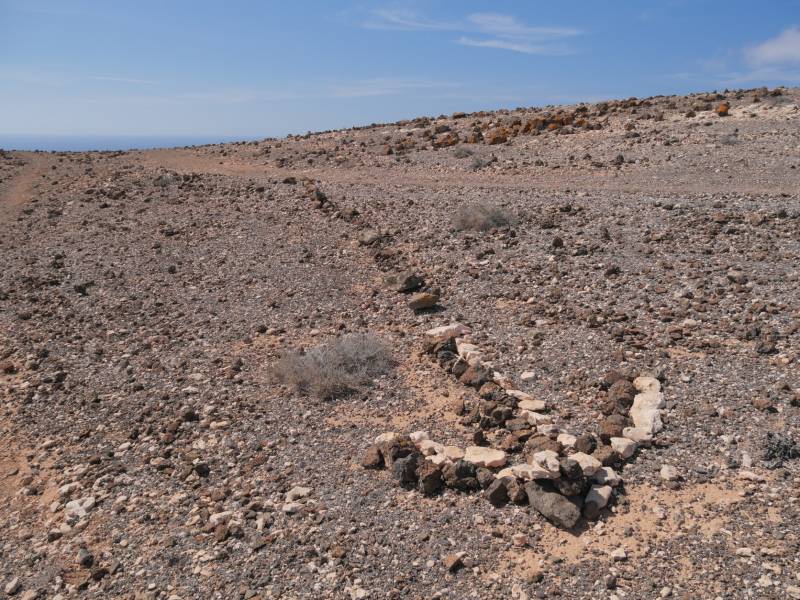
If you are taking this route, get to know that there are good indicators of the path (as of 2024 anyway) in the form of little piles of stones. There are a few places the way is difficult. Following the route suggested is very helpful.
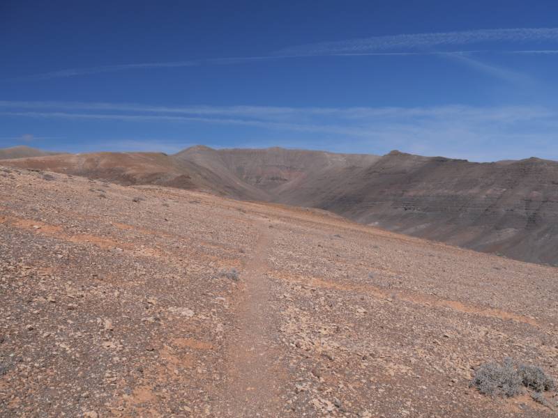
As you proceed you can start to see the main Jandia ridge. The route joins the main tourist route which is easy to follow. There are a huge mixture of travellers from runners to strugglers. It is hard work to the top because of the steepness and the heat even though a zig zag route has been constructed.
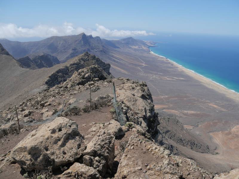
On our previous trip to PIco de la Zarza we were in mist at the top. This time the view was magnificent in all directions. The steepness of the ground is also apparent. There is a giant concave slope towards the beach. In the preceeding photo, note the barrier. It would appear that walking along the ridge is discouraged.
On this trip I returned on the same route as I had gone up, however it would be perfectly possible to have come down in Morro Jable.
All in all a great walk, if somewhat constrained to a prescribed route. Try to do it on a clear day if at all possible for the views.
NOTE: ALL information such as Ascent, Length and Creator time taken etc should be regarded as approximate. The creator's comments are opinions and may not be accurate or still correct.
Your time to complete will depend on your speed plus break time and your mode of transport. For walkers: Naismith's rule, an approximate though often inaccurate estimate, suggests a time of 4h 2m + time stopped for breaks
NOTE: It is up to you to ensure that your route is appropriate for you and your party to follow bearing in mind all factors such as safety, weather conditions, experience and access permission.
* Note: A GPS Height in the elevation profile is sourced from the device that recorded the track. An "SRTM" height is derived from a model of elevations for parts of the earth. More detail![]()
|
|
|
||
| MountainViews.ie, a Hill-walking Website for the island of Ireland. 2400 Summiteers, 1480 Contributors, maintainer of lists: Arderins, Vandeleur-Lynams, Highest Hundred, County Highpoints etc | |||