Guestuser: Login or enrol?
- Home
- Main Display
- Main Display (Old)
- Find a Walk
- Display INTRODUCTION
- DONATE
- Click below for your
profile & contributions
guestuser- New
- Tracks, Walks
- Challenge
- Community
- Lists & Logs
- Popular Lists:
- County Highpoints
- Range & Area Highpoints
- Local 100
- Highest Hundred
- Vandeleur-Lynams
- Arderins
- Carns
- Best rated
- Irish 900 up
- Irish Island
- Munros
- All Lists
- Shorter Irish
- County Highpoints
- Range & Area Highpoints
- Highest Hundred
- Local 100
- Local 100 (pre2014)
- Local Historical Cultural
- Best rated
- Irish 900 up
- Larger Irish
- Arderins
- Arderin Begs
- Arderins + Arderin Begs
- Vandeleur-Lynams
- Vandeleur-Lynams + Arderins
- Carns
- Binnions
- Highest 50 per Province
- Island Features
- Irish Island
- Coastal Hills
- Irish 600 up
- Irish 500 up
- British
- Munros
- British 600 up
- British 500-600
- British Marilyns
- Comprehensive
- All Irish summits
- All Irish features
- All British summits
- All Britain+ Ireland
- Special
- Analysis List
- Simple Irish Listings
- Simple Irish & British Listings
-
- More
- Motley Views
Welcome to MountainViews
If you want to use the website often please enrol (quick and free) at top right.OverviewFor more map options click on any overview map area or any detail map feature.Detail Map FeaturesFind Suggested Walks
Find hill, mountain, island, coastal feature.Videos
 Recent Contributions
 Get Notifications
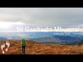
Lateeve: Forest tamed
Garraun: Flat and Featureless Summit
Lago Maggiore: Stresa to Belgirate
Lake Como: Como Greenway from Cadenabbia to Lenno
Ben Gorm: Flattish Summit - high point of an exciting and rugged range.
A circuit of Leenaun Hill.
Rutland Island: Interesting history on small island
Inishfree Upper: W.A.W. Trail-point
Steep ascent, stunning views
Inishfree Upper: Free and easy on Inishfree
Long trail to rewarding tops.
Inishkeeragh: Flat island in the sun
Conditions and Info
Use of MountainViews is governed by conditions and a privacy policy.
Read general information about the site.
Opinions in material here are not necessarily endorsed by MountainViews.
Hillwalking is a risk sport. Information in comments, walks, shared GPS tracks or about starting places may not be accurate for example as regards safety or access permission. You are responsible for your safety and your permission to walk.
See the credits and list definitions.Video displayBoggeragh Mountains Area N: Banteer SubareaPlace count in area: 11, OSI/LPS Maps: 79, 80
Highest place: Musheramore, 642.7m
Maximum height for area: 642.7 metres, Maximum prominence for area: 439 metres,
Places in area Boggeragh Mountains:
Cen: Seefin:Knockcraugh 434mSeefin 491mSeefin East Top 491m
N: Banteer:Mount Hillary 391mTooreen 322m
NE: Bweeng:Bweeng Little 414mBweengduff 416m
S: Macroom Hills:Burren 380mKnockagreenan 263m
W: Musheramore:Musherabeg 498.8mMusheramore 642.7m
Note: this list of places includes island features such as summits, but not islands as such.
(Ir. Cnoc an Iolair [PNABD*], 'hill of the eagle') Cork County in Munster Province, in Binnion List, Red conglomerate, sandstone & mudstone Bedrock
Height: 391m OS 1:50k Mapsheet: 80 Grid Reference: W42527 95648
Place visited by 66 members. Recently by: MartMc, JustMe, jeb, Padraigin, Leatra, DeirdreM, markmjcampion, Glanman2, dregish, Causticblonde, caiomhin, mlmoroneybb, maryblewitt, mh400nt, nolanlynI have visited this place: NO (You need to be a logged-in member to change this.)Longitude: -8.839616, Latitude: 52.110246 , Easting: 142527, Northing: 95648 Prominence: 176m, Isolation: 4.6km, Has trig pillar
ITM: 542489 595705 , GPS IDs, 6 char: MntHlr, 10 char: MntHlry
Bedrock type: Red conglomerate, sandstone & mudstone, (Old Red Sandstone (undifferentiated))
Mount Hillary is the 977th highest place in Ireland. Mount Hillary is the most northerly summit in the Boggeragh Mountains area.
Linkback: https://mountainviews.ie/summit/852/COMMENTS for Mount Hillary (Mullach Allaíre) 1 of 1  Follow this place's comments
 Height layer: © MapTiler

MountainViews.ie, a Hill-walking Website for the island of Ireland. 2500 Summiteers, 1480 Contributors, maintainer of lists such as: Arderins, Vandeleur-Lynams, Highest Hundred, County Highpoints etc

 Collaborative entry
 Collaborative entry
 simon3
 Fergalh
 Fergalh
 Colin Murphy
 Fergalh
 Colin Murphy
 Fergalh
 Visit our Facebook page.