Guestuser: Login or enrol?
- Home
- Main Display
- Main Display (Old)
- Find a Walk
- Display INTRODUCTION
- DONATE
- Click below for your
profile & contributions
guestuser- New
- Tracks, Walks
- Challenge
- Community
- Lists & Logs
- Popular Lists:
- County Highpoints
- Range & Area Highpoints
- Local 100
- Highest Hundred
- Vandeleur-Lynams
- Arderins
- Carns
- Best rated
- Irish 900 up
- Irish Island
- Munros
- All Lists
- Shorter Irish
- County Highpoints
- Range & Area Highpoints
- Highest Hundred
- Local 100
- Local 100 (pre2014)
- Local Historical Cultural
- Best rated
- Irish 900 up
- Larger Irish
- Arderins
- Arderin Begs
- Arderins + Arderin Begs
- Vandeleur-Lynams
- Vandeleur-Lynams + Arderins
- Carns
- Binnions
- Highest 50 per Province
- Island Features
- Irish Island
- Coastal Hills
- Irish 600 up
- Irish 500 up
- British
- Munros
- British 600 up
- British 500-600
- British Marilyns
- Comprehensive
- All Irish summits
- All Irish features
- All British summits
- All Britain+ Ireland
- Special
- Analysis List
- Simple Irish Listings
- Simple Irish & British Listings
-
- More
- Motley Views
Welcome to MountainViews
If you want to use the website often please enrol (quick and free) at top right.OverviewFor more map options click on any overview map area or any detail map feature.Detail Map FeaturesShowing 9 items:
Common Mountain 499.7m, Glengesh Hill 390m, Croaghavehy 372m,Tracks:4652, 16km 3887, 9km 4793, 9km 2761, 8km 2603, 6km 3537, 3km Find Suggested Walks
Find hill, mountain, island, coastal feature.Videos
Recent Contributions
 Get Notifications
Meikle Bin: Long trek to summit
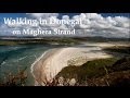
Lanzarote, from Femés to Puerto Calera via Pico de la Oveja and Montana Bermeja
Lanzarote, Puerto del Carmen Stroll
Little Bin: Tough little climb
Cort-ma Law East Top: Do not climb in the rain !
Lecket Hill: Short trek to summit of around 2 Km from Crow road
Great Knock: Short trek to summit
Brown Knowe: Straight forward track to the summit
Burren: Black Head Loop
Silvermines Hydro Project
Lamb Knowe: Short trek from Tods Knowe
Letterettrin - a perspective on the N Connemara peaks
Conditions and Info
Use of MountainViews is governed by conditions and a privacy policy.
Read general information about the site.
Opinions in material here are not necessarily endorsed by MountainViews.
Hillwalking is a risk sport. Information in comments, walks, shared GPS tracks or about starting places may not be accurate for example as regards safety or access permission. You are responsible for your safety and your permission to walk.
See the credits and list definitions.Video displayDonegal SW Area NE: Glengesh SubareaPlace count in area: 24, OSI/LPS Maps: 10
Highest place: Slieve League, 596.4m
Maximum height for area: 596.4 metres, Maximum prominence for area: 470 metres,
Places in area Donegal SW:Maum 325m
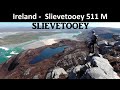
N: Sliabh Tuaidh:Tormore Island South 94mTormore Island North 139mCrockuna 400mSlievetooey 511mSlievetooey Far West Top 460mSlievetooey West Top 472m
NE: Glengesh:Balbane Hill 472mGlengesh Hill 390mCommon Mountain 499.7mCrocknapeast 497mCroaghavehy 372mMulmosog Mountain 351mMulnanaff 475m
NW: Glencolmkille:Croaghacullion 374mCroaghloughdivna 310m
S: Killybegs Hills:Croaghacullin 405mCroaghmuckros 275mCrownarad 493mCrownarad SW Top 471m
SW: Slieve League:Crockrawer 435.2mLeahan 427mSlieve League 596.4mSlieve League SE Top 576.7m
Note: this list of places includes island features such as summits, but not islands as such.
Ir. Cnoc Ghleann Gheis [logainm.ie], 'hill of Gleann Gheis or the Donegal County in Ulster Province, in Binnion List, Whitish quartzite with pebble beds Bedrock
glen of [obscure element]'
Height: 390m OS 1:50k Mapsheet: 10 Grid Reference: G70195 88728
Place visited by 13 members. Recently by: Carolyn105, eamonoc, melohara, LorraineG60, markmjcampion, MichaelG55, Fergalh, hgboyle, sandman, Garmin, chalky, leader1, Harry GoodmanI have visited this place: NO (You need to be a logged-in member to change this.)Longitude: -8.463586, Latitude: 54.745614 , Easting: 170195, Northing: 388728 Prominence: 126m, Isolation: 2.4km
ITM: 570151 888719 , GPS IDs, 6 char: Gln390, 10 char: GlngshHil
Bedrock type: Whitish quartzite with pebble beds, (Slieve Tooey Quartzite Formation)
Cnoc Ghleann Gheis is the 978th highest place in Ireland.
Linkback: https://mountainviews.ie/summit/1069/COMMENTS for Glengesh Hill (Cnoc Ghleann Gheis) 1 of 1  Follow this place's comments
 Height layer: © MapTiler

MountainViews.ie, a Hill-walking Website for the island of Ireland. 2500 Summiteers, 1480 Contributors, maintainer of lists such as: Arderins, Vandeleur-Lynams, Highest Hundred, County Highpoints etc

 Fergalh
 simon3
 Fergalh
 Fergalh
 Fergalh
 Fergalh
 Fergalh
 Fergalh
 glencree
 Visit our Facebook page.