Guestuser: Login or enrol?
- Home
- Main Display
- Main Display (Old)
- Find a Walk
- Display INTRODUCTION
- DONATE
- Click below for your
profile & contributions
guestuser- New
- Tracks, Walks
- Challenge
- Community
- Lists & Logs
- Popular Lists:
- County Highpoints
- Range & Area Highpoints
- Local 100
- Highest Hundred
- Vandeleur-Lynams
- Arderins
- Carns
- Best rated
- Irish 900 up
- Irish Island
- Munros
- All Lists
- Shorter Irish
- County Highpoints
- Range & Area Highpoints
- Highest Hundred
- Local 100
- Local 100 (pre2014)
- Local Historical Cultural
- Best rated
- Irish 900 up
- Larger Irish
- Arderins
- Arderin Begs
- Arderins + Arderin Begs
- Vandeleur-Lynams
- Vandeleur-Lynams + Arderins
- Carns
- Binnions
- Highest 50 per Province
- Island Features
- Irish Island
- Coastal Hills
- Irish 600 up
- Irish 500 up
- British
- Munros
- British 600 up
- British 500-600
- British Marilyns
- Comprehensive
- All Irish summits
- All Irish features
- All British summits
- All Britain+ Ireland
- Special
- Analysis List
- Simple Irish Listings
- Simple Irish & British Listings
-
- More
- Motley Views
Welcome to MountainViews
If you want to use the website often please enrol (quick and free) at top right.OverviewFor more map options click on any overview map area or any detail map feature.Detail Map FeaturesFind Suggested Walks
Find hill, mountain, island, coastal feature.Videos


Recent Contributions
 Get Notifications
Donnell's Hill: Great views of the Comeraghs
Knocklettercuss: Ascend via the spur
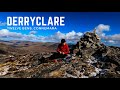
Letterettrin - a perspective on the N Connemara peaks
Dún Briste: You must be joking
Kilbrony Park Ramble
Doonvinalla E Top: Portacloy Cliff Walk
Erris Head Hill: Fantastic loop
Burren: Black Head Loop
Knocknakilton & Cummeen, Dingle Penninsula
Silvermines Hydro Project
Aghaglasheen: Highest point on the peninsula
Croaghnageer and Croghanirwore
Conditions and Info
Use of MountainViews is governed by conditions and a privacy policy.
Read general information about the site.
Opinions in material here are not necessarily endorsed by MountainViews.
Hillwalking is a risk sport. Information in comments, walks, shared GPS tracks or about starting places may not be accurate for example as regards safety or access permission. You are responsible for your safety and your permission to walk.
See the credits and list definitions.Video displaySouth Connemara Area N: Cashel SubareaPlace count in area: 14, OSI/LPS Maps: 44, 45, EW-CON
Highest place: Shannavara, 358m
Maximum height for area: 358 metres, Maximum prominence for area: 329 metres,
Places in area South Connemara:
Cen: Kilkieran:Cnoc Mordáin 354m
E: Moycullen:Newtown Hill 198m
N: Cashel:Cashel Hill 311mLettershinna Hill 192m
N: Derroura:Cappanalaurabaun 273mKeeraunnageeragh 305m
N: Oughterard:Cloghermore 280mKnocknasilloge 346mKnocknalee 291mLeam Hill 253m
N: Shannavara:Knockadav 224mShannavara 358m
S: Lettermore:Lettermore 117m
W: Roundstone:Errisbeg 300m
Note: this list of places includes island features such as summits, but not islands as such.
Galway County in Connacht Province, in Binnion List, Quartz diorite orthogneiss Bedrock
Height: 192m OS 1:50k Mapsheet: 44 Grid Reference: L83118 43257
Place visited by 21 members. Recently by: paulbrown, jlk, Colin Murphy, madfrankie, osullivanm, simon3, magnumpig, conormcbandon, markwallace, Jamessheerin, juliewoods, paddyhillsbagger, sandman, markmjcampion, eamonocI have visited this place: NO (You need to be a logged-in member to change this.)Longitude: -9.759087, Latitude: 53.426674 , Easting: 83118, Northing: 243257 Prominence: 127m, Isolation: 3.1km
ITM: 483093 743282 , GPS IDs, 6 char: LtrsHl, 10 char: LtrshnHil
Bedrock type: Quartz diorite orthogneiss, (Quartz Diorite Gneiss)
Lettershinna Hill is the 1416th highest place in Ireland.
Linkback: https://mountainviews.ie/summit/1301/COMMENTS for Lettershinna Hill 1 of 1  Follow this place's comments
 Height layer: © MapTiler

MountainViews.ie, a Hill-walking Website for the island of Ireland. 2500 Summiteers, 1480 Contributors, maintainer of lists such as: Arderins, Vandeleur-Lynams, Highest Hundred, County Highpoints etc

 DeirdreM
 TommyV
 glencree
 TommyV
 TommyV
 TommyV
 TommyV
 Peter Walker
 Visit our Facebook page.