Guestuser: Login or enrol?
- Home
- Main Display
- Main Display (Old)
- Find a Walk
- Display INTRODUCTION
- DONATE
- Click below for your
profile & contributions
guestuser- New
- Tracks, Walks
- Challenge
- Community
- Lists & Logs
- Popular Lists:
- County Highpoints
- Range & Area Highpoints
- Local 100
- Highest Hundred
- Vandeleur-Lynams
- Arderins
- Carns
- Best rated
- Irish 900 up
- Irish Island
- Munros
- All Lists
- Shorter Irish
- County Highpoints
- Range & Area Highpoints
- Highest Hundred
- Local 100
- Local 100 (pre2014)
- Local Historical Cultural
- Best rated
- Irish 900 up
- Larger Irish
- Arderins
- Arderin Begs
- Arderins + Arderin Begs
- Vandeleur-Lynams
- Vandeleur-Lynams + Arderins
- Carns
- Binnions
- Highest 50 per Province
- Island Features
- Irish Island
- Coastal Hills
- Irish 600 up
- Irish 500 up
- British
- Munros
- British 600 up
- British 500-600
- British Marilyns
- Comprehensive
- All Irish summits
- All Irish features
- All British summits
- All Britain+ Ireland
- Special
- Analysis List
- Simple Irish Listings
- Simple Irish & British Listings
-
- More
- Motley Views
Welcome to MountainViews
If you want to use the website often please enrol (quick and free) at top right.OverviewFor more map options click on any overview map area or any detail map feature.Detail Map FeaturesFind Suggested Walks
Find hill, mountain, island, coastal feature.Videos
 Recent Contributions
 Get Notifications
Meikle Bin: Long trek to summit
Lanzarote, from Femés to Puerto Calera via Pico de la Oveja and Montana Bermeja
Lanzarote, Puerto del Carmen Stroll
Little Bin: Tough little climb
Cort-ma Law East Top: Do not climb in the rain !
Lecket Hill: Short trek to summit of around 2 Km from Crow road
Great Knock: Short trek to summit
Brown Knowe: Straight forward track to the summit
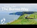
Burren: Black Head Loop
Silvermines Hydro Project
Lamb Knowe: Short trek from Tods Knowe
Letterettrin - a perspective on the N Connemara peaks
Conditions and Info
Use of MountainViews is governed by conditions and a privacy policy.
Read general information about the site.
Opinions in material here are not necessarily endorsed by MountainViews.
Hillwalking is a risk sport. Information in comments, walks, shared GPS tracks or about starting places may not be accurate for example as regards safety or access permission. You are responsible for your safety and your permission to walk.
See the credits and list definitions.Video displayClare Islands AreaPlace count in area: 25, OSI/LPS Maps: 51, 51A, 52, 57, 58, 63, 64
Highest place: Branaunmore, 61m
Places in area Clare Islands:Aughinish 25mBlackthorn Island 5mBranaunmore 61mCanon Island 25mCarrickaneelwar 7mConey Island (2) 59mCrab Island 10mDeenish Island (1) 22mDoon Island 4mFeenish 22mHog Island (2) 14mIllaunbeg 11mIllaunloo 5mInishdadroum 5mInishloe 13mInishmacowney 25mInishmore (2) 36mInishmurry 5mInishtubbrid 33mMattle Island 12mMutton Island (2) 28mScanlan's Island 10mScattery Island 14mShore Island 28mTrummer 6m
Note: this list of places includes island features such as summits, but not islands as such.
Clare County in Munster Province, in Irish Islands List
Landing grid ref.: R03700 92400
Reachable "On Foot " NHeight: 61m OS 1:50k Mapsheet: 51 Grid Reference: R03700 92400
Place visited by 2 members. Recently by: miriam, DavidWalshIsland visited by 2 members. I have visited this place: NO (You need to be a logged-in member to change this.)I have visited this island: NO (You need to be a logged-in member to change this.)Longitude: -9.434244, Latitude: 52.97401 , Easting: 103700, Northing: 192400
ITM: 503671 692435 , GPS IDs, 6 char: Brnnmr, 10 char: Brnnmr
Sea stack on Cover of 'Oileán' book 2nd Edition
Linkback: https://mountainviews.ie/island/2332/COMMENTS for Branaunmore (An Branán Mór) 1 of 1  Follow this place's comments
 Height layer: © MapTiler

MountainViews.ie, a Hill-walking Website for the island of Ireland. 2500 Summiteers, 1480 Contributors, maintainer of lists such as: Arderins, Vandeleur-Lynams, Highest Hundred, County Highpoints etc

 Fergalh
 simon3
 Fergalh
 Fergalh
 Fergalh
 Fergalh
 Fergalh
 Fergalh
 glencree
 Visit our Facebook page.