Guestuser: Login or enrol?
- Home
- Main Display
- Main Display (Old)
- Find a Walk
- Display INTRODUCTION
- DONATE
- Click below for your
profile & contributions
guestuser- New
- Tracks, Walks
- Challenge
- Community
- Lists & Logs
- Popular Lists:
- County Highpoints
- Range & Area Highpoints
- Local 100
- Highest Hundred
- Vandeleur-Lynams
- Arderins
- Carns
- Best rated
- Irish 900 up
- Irish Island
- Munros
- All Lists
- Shorter Irish
- County Highpoints
- Range & Area Highpoints
- Highest Hundred
- Local 100
- Local 100 (pre2014)
- Local Historical Cultural
- Best rated
- Irish 900 up
- Larger Irish
- Arderins
- Arderin Begs
- Arderins + Arderin Begs
- Vandeleur-Lynams
- Vandeleur-Lynams + Arderins
- Carns
- Binnions
- Highest 50 per Province
- Island Features
- Irish Island
- Coastal Hills
- Irish 600 up
- Irish 500 up
- British
- Munros
- British 600 up
- British 500-600
- British Marilyns
- Comprehensive
- All Irish summits
- All Irish features
- All British summits
- All Britain+ Ireland
- Special
- Analysis List
- Simple Irish Listings
- Simple Irish & British Listings
-
- More
- Motley Views
Welcome to MountainViews
If you want to use the website often please enrol (quick and free) at top right.OverviewFor more map options click on any overview map area or any detail map feature.Detail Map FeaturesFind Suggested Walks
Find hill, mountain, island, coastal feature.Videos

Recent Contributions
 Get Notifications
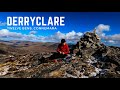
Carrigroe: Twin tops
Kilbrony Park Ramble
Letterettrin - a perspective on the N Connemara peaks
Grieve Hill: Summit position recently revised.
Knocknakilton & Cummeen, Dingle Penninsula
Leean Mountain: Ireland's Best Small Hill?
Scarr North-West Top: Popular spot in the heart of the mountains
Croaghnageer and Croghanirwore
Silvermines Hydro Project
Blackstairs Mountain: Good access and a great viewpoint above a patchwork quilt
Brown Mountain: Granite - mica schist boundary
9 km walk around Mullaghmeen Woods April 2025
Conditions and Info
Use of MountainViews is governed by conditions and a privacy policy.
Read general information about the site.
Opinions in material here are not necessarily endorsed by MountainViews.
Hillwalking is a risk sport. Information in comments, walks, shared GPS tracks or about starting places may not be accurate for example as regards safety or access permission. You are responsible for your safety and your permission to walk.
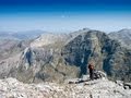
See the credits and list definitions.Video displaySouth Connemara Area N: Cashel SubareaPlace count in area: 14, OSI/LPS Maps: 44, 45, EW-CON
Highest place: Shannavara, 358m
Maximum height for area: 358 metres, Maximum prominence for area: 329 metres,
Places in area South Connemara:
Cen: Kilkieran:Cnoc Mordáin 354m
E: Moycullen:Newtown Hill 198m
N: Cashel:Cashel Hill 311mLettershinna Hill 192m
N: Derroura:Cappanalaurabaun 273mKeeraunnageeragh 305m
N: Oughterard:Cloghermore 280mKnocknasilloge 346mKnocknalee 291mLeam Hill 253m
N: Shannavara:Knockadav 224mShannavara 358m
S: Lettermore:Lettermore 117m
W: Roundstone:Errisbeg 300m
Note: this list of places includes island features such as summits, but not islands as such.
(Ir. Cnoc an Chaisil [OSI], 'hill of an Caiseal or the stone Galway County in Connacht Province, in Binnion List, Hornblende metagabbros & metanorites Bedrock
ring-fort')
Height: 311m OS 1:50k Mapsheet: 44 Grid Reference: L80036 43672
Place visited by 57 members. Recently by: oakesave, trekker, jlk, garrettd, Joshua3, TommyMc, Geo, blowin, Damian120, TommyV, conormcbandon, Haulie, paulbrown, Wilderness, mdoc1969I have visited this place: NO (You need to be a logged-in member to change this.)Longitude: -9.805584, Latitude: 53.4297 , Easting: 80036, Northing: 243672 Prominence: 285m, Isolation: 3.1km, Has trig pillar
ITM: 480012 743695 , GPS IDs, 6 char: CshlHl, 10 char: Cashel Hil
Bedrock type: Hornblende metagabbros & metanorites, (Metagabbro and Related Lithologies)
Cashel / An Caiseal is the name of a settlement south of the hill, and also a townland. The townland is named from the earth- and stone-banked 'ringfort' or cashel surrounding the old cemetery in Caiseal Ard / High Cashel. This is probably an Early Christian religious site (TR, 72). Walks: for a route to the summit from the SW, see Whilde & Simms, New Irish Walk Guide - West and North, 30. Cashel Hill is the 1140th highest place in Ireland. Cashel Hill is the second most westerly summit in the South Connemara area.
Linkback: https://mountainviews.ie/summit/947/COMMENTS for Cashel Hill (Cnoc an Chaisil) 1 2 Next page >>  Follow this place's comments
 Height layer: © MapTiler

MountainViews.ie, a Hill-walking Website for the island of Ireland. 2500 Summiteers, 1480 Contributors, maintainer of lists such as: Arderins, Vandeleur-Lynams, Highest Hundred, County Highpoints etc

 Colin Murphy
 glencree
 Collaborative entry
 Geo
Geo
 hibby
hibby
 Peter Walker
 Collaborative entry
 hibby
hibby
 ceadeile
 Visit our Facebook page.