Welcome to MountainViews
If you want to use the website often please enrol (quick and free) at top right.
If you want to use the website often please enrol (quick and free) at top right.
Overview

For more map options click on any overview map area or any detail map feature.
Detail Map Features
Find Suggested Walks
Find hill, mountain, island, coastal feature.
Videos
Recent Contributions
 Get Notifications
Get Notifications
A visit to Tievummera via its South East spur.
 simon3
Ben Creggan: Craggy summit with long descending spur to the east.
 Collaborative entry
Teevenacroaghy: Misty Achill.
 simon3
Dorinish More: Shapely islands in Clew Bay, Co Mayo.
 simon3
Croagh Patrick's ridge to the east, visited from the south.
Crott Mountain: Quiet Arderin at the east end of the Croagh Patrick ridge.
 Collaborative entry
Teevenacroaghy: A heathery ridge bump with good views.
 Collaborative entry
Teevenacroaghy: A clear day on the Hill
 three5four0
Madeira: From Pico Arieiro to Pico Ruivo
Hag's Tooth: This might hurt
 No1Grumbler
More EastWest names added for summits.
Donations Drive, now finished.
Conditions and Info
Use of MountainViews is governed by conditions and a privacy policy.
Read general information about the site.
Opinions in material here are not necessarily endorsed by MountainViews.
Hillwalking is a risk sport. Information in comments, walks, shared GPS tracks or about starting places may not be accurate for example as regards safety or access permission. You are responsible for your safety and your permission to walk.
See the credits and list definitions.
 Visit our Facebook page.
Video display
Donegal North
Area Cen: Rosguill Subarea
Place count in area: 9,
OSI/LPS Maps: 2
Highest place: Knockalla, 363m
Maximum height for area: 363 metres,
Maximum prominence for area: 328 metres,
Places in area Donegal North:
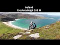
Cen: Rosguill:Crocknasleigh 163mGaniamore 207m
E: Fanad:Cashelmore 149mKnockalla 363mMurren Hill 227mCrockdonnelly 152mCraigcannon 357mDrumavohy Hill 153m
W: Horn Head:Croaghnamaddy 252m
Note: this list of places includes island features such as summits, but not islands as such.
Highest place:
Knockalla, 363mPlaces in area Donegal North:
Cen: Rosguill:
Crocknasleigh 163mGaniamore 207mE: Fanad:
Cashelmore 149mKnockalla 363mMurren Hill 227mCrockdonnelly 152mCraigcannon 357mDrumavohy Hill 153mW: Horn Head:
Croaghnamaddy 252mNote: this list of places includes island features such as summits, but not islands as such.

2008], 'hill of the spear')
Bedrock type: Xenolithic facies, (Fanad Granite)
Cnoc na Sleá is the modern Irish form. Arguably the Classical Irish form Cnoc na Sleighe is more faithful to the pronunciation. Cnoc na Sleá is the 1453th highest place in Ireland. Cnoc na Sleá is the second most northerly summit in the Donegal North area.
Linkback: https://mountainviews.ie/summit/1047/
COMMENTS for Crocknasleigh (Cnoc na Sleá) 1 2 Next page >>  Follow this place's comments

|
|
|
|
||
| MountainViews.ie, a Hill-walking Website for the island of Ireland. 2400 Summiteers, 1480 Contributors, maintainer of lists: Arderins, Vandeleur-Lynams, Highest Hundred, County Highpoints etc | |||