Donation Request 2024

DONATE
Members and Supporters, the MountainViews Committee requests your help to meet the costs of the website and of other activities such as insured events or publications.

You do not have to be logged in to donate.

Welcome to MountainViews
If you want to use the website often please enrol (quick and free) at top right.
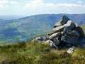
Overview
Detail
Zoom: ??
For more map options click on any overview map area or any detail map feature.
Find Suggested Walks
Find hill, mountain, island, coastal feature.
Videos
(none available)
Recent Contributions
Get Notifications

Carran NE Top: Approach via wind farm tracks

Lobawn Loop - Clockwise avoids any steep ascent! Easy stream crossing.

Long Island: No sign of the Great Gatsby

Walk on tracks above Glendalough

Knockree: Reasonably clear path to summit

Circumnavigation of Tawny Rower

Little Sugar Loaf: Windy at the top

Aganny Top: Approach from SW

Near Church Mountain, Wicklow (Ireland)

Keeloges: Go and enjoy.

Keeloges-Aganny loop

Ireland's County Second Summits

Conditions and Info
Use of MountainViews is governed by conditions and a privacy policy.
Read general information about the site.
Opinions in material here are not necessarily endorsed by MountainViews.
Hillwalking is a risk sport. Information in comments, walks, shared GPS tracks or about starting places may not be accurate for example as regards safety or access permission. You are responsible for your safety and your permission to walk.
See the credits and list definitions.
Video display
Peter Walker: Track 3848 in area near Sail Mhor, Loch Maree to Loch Broom (Britain)
Sail Mhor
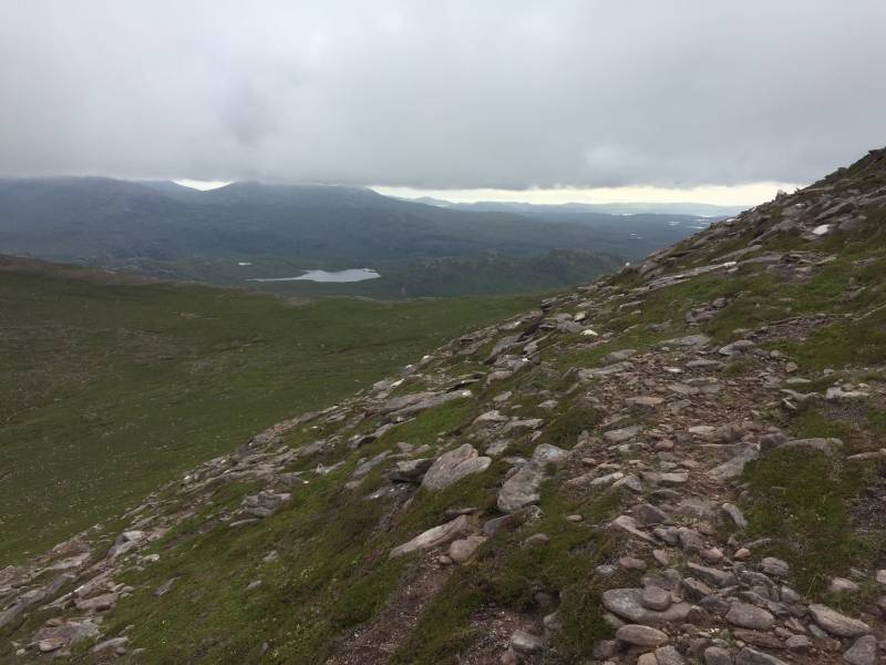
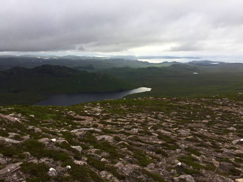
Length: 11.3km, Creator time taken: 3h19m, Ascent: 833m,
Descent: 827m

Places: Start at NH0541489557, Sail Mhor, Ruigh Mheallain, end at Start
Logged as completed by 1

After a week of blazing sunshine in the Peak District overwhelmingly spent swimming in the pool, lazing by the pool and consuming vast amounts of food purchased in the nearby Waitrose (lying by the pool, obviously), that was the missus' half of the holiday done and dusted. My week was still to come, and so it was that we rocked up in the north-west of Scotland on a glorious evening, the mountains resplendent and inviting in razor-sharp visibility.

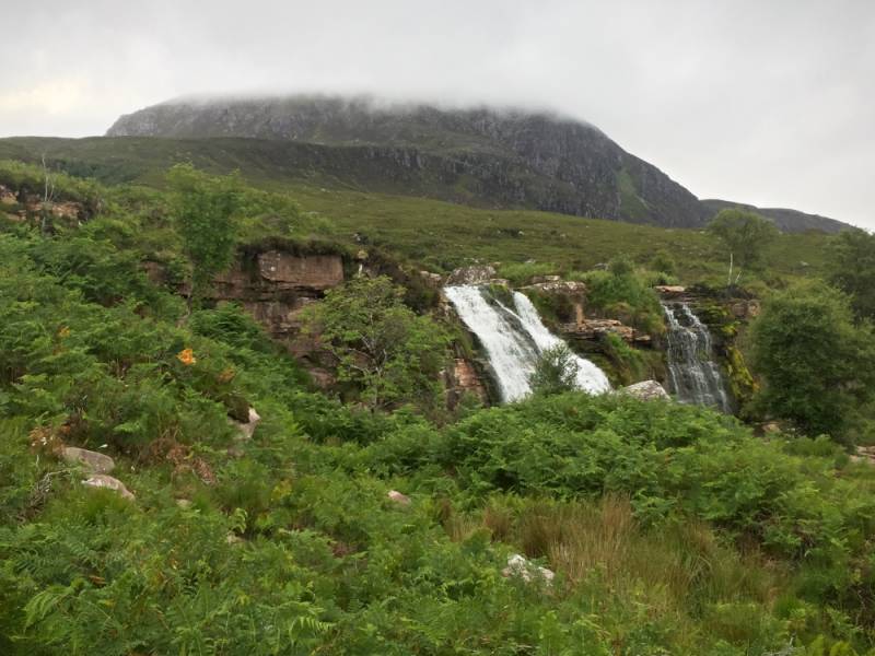
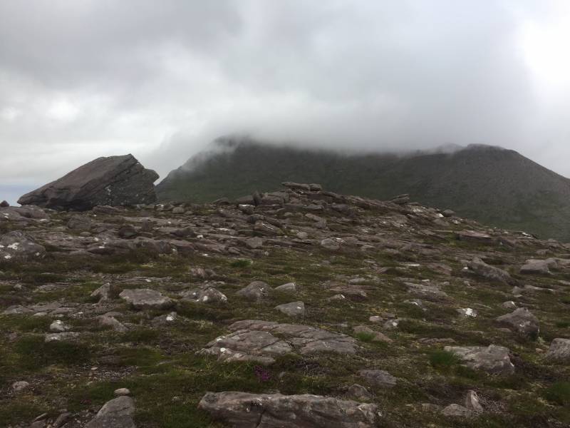
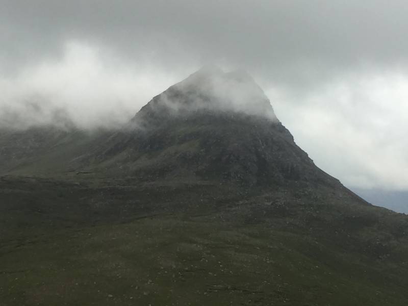
Of course, by the morning it was raining. Little Loch Broom was now Invisible Loch Broom, swaddled in sea mist, while the drizzle was amongst the most impressively wetting I'd ever encountered. And the telly in the cottage wasn't working, so we went out for a drive. As the afternoon wore on the skies became less distressed and the clouds saw fit to retreat upwards a bit, so by 5pm it was overcast but anything under 2500ft was basically clear.

And that's the problem with hillwalking holidays...you're kinda obliged to go hillwalking.
Sail Mhor above the Ardessie Falls
Sail Mhor seemed an obvious choice, less that ten minutes from the house and very much falling into the 'half day on the hill if you get your skates on' category. I left the car at the Ardessie Falls car park (which is only just above sea level...even the 'lesser' summits in this neck of the woods tend to be full value for their altitude before setting off up the path up the east side of the burn...well aware of my promise to be back by 10pm I wasn't planning on dawdling. The path was rough and a bit indeterminate but the falls were gorgeous and musical as height was gained fairly sharply. The bulk of Sail Mhor reared above as the flatter upper stretches of the valley were reached, and a boulder hop across the burn (potentially nasty in any sort of spate) commenced the substantial part of the climb.
On the ascent to Sail Mhor
This is based on a tributary flowing down from the col south of Sail Mhor, but I soon trended away from it to favour a more direct climb up to the shoulder on its north side. A slog if truth be told, but gradually outcropping sandstone began to replace boggy grass, and up into the clouds I went. Once the skyline was reached the ridge curved round with one small descent before the final easy pull up to Sail Mhor's summit cairns (the second looked higher, as much as I could tell). The views from here must be awesome given the sharpness of the drop to the sea, but the cloud base was resolute in its occupation of the upper slopes. With that in mind I didn't linger, and dropped quickly down the ridge to the south. This restored some atmospheric clarity, and I felt I'd earned a few minutes to rhapsodise about the amazing wilderness thus revealed...it really is one of the most exceptional mountain areas in these islands.
Looking out to Gruinard Bay
A brisk schlep across the col and a short climb led up onto Ruigh Mheallain. This made up for its relatively subdued size in all the vastness by having a 20ft high boulder as its summit, undercut most of the way round and lacking an obvious way up. I sorted this with by climbing its eastern arete via a step up on a sloping hold to slap for a hold on the other side of the boulder...bit of a one-move wonder but still awkward (bear in mind I'm quite tall). Summit definitely attained I could drink in the view...clear of clouds there was more to see here than from Sail Mhor, with the monumental prow of Sgurr Ruadh (an outlier of An Teallach) boggling the eyes to the south.
Sail Mhor from Ruigh Mheallain
I continued on down the ridge for about 500m before turning west for a diagonally descending bogtrot back to the river crossing from the ascent...not horrendous but still not really carefree. Back on familiar ground (although not THAT familiar...a close examination of the uploaded track will tell you that the path isn't clear enough to follow exactly) the return was uneventful, unless you count a grown man falling over because he got his right leg tangled behind his left leg to be an event.
Sgurr Ruadh
So, a day rescued from drizzly frustration. It's a fine outing, but also a lesson that even the lesser outings hereabouts are substantial...a sea level climb to over 2500ft on mostly tough pathless terrain isn't trivial.

Uploaded on: Sun, 8 Jul 2018 (21:32:31)
Linkback: https://mountainviews.ie/track/3848/  
To download GPS tracks you must be enrolled and logged in. See "Login or enrol", top right - quick and easy.


COMMENTS
No comments uploaded yet.

NOTE: ALL information such as Ascent, Length and Creator time taken etc should be regarded as approximate. The creator's comments are opinions and may not be accurate or still correct.
Your time to complete will depend on your speed plus break time and your mode of transport. For walkers: Naismith's rule, an approximate though often inaccurate estimate, suggests a time of 3h 39m + time stopped for breaks
NOTE: It is up to you to ensure that your route is appropriate for you and your party to follow bearing in mind all factors such as safety, weather conditions, experience and access permission.

* Note: A GPS Height in the elevation profile is sourced from the device that recorded the track. An "SRTM" height is derived from a model of elevations for parts of the earth. More detail

OSi logo OSNI/LPS logo
Some mapping:
Open Street Map
(Various variations used.)
British summit data courtesy:
Database of British & Irish Hills
(Creative Commons Licence)
MountainViews.ie, a Hill-walking Website for the island of Ireland. 2400 Summiteers, 1480 Contributors, maintainer of lists: Arderins, Vandeleur-Lynams, Highest Hundred, County Highpoints etc