You do not have to be logged in to donate.
If you want to use the website often please enrol (quick and free) at top right.

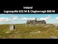
Lugnaquilla 924.7m, Cloghernagh 800m, Corrigasleggaun 794.6m, Slievemaan 759.7m, Camenabologue 758m, Conavalla 734m, Table Mountain 701.7m, Camaderry Mountain 698.6m, Benleagh 689m, Tomaneena 682.4m,

 Get Notifications
Cunnigar: Short trek to summit
 Fergalh
Westtown Hill: Tramore's Highest Point
 DeirdreM
Lobawn Loop - Clockwise avoids any steep ascent! Easy stream crossing.
Knockbrinnea West Top: Eflanagan on the Knockbrinneas
 eflanaga
Knockbrinnea West Top: Larger Twin
 Collaborative entry
Walk on tracks above Glendalough
 ceadeile
Ascending the Knockbrinneas from the north.
 simon3
Knockaunanattin West Top: Views, loughs and a navigational aid.
 simon3
Circumnavigation of Tawny Rower
 glencree
Knockaunanattin West Top: First step to Stumpa Duloigh
 Collaborative entry
Knockaunanattin West Top: Impressive defile start leads to airy ridgeline.
 Peter Walker
Near Church Mountain, Wicklow (Ireland)
Use of MountainViews is governed by conditions and a privacy policy.
Read general information about the site.
Opinions in material here are not necessarily endorsed by MountainViews.
Hillwalking is a risk sport. Information in comments, walks, shared GPS tracks or about starting places may not be accurate for example as regards safety or access permission. You are responsible for your safety and your permission to walk.
See the credits and list definitions.
 Visit our Facebook page.
 Length: 33.6km, Creator time taken: 7h 8m, Ascent: 1554m,
Descent: 1560m
Places: Start at T1115996357, Cloghernagh, Lugnaquilla, Camenabologue, Conavalla, end at Start
Logged as completed by 1

NOTE: ALL information such as Ascent, Length and Creator time taken etc should be regarded as approximate. The creator's comments are opinions and may not be accurate or still correct.
Your time to complete will depend on your speed plus break time and your mode of transport. For walkers: Naismith's rule, an approximate though often inaccurate estimate, suggests a time of 9h 18m + time stopped for breaks
NOTE: It is up to you to ensure that your route is appropriate for you and your party to follow bearing in mind all factors such as safety, weather conditions, experience and access permission.
* Note: A GPS Height in the elevation profile is sourced from the device that recorded the track. An "SRTM" height is derived from a model of elevations for parts of the earth. More detail![]()
|
|
|
||
| MountainViews.ie, a Hill-walking Website for the island of Ireland. 2400 Summiteers, 1480 Contributors, maintainer of lists: Arderins, Vandeleur-Lynams, Highest Hundred, County Highpoints etc | |||