Members and Supporters, the MountainViews Committee requests your help to meet the costs of the website and of other activities such as insured events or publications.
Feature count in area: 46, all in ,
Highest Place: Ben Vorlich 985m
Starting Places in area Strathyre to Strathallan:
None for this area
Summits & other features in area Strathyre to Strathallan: Am Bioran 616m, Beinn Bhreac 701.7m, Beinn Dearg 706.7m, Beinn Domhnuill 739m, Beinn Each 813m, Beinn Each Far North Top 682m, Beinn Each North Top 704m, Beinn Fuath 661m, Ben Halton 620.2m, Ben Our 742m, Ben Vorlich 985m, Black Craig 692m, Carn Labhruinn 563m, Creag a'Gheata 558m, Creag Bheithe West Top 570m, Creag Bheithe [Druim Ardoch] 576m, Creag na h-Eararuidh [Stuc na Cabaig] 708.3m, Creagan an Lochain [Creagah an Lochain] 685m, Creagan nan Gabhar 725m, Leacan Dubha 642m, Leacan Dubha West Top 629m, Leacann Amarach 753.6m, Meall Biorach 431m, Meall Gobhlach 582m, Meall Mor 565m, Meall na Caora 765m, Meall na Caora East Top 694m, Meall na Fearna 809m, Meall na Fearna South Top 686m, Meall na Fearna West Top 717m, Meall nan Oighreag 579.5m, Meall nan Saighdearan 681m, Meall Odhar 646m, Meall Reamhar 662m, Mor Bheinn 640.3m, Mor Bheinn North Top 552m, Sgiath a'Chaise 644.1m, Sgiath a'Chaise North Top 642.7m, Sron na Maoile 617.8m, Sron nam Broighleag 679m, Stob Chalum Mhic Griogair 742m, Stob Chalum Mhic Griogair South Top 701m, Stuc a'Chroin 975m, Stuc a'Chroin West Top 735m, Stuc Gharbh 636m Glen Artney Hills: Druim Meadhoin 418m
Note: this list of places may include island features such as summits, but not
islands as such.
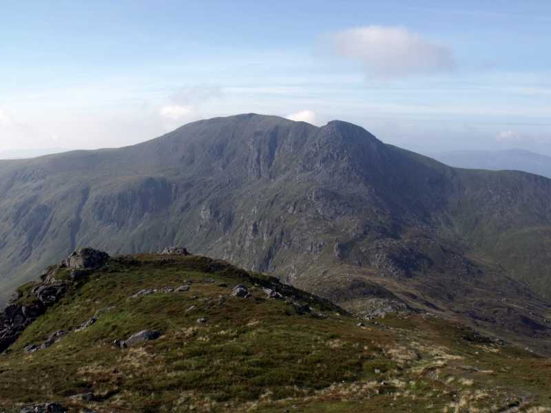
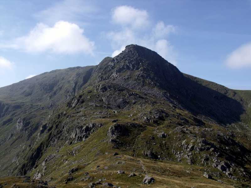
Stuc a'Chroin, 975mMountain
Place Rating ..
, in British over 600m, British Marilyn, Munro Lists Grid Reference NN61746 17466,
OS 1:50k mapsheet 57 Place visited by: 28members, recently by: rhw, ochils_trekker, OutdoorBill, gneissadventures, Aongus, joreidy, annem, Lauranna, tseepra, nordicstar, rangertobi, bolton12, gerrybowes, DeltaP, IainT
I visited this place: NO (You need to be a logged-in member for this.)
Use of MountainViews is governed by conditions and a privacy policy.
Read general information about the site. Opinions in material here are not necessarily endorsed by MountainViews.
Hillwalking is a risk sport. Information in comments, walks, shared GPS tracks or about starting places may
not be accurate for example as regards safety or access permission. You are responsible for your safety and your permission to walk.
See the credits and list definitions.


 Our Facebook page.