Donation Request 2024
You do not have to be logged in to donate.
DONATE
Members and Supporters, the MountainViews Committee requests your help to meet the costs of the website and of other activities such as insured events or publications.You do not have to be logged in to donate.
Welcome to MountainViews
If you want to use the website often please enrol (quick and free) at top right.
If you want to use the website often please enrol (quick and free) at top right.
Overview

For more map options click on any overview map area or any detail map feature.
Detail Map Features
Find Suggested Walks
Find hill, mountain, island, coastal feature.
Videos
Recent Contributions
 Get Notifications
Get Notifications
Cunnigar: Short trek to summit
 Fergalh
Westtown Hill: Tramore's Highest Point
 DeirdreM
Knockbrinnea West Top: Eflanagan on the Knockbrinneas
 eflanaga
Ascending the Knockbrinneas from the north.
 simon3
Knockbrinnea West Top: Larger Twin
 Collaborative entry
Knockaunanattin West Top: Views, loughs and a navigational aid.
 simon3
Lobawn Loop - Clockwise avoids any steep ascent! Easy stream crossing.
Knockaunanattin West Top: First step to Stumpa Duloigh
 Collaborative entry
Walk on tracks above Glendalough
 ceadeile
Knockaunanattin West Top: Impressive defile start leads to airy ridgeline.
 Peter Walker
Ireland's County Second Summits
 murphysw
More EastWest names added for summits.
Conditions and Info
Use of MountainViews is governed by conditions and a privacy policy.
Read general information about the site.
Opinions in material here are not necessarily endorsed by MountainViews.
Hillwalking is a risk sport. Information in comments, walks, shared GPS tracks or about starting places may not be accurate for example as regards safety or access permission. You are responsible for your safety and your permission to walk.
See the credits and list definitions.
 Visit our Facebook page.
Video display
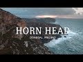
Donegal North
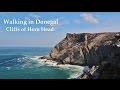
Area W: Horn Head Subarea
Place count in area: 9,
OSI/LPS Maps: 2
Highest place: Knockalla, 363m
Maximum height for area: 363 metres,
Maximum prominence for area: 328 metres,
Places in area Donegal North:
Cen: Rosguill:Crocknasleigh 163mGaniamore 207m
E: Fanad:Cashelmore 149mKnockalla 363mMurren Hill 227mCrockdonnelly 152mCraigcannon 357mDrumavohy Hill 153m
W: Horn Head:Croaghnamaddy 252m
Note: this list of places includes island features such as summits, but not islands as such.
Highest place:
Knockalla, 363mPlaces in area Donegal North:
Cen: Rosguill:
Crocknasleigh 163mGaniamore 207mE: Fanad:
Cashelmore 149mKnockalla 363mMurren Hill 227mCrockdonnelly 152mCraigcannon 357mDrumavohy Hill 153mW: Horn Head:
Croaghnamaddy 252mNote: this list of places includes island features such as summits, but not islands as such.

Bedrock type: Hornblendic and sometimes schistose, (Metadolerite)
The highest point on Horn Head. The Metrical Dindsenchas contains a reference to Sliab Irguill, which the editor Edward Gwynn identifies with Horn Head, so it be an old name for Croaghnamaddy or may have referred to all the upland on Horn Head. For origin of name, see Ganiamore re the name Sliab Guill. There is another Croaghnamaddy SW of Dungloe. Croaghnamaddy is the third highest hill in the Donegal North area and the 1280th highest in Ireland. Croaghnamaddy is the most westerly summit in the Donegal North area.
Linkback: https://mountainviews.ie/summit/999/
COMMENTS for Croaghnamaddy (Cruach na Madadh) 1 2 Next page >>  Follow this place's comments

|
|
|
|
||
| MountainViews.ie, a Hill-walking Website for the island of Ireland. 2400 Summiteers, 1480 Contributors, maintainer of lists: Arderins, Vandeleur-Lynams, Highest Hundred, County Highpoints etc | |||