Donation Request 2024

DONATE
Members and Supporters, the MountainViews Committee requests your help to meet the costs of the website and of other activities such as insured events or publications.

You do not have to be logged in to donate.

Welcome to MountainViews
If you want to use the website often please enrol (quick and free) at top right.
Overview
Detail
Zoom: ??
For more map options click on any overview map area or any detail map feature.
Find Suggested Walks
Find hill, mountain, island, coastal feature.
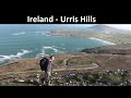
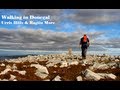
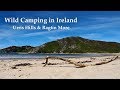
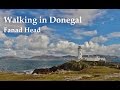
Videos


Recent Contributions
Get Notifications

Cunnigar: Short trek to summit

Westtown Hill: Tramore's Highest Point

Lobawn Loop - Clockwise avoids any steep ascent! Easy stream crossing.

Knockbrinnea West Top: Eflanagan on the Knockbrinneas

Knockbrinnea West Top: Larger Twin

Walk on tracks above Glendalough

Ascending the Knockbrinneas from the north.

Knockaunanattin West Top: Views, loughs and a navigational aid.

Circumnavigation of Tawny Rower

Knockaunanattin West Top: First step to Stumpa Duloigh

Knockaunanattin West Top: Impressive defile start leads to airy ridgeline.

Near Church Mountain, Wicklow (Ireland)

Conditions and Info
Use of MountainViews is governed by conditions and a privacy policy.
Read general information about the site.
Opinions in material here are not necessarily endorsed by MountainViews.
Hillwalking is a risk sport. Information in comments, walks, shared GPS tracks or about starting places may not be accurate for example as regards safety or access permission. You are responsible for your safety and your permission to walk.
See the credits and list definitions.
Video display
Inishowen Area   NW: Urris Subarea
Place count in area: 27, OSI/LPS Maps: 2, 3, 4, 6, 7 
Highest place:
Slieve Snaght, 614.6m
Maximum height for area: 614.6 metres,     Maximum prominence for area: 600 metres,

Note: this list of places includes island features such as summits, but not islands as such.
Rating graphic.
Raghtin More Mountain Reachtain Mhór A name in Irish, also Slieve Keeroge an extra name in English (Ir. Reachtain Mhór [OSI], 'big [obscure element]') Donegal County in Ulster Province, in Arderin List, Whitish quartzite with pebble beds Bedrock

Height: 502m OS 1:50k Mapsheet: 2&3 Grid Reference: C33890 45576
Place visited by 123 members. Recently by: CusackMargaret, abacusms, Claybird007, Meenat, Cecil1976, johncusack, annem, a3642278, padstowe, sharonporter, Grumbler, eamonoc, srr45, Kilcoobin, mgkelly
I have visited this place: NO (You need to be a logged-in member to change this.)

Longitude: -7.467835, Latitude: 55.255965 , Easting: 233890, Northing: 445576 Prominence: 407m,  Isolation: 0.7km,   Has trig pillar
ITM: 633832 945553,   GPS IDs, 6 char: RghtMr, 10 char: RghtnMore
Bedrock type: Whitish quartzite with pebble beds, (Slieve Tooey Quartzite Formation)

This mountain has a megalithic cairn and circles at the summit [The Heritage of Inishowen, Mabel R. Colhoun]. It is known as Raghtin on the Buncrana side and as Coing (meaning 'roof beam') on the Urris side. Another alternative name, Slieve Keeroge, is recorded at logainm.ie and, with a slightly different spelling, Slieve Keerogue, on the 1st edition 6" map.   Raghtin More is the third highest mountain in the Inishowen area and the 565th highest in Ireland.

Linkback: https://mountainviews.ie/summit/451/
COMMENTS for Raghtin More (Reachtain Mhór) 1 2 Next page >>  
Follow this place's comments
MountainViews.ie Picture about mountain Raghtin More (<i>Reachtain Mhór</i>) in area Inishowen, Ireland
Picture: Raghtin More from Crockmain
 
The smallest Inishowen Arderin
Short Summary created by liz50  21 Mar 2017
The easiest approach is to park at Urrismenagh viewpoint carpark C317 443 starA and follow the track to its highest point. From here you can avoid Crockmain and carry on towards Raghtin More to the North.
Alternatively from Mamore Gap car park C323 423 starB walk downhill in a SE direction to a gravel track and follow it to the head of the valley before veering off to the North to reach the summit dirctly by avoiding Crockmain.
From the North East park at Butlers Glen C358 468 starC with off road parking and walk up through the Glen to the end of the track before ascending over open boggy hillside.
There is a large cairn on the large flat rocky summit area.
To the East is Sl Snaght and to the West Lough Swilly is in view Linkback: https://mountainviews.ie/summit/451/comment/5210/
 
MountainViews.ie Picture about mountain Raghtin More (<i>Reachtain Mhór</i>) in area Inishowen, Ireland
Picture: Raghtin More puts its head above the parapet
eflanaga on Raghtin More, 2006
by eflanaga  26 Feb 2006
The third and final leg of my attempt to bag the Innishowen 500’s (See Slieve Main & Slieve Snaght for earlier legs). This part of the walk began at the Urrismenagh Viewpoint carpark (C317443 starA). A track (meeting up with that described by Eoin below) runs from the edge of the carpark. I followed it up to below Crockmain. The track itself is much more convoluted than the map suggests. From the end of the track a bearing of 52 degrees NW takes you up a short ascent over a heather clad hill to a cairn. From here Crockmain can be reached maintaining the same bearing. Raghtin More peeps out above and behind. Rather than continuing straight, though, veer left to an obvious ridge/saddle. I turned right here and made for Crockmain summit. You could carry on towards Raghtin More if you didn't wish to climb Crockmain. The ascent to this minor top, sometimes rocky, is relatively easy. From Crockmain summit (C335449 starD) there is a short drop of some 40 metres before an ascent of about 82m to the rocky summit of Raghtin More. With light beginning to fail and my camera on the blink, thus having to forego the wonderful views described by Eoin & Gerrym, I thought it best to beat a fairly hasty retreat, on a direct bearing of 224 degrees SW, across the western slope of Crockmain, rejoining the track described earlier. An enjoyable walk in the cool of the late afternoon which made the morning’s purgatorial trek seem almost worthwhile and all topped off with a beautiful sunset witnessed as I approached the Viewpoint carpark. Linkback: https://mountainviews.ie/summit/451/comment/2201/
Your Score: Very useful <<  >>Average
 
MountainViews.ie Picture about mountain Raghtin More (<i>Reachtain Mhór</i>) in area Inishowen, Ireland
 
eoin on Raghtin More, 2003
by eoin  11 Jun 2003
The best route for a medium walk is from Mamore Gap. Use the car park/layby located on the left of the road, 200m from the top of the Gap on the southern side. From here walk downhill for 200m to a small group of trees and a gravelled track heading into the valley. Follow the track to the head of the valley just below Raghtin More.

From here you veer slightly left over the heather and turf banks to reach the saddle between Raghtin More and Slievekeeragh. Keep climbing heading diagonally across the slope to avoid climbing the small summit of Crock Main and you reach a small flat area before the last 100m to the summit. There are lots of rocky patches on these slopes, heading to the right misses most of them.

On the large flat summit plateau there is a substantial cairn which can seat about 8 and provides soem wind shelter when it blows!! There is also a trig point and of course excellent views from Malin Head to Errigal on a clear day.

On the way back either..

A) Retrace your steps to reach the path in the valley.

B) Climb Crock Main (460m) and Mamore Hill (423m) which adds about another 150m of ascent and is a lovely trail to take you out just at the top of the Gap and it is a short walk downhill to the car park.

The image below is the view from the trig point looking north at Dunaff Head Linkback: https://mountainviews.ie/summit/451/comment/539/
Your Score: Very useful <<  >>Average
 
MountainViews.ie Picture about mountain Raghtin More (<i>Reachtain Mhór</i>) in area Inishowen, Ireland
Picture: looking S to Urris Hills
gerrym on Raghtin More, 2008
by gerrym  30 May 2008
Started at Butlers Glen (358468 starC) which has off road parking and other facilities. A lovely walk up through the glen crosses the river a number of times with the sound of burbling water as a constant. An army of ferns were pushing their way skyward in the late spring sunshine which only reached part of the deep sided glen. Views down the glen reach to BInnion Hill and Tullagh Bay on the coast. Rounding a bend the spectacular waterfall comes into view. Climb steeply out of the glen to the left - would be a nightmare in the wet!
Join a track heading further up the valley for a short distance before dropping down (again steeply) to cross the river. Open hillside leads to the objective of Raghtin Beg ahead. The ground was spongy and would be very wet normally - was a bit of a slog to be honest. I did see a frog and a newt - a bat would have completed a perfect recipe for Shakespeares witches.
Clouds were forming off the sea in the E wind leading to overcast and windy conditions on top of Raghtin Beg whilst the surrounding coastline bathed in sunshine. Views to the double horseshoe bays northward were spectacular. A short but steep final climb brings the top of Raghtin More. There is a massive cairn with other lesser effortsdotted about. Views to tthe E are taken up by the height of Slieve Snaght and Crockmain. To the W Lough Swilly with Fanad lighthouse at its head is in view. As move across the top the spectacular line of rugged tops heading S take the breath away, along with the never ending reaches of L Swilly with its occasional golden beaches.
It would be very difficult to just visit this hill and we continued over Crockmain and Mamore Hill, returning to Butlers Glen by the track which follows the Camowen river (323423 starB). Great days walking and there was no one else on a bank holiday Sunday! Linkback: https://mountainviews.ie/summit/451/comment/967/
Your Score: Very useful <<  >>Average
 
MountainViews.ie Picture about mountain Raghtin More (<i>Reachtain Mhór</i>) in area Inishowen, Ireland
 
Glashedy007 on Raghtin More, 2009
by Glashedy007  13 Jun 2009
It was a beautiful spring morning as a parked in the carkpark at the glen house, Urris. Starting off on a 1 km walk through the glen house waterfall park. When you reach the waterfall i went off to the right were you climb a steep ravine, when you get to the top of that the beauty of raghtin more is starring straight at you. The walk ahead west side is through heather, ferns and marshy bogland but that is all part of the challenge. Good footwear is essential. As you get 100m from the summit it can be rocky with loose rocks stacked on each other, good concentration is essential.When you on the summit the views range from every angle Lough swilly, Fanad , to the west, Slieve snacht to the east and the coastline of scotland to the north east. A great walk!! Linkback: https://mountainviews.ie/summit/451/comment/3841/
Your Score: Very useful <<  >>Average
 
retepcooper on Raghtin More, 2002
by retepcooper  19 Nov 2002
The Raghtins are well worth a visit, excellent views and a good one for the lungs. Regularly run up Butlers Glen onto these summits, can also be accessed from Mamore Gap. Views across Urris hills to Muckish, Errigal, Fanad Head, Tory Island and Inishowen can be breathtaking; good photo opportunities! Linkback: https://mountainviews.ie/summit/451/comment/225/
Your Score: Very useful <<  >>Average
 
COMMENTS for Raghtin More (Reachtain Mhór) 1 2 Next page >>
(End of comment section for Raghtin More (Reachtain Mhór).)

OSi logo OSNI/LPS logo
Some mapping:
Open Street Map
(Various variations used.)
British summit data courtesy:
Database of British & Irish Hills
(Creative Commons Licence)
MountainViews.ie, a Hill-walking Website for the island of Ireland. 2400 Summiteers, 1480 Contributors, maintainer of lists: Arderins, Vandeleur-Lynams, Highest Hundred, County Highpoints etc