Donation Request 2024

DONATE
Members and Supporters, the MountainViews Committee requests your help to meet the costs of the website and of other activities such as insured events or publications.
You do not have to be logged in to donate.
Features
Nearby features appear when you click the map.
Declutter tracks on map.
Place Search
Video
X
Pub: by
Caha Mountains Area , E: Glengarriff Subarea
Feature count in area: 57, by county: Cork: 32, Kerry: 36, of which 11 are in both Cork and Kerry, OSI/LPS Maps: 83, 84, 85, 88
Highest Place: Hungry Hill 682m

Starting Places (51) in area Caha Mountains:
Ardgroom, Barley Lake North, Bere Island Pier, Caha Pass, Canshanavoe South, Carriganine, Cashelkeelty Stone Circles Carpark, Castletownbere Lifeboat Harbour, Clashduff River Farm, Coolieragh Harbour Road, Coomadayallig Lake Road N, Coomadayallig Lake Road S, Cooryeen Lane, Cummer Lough East Road, Derreenataggart Stone Circle Road, Dromoghty Lough North, Dunboy Wood, Esk Boreen, Eyeries, Fehanah Lane, Garinish Island Pier, Glantrasna Bridge, Glenbeg Lough N, Glengarriff, Glengarriff Nature Reserve CP, Gleninchaquin Waterfall, Gowlaun Lough, Healy Pass, Healy Pass Hairpin, Ilnacullin Car Park, Kenmare Bridge, Knockacullin Lane, Leahill Bog, Leitrim Beg Standing Stone, Lough Inchiquin SE, Magannagan Stream, Molly Gallivan's Visitor Centre, Nora's Cottage, Old Lansdowne School, Owgarriff River Lane, Peg's Shop, Pooleen Wood Car Park, Red Trout Lake, Reenroe Bridge, River Drimminboy Track, Rossmackowen Bridge, Rossmackowen Cemetery, Shronebirrane Farm, Shronebirrane Road, Toberbanaha, Turner's Rock Tunnel

Summits & other features in area Caha Mountains:
Cen: Hungry Hill: Coombane 510m, Derryclancy 554m, Hungry Hill 682m
Cen: Knockowen: Cushnaficulla 594m, Glenkeel Top 417m, Knockastumpa 398m, Knockeirky 577m, Knockeirky South Top 523m, Knockowen 658m, Stookeennalackareha 412m
E: Glengarriff: Derrynafulla SW 375m, Gowlbeg Mountain 362m, Nareera 530m, Nareera North Top 503m, Nareera South-West Top 505m, Shrone Hill 283m, Sugarloaf Mountain 574m, Sugarloaf Mountain Far West Top 560m, Sugarloaf Mountain West Top 565m
N: Coomnadiha: Baurearagh Mountain 489m, Caha Far SE Top 555m, Caha SE Top 585m, Coomnadiha 644m, Coomnalack Top 435m, Cummeenbaun 510m, Droppa 522m, Killane Mountain 537m, Killane Mountain South-West Top 533m, Knockagarrane 414m, Knockreagh 500m
N: Knockeirka: Barraduff Mountain 400m, Killaha Mountain 400m, Knockeirka 426m
N: Knocknagorraveela: Derrysallagh 410m, Feorus East 474m, Knocknagorraveela 507m, Knocknagorraveela NE Top 464m
N: Lauragh: Knockanoughanish 386m, Knockatee 330m
S: Castletownbere: Disert 205m, Knockanallig (Bear Island) 267m
W: Ardgroom: Derryvour Hill 160m
W: Eskatarriff: Coomacloghane 599m, Eskatarriff 600.5m, Eskatarriff East Top 532.7m, Knocknaveacal North Top 509.1m, Knocknaveacal South Top 507.2m, Lackabane 603m, Tooreenbaha 408.7m, Tooreennamna 524m, Tooth Mountain 592m
W: Knocknagree: Knocknagree 586m, Knocknagree East Top 461m, Knocknagree SE Top 442m, Lackawee 572m, Maulin 621m, Maulin North Top 579m

Note: this list of places may include island features such as summits, but not islands as such.
Rating graphic.
Sugarloaf Mountain, 574m Mountain Gabhal Mhór A name in Irish,
Place Rating ..
(Ir. Gabhal Mhór [OSI], 'big fork') Slieve na Goill an extra name in Irish, Cork County in Munster province, in Arderin Lists, Sugarloaf Mountain is the 351st highest place in Ireland.
Grid Reference V87376 52952, OS 1:50k mapsheet 85
Place visited by: 131 members, recently by: maoris, frostie89, hoppy78, Krzysztof_K, John.geary, mountainmike, garrettd, annem, eiremountains, daitho9, jackos, Ulsterpooka, millsd1, eoghancarton, chelman7
I visited this place: NO (You need to be a logged-in member for this.)
Longitude: -9.630382, Latitude: 51.718221, Easting: 87376, Northing: 52952, Prominence: 126m,  Isolation: 1.1km, Has trig pillar
ITM: 487350 553019
Bedrock type: Purple & green sandstone & siltstone, (Caha Mountain Formation)
Notes on name: The Irish name Gabhal Mhór may seem odd as a name for a mountain, but it appears to have developed from Sliabh na Gaibhle, 'mountain of the fork'. This accounts for the anglicised form Slieve Goul found in several 19th century sources. It is unclear what exactly the fork is, but it may be a confluence of streams referred to in the name of the nearby townland, Kealagowlane (Ir. Caol an Ghabhláin, 'marsh/narrowing of the little fork'). Gabhal Mhór stands in contrast to Gabhal Bheag, Gowlbeg Mountain, its lower neighbour. For the origin of the English name, see Sugarloaf Hill in Wicklow for an explanation of hills called Sugarloaf.Claude Wall [Mountaineering in Ireland] suggested the name ‘Slieve na Goill, “the misty hill”.
  Short or GPS IDs, 6 char: SgrlMn, 10 char: SgrlfMntn

Linkback: https://mountainviews.ie/summit/319/
Gallery for Sugarloaf Mountain (Gabhal Mhór) and surrounds
Summary for Sugarloaf Mountain (Gabhal Mhór): Feels higher than it is
Summary created by simon3, thomas_g 2021-07-03 09:48:58
            MountainViews.ie picture about Sugarloaf Mountain (<em>Gabhal Mhór</em>)
Picture: View from the SE
Access is possible from the old Beara way track which can be reached by parking at Magn Str (V91700 54569) (1 car) and following the track for about 5km. The turn to the old track is easy to miss it's at A (V888 536). The summit can be reached via the spot height 316m in what can be a slippery climb, it gets less steep the further west you go. Access is also straightforward from Sugarloaf West.
There are great views in all directions from the trig point which for some reason is painted white.
I would not recommend a descent to the east or especially the north - stick to the ridge or go S/SW.
Due to the way the peak sits above the valley to the north, it feels much higher than its 574m.
Linkback: mountainviews.ie/summit/319/comment/5079/
Member Comments for Sugarloaf Mountain (Gabhal Mhór)
Comment create / edit display placeholder

            MountainViews.ie picture about Sugarloaf Mountain (<em>Gabhal Mhór</em>)
Picture: Loooking over Bantry bay, Whiddy island in the centre
Shipwrecks and the French
by jackill 15 Aug 2011
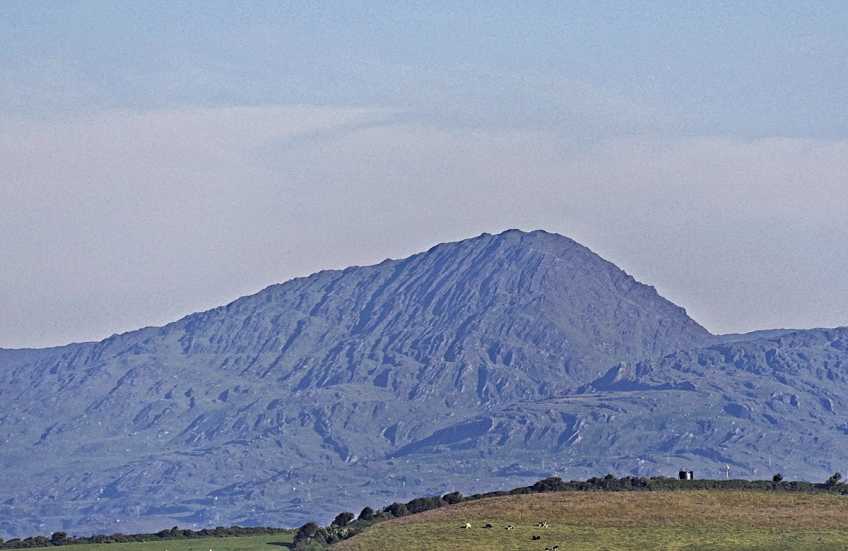
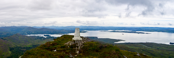
The Sugarloaf with its whitewashed pillar stands sentry over Bantry bay.
The bay itself has seen the devils own share of history and tragedy.
The town of Bantry was the place where an attempt to land and launch a rebellion was made by a French fleet, with Wolfe Tone, in December 1796. The French fleet consisting of 43 ships carrying 15,000 troops had divided mid-Atlantic into smaller groups to avoid interception by the Royal Navy with orders to reform at Bantry Bay. The bulk of the fleet arrived successfully, but several ships, including the flagship Fraternité carrying General Hoche were delayed. While awaiting their arrival, bad weather intervened and the lack of leadership, together with uneasiness at the prospect of being trapped, forced the decision to return to France. Tone wrote of the expedition in his diary, saying that "We were close enough to toss a biscuit ashore." The square in Bantry is today named after Wolfe Tone.

On January 8, 1979, 50 people were killed when the French oil tanker Betelgeuse, offloading at Whiddy Island caught fire, exploded, and broke into three pieces.

The bay has had numerous shipwrecks over the years. In 1981, while clean up efforts using sonar sweeps for the Betelgeuse were under way, the wreck of the French frigate La Surveillante, which had been scuttled during a storm north of Whiddy Island on 2 January 1797, was found Linkback: mountainviews.ie/summit/319/comment/6074/
Read Less
Read More

Sugarloaf from the west
by liz50 22 Jun 2015
On a bright clear day in June we decided to climb Sugarloaf mountain in West Cork. Initially our intention was to access it from the south west spur at B (V859 516) but were confronted by a No Entry sign on a gate. Travelling west along the road we came across a forestry road running uphill at LtBeg St (V84955 51210). There is parking for a couple of cars by a brown sign for Leitrim Beg standing stone. Following the track height was gained quickly and easily to C (V84939 52151) where the track ends. An old fence runs north for approx 500m where it joins the re-routed Beara way at D (V84950 52612). Follow the well marked (with yellow posts) Beara way for about a km with short diversions to take in the summit of Nareera SW top by Lough Keel and Nareera before leaving the Beara way at E (V86229 53270) to the South East and over the summit of Sugarloaf west top. Drop down to the col at F (V86770 52799) before the final ascent to Sugarloaf and spectacular views over Glengarriff, Bantry Bay and beyond. We retraced our steps taking the opportunity to 'bag' Sugarloaf mountain far west top on the way back. A round trip of approx 10km Linkback: mountainviews.ie/summit/319/comment/18156/
Read Less
Read More

            MountainViews.ie picture about Sugarloaf Mountain (<em>Gabhal Mhór</em>)
Picture: Sugarloaf from the west
A superb route that deserves to be better known
by IainT 6 Feb 2019
I followed Liz50's description (below) from the west, starting up the forestry track from the Leitrim Beg standing stone ( LtBeg St (V849 512)). This takes you quickly up onto the higher reaches of Nareera, where sheep tracks run up to the SW Top above Lough Keel, a brilliant viewpoint. I detoured north to take in Nareera N Top for bagging reasons, but it's probably a better walk if you don't. A cornucopia of rocky lumps and bumps and wild perched lochans takes you round to Sugarloaf itself and another stunning summit view. Because of the access problems lower down it's best to retrace your steps over the first two bumps then use the re-routed Beara Way to get back to Nareera N Top and an easy descent. As good a way of spending a (longish) half day as you're likely to find anywhere. Linkback: mountainviews.ie/summit/319/comment/20409/
Read Less
Read More

            MountainViews.ie picture about Sugarloaf Mountain (<em>Gabhal Mhór</em>)
Picture: View from Sugarloaf Beara
Bantry Bay View
by davsheen 1 Jan 2017
View from Sugarloaf Beara over Bantry Bay with Doughill, Douce and Shehy Mor hills visible in the distance. Linkback: mountainviews.ie/summit/319/comment/18758/
Read Less
Read More

            MountainViews.ie picture about Sugarloaf Mountain (<em>Gabhal Mhór</em>)
simon3 on Sugarloaf Mountain
by simon3 27 May 2003
When you finally reach Sugarloaf's top you find that it has this unusual brightly painted white trig pillar shown in the picture. The mountain in the background is Toberavanaha, almost as high as Sugarloaf, but not nearly as well known. Linkback: mountainviews.ie/summit/319/comment/517/
Read Less
Read More
EDIT Point of Interest
text
Videos

Recent Contributions
x
Conditions and Info
Use of MountainViews is governed by conditions and a privacy policy.
Read general information about the site.
Opinions in material here are not necessarily endorsed by MountainViews.
Hillwalking is a risk sport. Information in comments, walks, shared GPS tracks or about starting places may not be accurate for example as regards safety or access permission. You are responsible for your safety and your permission to walk.
See the credits and list definitions.

OSi logo
OSNI/LPS logo
Open Street Map
(Various variations used.)
British summit data courtesy:
Database of British & Irish Hills