Donation Request 2024
You do not have to be logged in to donate.
DONATE
Members and Supporters, the MountainViews Committee requests your help to meet the costs of the website and of other activities such as insured events or publications.You do not have to be logged in to donate.
Welcome to MountainViews
If you want to use the website often please enrol (quick and free) at top right.
If you want to use the website often please enrol (quick and free) at top right.
Overview

For more map options click on any overview map area or any detail map feature.
Detail Map Features
Find Suggested Walks
Find hill, mountain, island, coastal feature.
Videos

Recent Contributions
 Get Notifications
Get Notifications
Cunnigar: Short trek to summit
 Fergalh
Westtown Hill: Tramore's Highest Point
 DeirdreM
Lobawn Loop - Clockwise avoids any steep ascent! Easy stream crossing.
Knockbrinnea West Top: Eflanagan on the Knockbrinneas
 eflanaga
Knockbrinnea West Top: Larger Twin
 Collaborative entry
Walk on tracks above Glendalough
 ceadeile
Ascending the Knockbrinneas from the north.
 simon3
Knockaunanattin West Top: Views, loughs and a navigational aid.
 simon3
Circumnavigation of Tawny Rower
 glencree
Knockaunanattin West Top: First step to Stumpa Duloigh
 Collaborative entry
Knockaunanattin West Top: Impressive defile start leads to airy ridgeline.
 Peter Walker
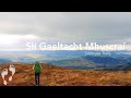
Near Church Mountain, Wicklow (Ireland)
Conditions and Info
Use of MountainViews is governed by conditions and a privacy policy.
Read general information about the site.
Opinions in material here are not necessarily endorsed by MountainViews.
Hillwalking is a risk sport. Information in comments, walks, shared GPS tracks or about starting places may not be accurate for example as regards safety or access permission. You are responsible for your safety and your permission to walk.
See the credits and list definitions.
 Visit our Facebook page.
Video display
Derrynasaggart
Area Cen: Knocknabro Subarea
Place count in area: 24,
OSI/LPS Maps: 79
Highest place: The Paps East, 694m
Maximum height for area: 694 metres,
Maximum prominence for area: 623 metres,
Places in area Derrynasaggart:
Cen: Knocknabro:Knocknabro East Top 530mKnocknabro NE Top 535mKnocknabro West Top 592mKnocknagowan 574m
N: Caherbarnagh:Caherbarnagh 681mCaherbarnagh East Top 549mCaherbarnagh NW Top 668mClaragh Mountain 452mCurracahill 478m
SE: Mullaghanish:Ballyvouskill 401mKnockacommeen 426mKnockullane 462mKnockullane East Top 408mMullaghanish 649mMullaghanish North-East Top 586.4mMullaghanish Far North-East Top 558.5m
SW: Coomagearlahy:Knockbwee 461mCummeenboy 442mCoomagearlahy 506mCoomagearlahy West Top 462mDereenaculling 303m
W: The Paps:Coolcurtoga 425mThe Paps East 694mThe Paps West 690m
Note: this list of places includes island features such as summits, but not islands as such.
Highest place:
The Paps East, 694mPlaces in area Derrynasaggart:
Cen: Knocknabro:
Knocknabro East Top 530mKnocknabro NE Top 535mKnocknabro West Top 592mKnocknagowan 574mN: Caherbarnagh:
Caherbarnagh 681mCaherbarnagh East Top 549mCaherbarnagh NW Top 668mClaragh Mountain 452mCurracahill 478mSE: Mullaghanish:
Ballyvouskill 401mKnockacommeen 426mKnockullane 462mKnockullane East Top 408mMullaghanish 649mMullaghanish North-East Top 586.4mMullaghanish Far North-East Top 558.5mSW: Coomagearlahy:
Knockbwee 461mCummeenboy 442mCoomagearlahy 506mCoomagearlahy West Top 462mDereenaculling 303mW: The Paps:
Coolcurtoga 425mThe Paps East 694mThe Paps West 690mNote: this list of places includes island features such as summits, but not islands as such.

Bedrock type: Green sandstone & purple siltstone, (Glenflesk Chloritic Sandstone Formation)
This is the highest of the three tops of Knocknabro. The peak marked as Knocknabro on OSi maps is somewhat lower (530m) than this peak. The origin of the name is uncertain. John O’Donovan suggested Cnoc na Bró, ‘hill of the quern’, though without any explanation of the name. Another possibility is that the final element is the same as in Broemountain. In Welsh briw means ‘cut’ or ‘wound’. This may refer to the declivity between the two peaks which forms a pass between Rathmore to the N and the Clydagh Valley to the S. See also Broemountain, Inishnabro and Brow Head. Knocknabro West Top is the 314th highest place in Ireland.
Linkback: https://mountainviews.ie/summit/292/
COMMENTS for Knocknabro West Top (Cnoc na Breo (mullach thiar)) 1 of 1  Follow this place's comments

|
|
|
|
||
| MountainViews.ie, a Hill-walking Website for the island of Ireland. 2400 Summiteers, 1480 Contributors, maintainer of lists: Arderins, Vandeleur-Lynams, Highest Hundred, County Highpoints etc | |||