Donation Request 2024

DONATE
Members and Supporters, the MountainViews Committee requests your help to meet the costs of the website and of other activities such as insured events or publications.

You do not have to be logged in to donate.

Welcome to MountainViews
If you want to use the website often please enrol (quick and free) at top right.
Overview
Detail
Zoom: ??
For more map options click on any overview map area or any detail map feature.
Find Suggested Walks
Find hill, mountain, island, coastal feature.
Videos


Recent Contributions
Get Notifications

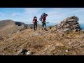
Cunnigar: Short trek to summit

Westtown Hill: Tramore's Highest Point

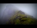
Knockbrinnea West Top: Eflanagan on the Knockbrinneas

Ascending the Knockbrinneas from the north.

Knockbrinnea West Top: Larger Twin

Knockaunanattin West Top: Views, loughs and a navigational aid.

Lobawn Loop - Clockwise avoids any steep ascent! Easy stream crossing.

Knockaunanattin West Top: First step to Stumpa Duloigh

Walk on tracks above Glendalough

Knockaunanattin West Top: Impressive defile start leads to airy ridgeline.

Ireland's County Second Summits

More EastWest names added for summits.

Conditions and Info
Use of MountainViews is governed by conditions and a privacy policy.
Read general information about the site.
Opinions in material here are not necessarily endorsed by MountainViews.
Hillwalking is a risk sport. Information in comments, walks, shared GPS tracks or about starting places may not be accurate for example as regards safety or access permission. You are responsible for your safety and your permission to walk.
See the credits and list definitions.
Video display
Brandon Group Area   S: Ballysitteragh Subarea
Place count in area: 15, OSI/LPS Maps: 70, EW-DC, EW-DW 
Highest place:
Brandon, 951.7m
Maximum height for area: 951.7 metres,     Maximum prominence for area: 934 metres,

Note: this list of places includes island features such as summits, but not islands as such.
Rating graphic.
Beennabrack Mountain Macha na gCab A name in Irish, also Binn na mBroc an extra EastWest name in Irish (Ir. Macha na gCab [OSI], 'plain of the beaks') Kerry County in Munster Province, in Arderin Beg, Vandeleur-Lynam Lists, Cross-bedded sandstone Bedrock

Height: 608.5m OS 1:50k Mapsheet: 70 Grid Reference: Q46865 05372
Place visited by 205 members. Recently by: DeirdreM, Sarahjb, maoris, Carolineswalsh, Tuigamala, ToughSoles, Barrington1978, Jai-mckinney, Carolyn105, SmirkyQuill, learykid, bagoff, CusackMargaret, farmerjoe, chelman7
I have visited this place: NO (You need to be a logged-in member to change this.)

Longitude: -10.239485, Latitude: 52.179367 , Easting: 46866, Northing: 105372 Prominence: 23m,  Isolation: 0.9km
ITM: 446849 605426,   GPS IDs, 6 char: Bnbrck, 10 char: Benabrack
Bedrock type: Cross-bedded sandstone, (Coumeenoole Sandstone Formation)

The Irish name Macha na gCab and the anglicised name Beennabrack have very different meanings. It seems unlikely that they originally referred to the same feature. An Seabhac gives the name Binn na mBroc ('peak of the badgers') for this hill (TCCD, 143, 233), which shows that Beennabrack is a corruption. He does not mention Macha na gCab.   Macha na gCab is the 269th highest place in Ireland. Macha na gCab is the most southerly summit in the Brandon Group area.

Linkback: https://mountainviews.ie/summit/273/
COMMENTS for Beennabrack (Macha na gCab) 1 of 1  
Follow this place's comments
MountainViews.ie Picture about mountain Beennabrack (<i>Macha na gCab</i>) in area Brandon Group, Ireland
Picture: pic:padodes - view north from the summit
 
Easy Climb from the South
Short Summary created by Onzy  20 Aug 2014
Beennabrack is situated on the southern end of the Brandon ridge just north of the Conor Pass.

The hill can be reached from a number of directions. Most easily, it is hard to ignore the Conor Pass carpark (Q490 056 starA) - already at a height of c.400m, the summit should take no more than 30mins from here. Head west over An Bhinn Dubh.

More interesting is an approach from the north as the last significant hill in a north-south traverse of the Brandon ridge beginning at Masatiompan and ending at the Conor Pass. Any of the typical starting points for Brandon itself could be used. A full traverse of the ridge will take 6-7 hours one way.

A further approach is possible from the east - a circular walk beginning at Mullaghveal (Q470 068 starB) and climbing north to Gearhane before swinging southwest along the ridge to Ballysitteragh and Beennabrack, descending to the Conor Pass and returning via the Cloghane Valley. Allow 4-5 hours for this. Linkback: https://mountainviews.ie/summit/273/comment/5033/
 
MountainViews.ie Picture about mountain Beennabrack (<i>Macha na gCab</i>) in area Brandon Group, Ireland
jackill on Beennabrack, 2004
by jackill  22 Aug 2004
Coming down from the Brandon ridge at Fallaghnamara , Q459 078 starC ,623m.
Looking down the valley you can see Loch Dubh, Loch Geal, Loch Tarbh cut into the hillside above,Loch Ui Fhiannachta and the corner of Loch Neil Phadraig.The Summit of Ballysitteragh is just out of shot on the extreme right , Beenabracks summit is in the centre of the shot over Loch Geal with the Connor pass over the right hand corner of Loch Ui Fhiannachta ,behind the pass is Slievanea.You can make out where the tarred road ends at the farm at the end of the Pilgrims Route in the area of green fields between Loch Ui Fhiannachta and Loch Geal. There is plenty of room to park a few cars by the side of the road just before you get to the farmyard. The dwellings in the farmyard are uninhabited except for a few dogs the farmer working the land keeps there for rounding up his sheep, these dogs are locked in when the farmer is not there. After the farm there is a bridge over the stream and a gate with a stile , the road has changed to a rough track that leads over the gap to the Dingle side of the Mountains to Na Gleanna Thuaidh. Linkback: https://mountainviews.ie/summit/273/comment/1110/
Your Score: Very useful <<  >>Average
 
MountainViews.ie Picture about mountain Beennabrack (<i>Macha na gCab</i>) in area Brandon Group, Ireland
 
padodes on Beennabrack, 2008
by padodes  9 Jan 2008
This view northwards, from the top of Beennabrack, shows the full extent of the valley leading to the sea at Cloghane. A tongue of Loch Tarbh is sticking out at the foot of the cliffs. After that the ground falls away steeply to the valley floor, with Loch Ui Fhiannachta and Loch Neil Phadraig beyond. To the left of the photo, the white thread of the Pilgrims' Route is just visible, skirting the end of a ridge leading up to Gearhane. Linkback: https://mountainviews.ie/summit/273/comment/2941/
Your Score: Very useful <<  >>Average
 
MountainViews.ie Picture about mountain Beennabrack (<i>Macha na gCab</i>) in area Brandon Group, Ireland
padodes on Beennabrack, 2008
by padodes  9 Jan 2008
Looking across a stretch of Loch Ui Fhiannachta (Clogharee Lough), one can see the dark form of Beennabrack rising up behind. What is not visible is the little corry lake she holds in her lap: Loch Tarbh (Lough Coumeenoughter). Nearly all the lakes and mountain tops in this area seem to have both an Irish name and a very different anglicised alternative. Further back, to the right of Beennabrack, is Ballysitteragh Mountain (An Scraig). Coming from Cloghane, one can walk into this valley along the "Pilgrims' Route", as it's called in the OS 70 map, and up to the saddle on the right. From there, a fine walk can be had by skirting the north-facing cliffs of Ballysitteragh, Beennabrack and An Bhinn Dubh, right across to the Connor Pass. After that, a few hundred yards down the Connor Hill Road, it is easy to cross the fence to the left and circle back over the valley beneath the same brooding mountains, passing between Loch Ui Fhiannachta and Loch Neil Phadraig and then onto the Pilgrims' Route again. My own photo was taken at this stage of the walk. I have never experienced any access problem here. There is much to explore at the head of this valley, with the ruins of a good deal of human habitation gradually merging back into nature. Linkback: https://mountainviews.ie/summit/273/comment/2940/
Your Score: Very useful <<  >>Average
 
Great round to Brandon Peak.
by nickywood  6 Jan 2022
Visited in September 2021 on the way round to Brandon Peak, enjoyed the walk very much on a partly cloudy day but got away with it. Easy Climb up from the Conor Pass and great round of hills. Came back the hard way via the valley and river crossing was tricky - probably best avoid that. Linkback: https://mountainviews.ie/summit/273/comment/23378/
Your Score: Very useful <<  >>Average
 
MountainViews.ie Picture about mountain Beennabrack (<i>Macha na gCab</i>) in area Brandon Group, Ireland
Picture: A view of Beenabrack and Ballysitteragh from below Gearhane to the North
 
Steep Cliffs to the North
by Bunsen7  26 Jul 2021
It's a shame that I've only summitted this particular top in thick mist but on a subsequent fair weather hike to Gearhane to the north I captured this image which gives a fair impression of the cliffs above Loch Duff.

It also highlights the low prominence of Beenabrack (relative to Ballysitteragh), just 23 metres drop according to the stats in the MV detail.

If I remember it well, it's boggy, and there's a fence along the cliffs with a path almost the whole way from the Conor Pass. Linkback: https://mountainviews.ie/summit/273/comment/23226/
Your Score: Very useful <<  >>Average
 
(End of comment section for Beennabrack (Macha na gCab).)

OSi logo OSNI/LPS logo
Some mapping:
Open Street Map
(Various variations used.)
British summit data courtesy:
Database of British & Irish Hills
(Creative Commons Licence)
MountainViews.ie, a Hill-walking Website for the island of Ireland. 2400 Summiteers, 1480 Contributors, maintainer of lists: Arderins, Vandeleur-Lynams, Highest Hundred, County Highpoints etc