Donation Request 2024
You do not have to be logged in to donate.
DONATE
Members and Supporters, the MountainViews Committee requests your help to meet the costs of the website and of other activities such as insured events or publications.You do not have to be logged in to donate.
Welcome to MountainViews
If you want to use the website often please enrol (quick and free) at top right.
If you want to use the website often please enrol (quick and free) at top right.
Overview

For more map options click on any overview map area or any detail map feature.
Detail Map Features
Showing 10 of a total of 28 items:
Roscahill Hill 56m, Claggan Hill 53m, Inishturkbeg 51m, Rostoohy Hill 51m, Collan More 46m, Inishlaughil 43m, Island More 42m, Clynish 42m, Rosbarnagh Island 37m, Inishdaff 31m,
Roscahill Hill 56m, Claggan Hill 53m, Inishturkbeg 51m, Rostoohy Hill 51m, Collan More 46m, Inishlaughil 43m, Island More 42m, Clynish 42m, Rosbarnagh Island 37m, Inishdaff 31m,
Find Suggested Walks
Find hill, mountain, island, coastal feature.
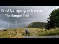
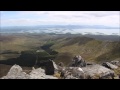
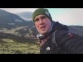
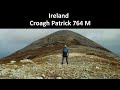
Videos
Recent Contributions
 Get Notifications
Get Notifications
Cunnigar: Short trek to summit
 Fergalh
Westtown Hill: Tramore's Highest Point
 DeirdreM
Lobawn Loop - Clockwise avoids any steep ascent! Easy stream crossing.
Knockbrinnea West Top: Eflanagan on the Knockbrinneas
 eflanaga
Knockbrinnea West Top: Larger Twin
 Collaborative entry
Walk on tracks above Glendalough
 ceadeile
Ascending the Knockbrinneas from the north.
 simon3
Knockaunanattin West Top: Views, loughs and a navigational aid.
 simon3
Circumnavigation of Tawny Rower
 glencree
Knockaunanattin West Top: First step to Stumpa Duloigh
 Collaborative entry
Knockaunanattin West Top: Impressive defile start leads to airy ridgeline.
 Peter Walker
Near Church Mountain, Wicklow (Ireland)
Conditions and Info
Use of MountainViews is governed by conditions and a privacy policy.
Read general information about the site.
Opinions in material here are not necessarily endorsed by MountainViews.
Hillwalking is a risk sport. Information in comments, walks, shared GPS tracks or about starting places may not be accurate for example as regards safety or access permission. You are responsible for your safety and your permission to walk.
See the credits and list definitions.
 Visit our Facebook page.
Video display
Mayo Islands
Area
Place count in area: 102,
OSI/LPS Maps: 22, 23, 24, 30, 31, 37, 38, CBE, CBW, EW-ACC
Highest place: Inishturk, 189.3m
Places in area Mayo Islands:
An Teach Beag 84mAn tOighean 78mAnnagh Island (2) 23mAnnagh Island (1) 14mBallybeg 5mBarranagh Island 7mBartragh Island 26mBills Rocks 5mBlack Rock (3) 71mCaher Island 5mCalf Island (2) 25mCarraig na Faola 45mCarrickawilt 9mCarrickmoylenacurhoga 10mCarricknaglamph 16mCarricknaweelion 20mCarrigee 11mClynish 42mCollan Beg 25mCollan More 46mCone Island South 15mCrovinish 23mDerrinish 21mDorinish Beg 15mDorinish More 25mDún Briste 50mDuvillaun Beg 14mDuvillaun Mór 60mEagle Island 55mErris Head Island 55mFinnaun Island 5mFreaghillan East 13mFreaghillan West 19mFrehil Island 17mGaghta Island 8mGovern island 10mHeath Island 5mHorse Island (2) 25mIllanambraher 25mIllanataggart 28mIllanballa 5mIllancroagh 8mIllanmaw 15mIllannaconney 13mInishaghoo 14mInishbee 29mInishbiggle 34mInishbollog 18mInishcannon 25mInishcarrick 21mInishcooa 27mInishcoragh 24mInishcorky 14mInishcuill 26mInishdaff 31mInishdalla 5mInishdasky 31mInishdaugh 23mInishdeashbeg 15mInishdeashmore 19mInishdegil Beg 12mInishdegil More 32mInishdoonver 26mInisheeny 22mInisherkin 30mInishfesh 26mInishgallon 45mInishglora 22mInishgort (1) 29mInishgowla 28mInishgowla South 21mInishilra 18mInishimmel 15mInishkea North 24mInishkee 26mInishlaghan 5mInishlaughil 43mInishleague 27mInishlyre 26mInishmolt 16mInishnacross 36mInishoo 29mInishquirk 44mInishraher 33mInishturk (1) 189.3mInishturkbeg 51mInniscottle Island 26mIsland More 42mKid Island 86mKnocknaskea (Inishkea South) 72mLeamareha 7mMoynish More 37mNo Name Island 8mPig Island (1) 55mRoeillaun (1) 30mRosbarnagh Island 37mRosmore Island 28mRossnafinna Island 5mRusheen Island 9mShanvallybeg 20mStags of Broadhaven (central) 97mStags of Broadhaven South 94m
Note: this list of places includes island features such as summits, but not islands as such.
Highest place:
Inishturk, 189.3mPlaces in area Mayo Islands:
An Teach Beag 84mAn tOighean 78mAnnagh Island (2) 23mAnnagh Island (1) 14mBallybeg 5mBarranagh Island 7mBartragh Island 26mBills Rocks 5mBlack Rock (3) 71mCaher Island 5mCalf Island (2) 25mCarraig na Faola 45mCarrickawilt 9mCarrickmoylenacurhoga 10mCarricknaglamph 16mCarricknaweelion 20mCarrigee 11mClynish 42mCollan Beg 25mCollan More 46mCone Island South 15mCrovinish 23mDerrinish 21mDorinish Beg 15mDorinish More 25mDún Briste 50mDuvillaun Beg 14mDuvillaun Mór 60mEagle Island 55mErris Head Island 55mFinnaun Island 5mFreaghillan East 13mFreaghillan West 19mFrehil Island 17mGaghta Island 8mGovern island 10mHeath Island 5mHorse Island (2) 25mIllanambraher 25mIllanataggart 28mIllanballa 5mIllancroagh 8mIllanmaw 15mIllannaconney 13mInishaghoo 14mInishbee 29mInishbiggle 34mInishbollog 18mInishcannon 25mInishcarrick 21mInishcooa 27mInishcoragh 24mInishcorky 14mInishcuill 26mInishdaff 31mInishdalla 5mInishdasky 31mInishdaugh 23mInishdeashbeg 15mInishdeashmore 19mInishdegil Beg 12mInishdegil More 32mInishdoonver 26mInisheeny 22mInisherkin 30mInishfesh 26mInishgallon 45mInishglora 22mInishgort (1) 29mInishgowla 28mInishgowla South 21mInishilra 18mInishimmel 15mInishkea North 24mInishkee 26mInishlaghan 5mInishlaughil 43mInishleague 27mInishlyre 26mInishmolt 16mInishnacross 36mInishoo 29mInishquirk 44mInishraher 33mInishturk (1) 189.3mInishturkbeg 51mInniscottle Island 26mIsland More 42mKid Island 86mKnocknaskea (Inishkea South) 72mLeamareha 7mMoynish More 37mNo Name Island 8mPig Island (1) 55mRoeillaun (1) 30mRosbarnagh Island 37mRosmore Island 28mRossnafinna Island 5mRusheen Island 9mShanvallybeg 20mStags of Broadhaven (central) 97mStags of Broadhaven South 94mNote: this list of places includes island features such as summits, but not islands as such.

Landing grid ref.: L93200 90700
Reachable "On Foot " N
Firewood Island?
Linkback: https://mountainviews.ie/island/2171/
COMMENTS for Illannaconney (Oileán an Chonnaidh) 1 of 1  Follow this place's comments

|
|
|
|
||
| MountainViews.ie, a Hill-walking Website for the island of Ireland. 2400 Summiteers, 1480 Contributors, maintainer of lists: Arderins, Vandeleur-Lynams, Highest Hundred, County Highpoints etc | |||