Members and Supporters, the MountainViews Committee requests your help to meet the costs of the website and of other activities such as insured events or publications.
Feature count in area: 65, all in Kerry,
OSI/LPS Maps: 78, 83, 84, 85, EW-KNP, EW-R
Highest Place: Stumpa Dúloigh 784m
Starting Places (66) in area Dunkerron Mountains: Ballaghasheen Coilte, Ballaghasheen Pass Viewpoint, Ballaghbeama Gap, Bohacullia, Bridia Valley End, Cahersavane Road, Cahersavane Schoolhouse, Cloon Lough NE, Cloon Lough SE, Coad Cemetery, Coad Road End, Com an Chiste, Coomaclarig Bridge, Coomnahorna River, Coomyanna Bridge, Dereenavurrig, Derreendarragh Church, Derrynane Quay, Dunkerron Mid, Eagles Lough Access Trailhead, Esknaloughoge Forest Trailhead, Fermoyle Farm, Foot Stick Ford Road, Gap of Dunloe Head of, Glashaknockbrassel Stream, Glasheenoultagh Stream, Gortaclohane Lane End, Gortaclohane Lane NE Branch, Gortagowan Wood, Gowlane School Ruin, Gowlanes Wood, Graces Landing, Inchimore West, Isknagahinney Lough E, Kenmare Bridge, Knockanamadane, Knockanaskill N, Knocknasullig, Knocknsallagh Bridge, Laghtacallow, Lissatinnig Bridge Boreen, Looscaunagh Lough W, Lough Barfinnihy CP, Lough Brin S, Lough Coomeen SE, Lough Dromtine NE, Lough Dromtine SE, Lough Fada N, Lough Iskanamacteery N, Lough Iskanamacteery NW, Lough Reagh N, Maghanlawaun Bridia Valley, Molls Gap, Ochtiabh Road, Poulacapple, River Owroe Source, River Sneem Fermoyle Loop, Rossacoosane Mid, Sahaleen Bridge, Scarriff Island, Shamrock Farmhouse B&B, Sneem, Tooreenboy Lough, Tooreennafersha Mid, Tooreennafersha South, Waterville Promenade
Summits & other features in area Dunkerron Mountains: Knocknagantee Near West Top 628m Cen: An Bheann Mhór: An Bheann Mhór 674.7m, An Bhinn Láir 514m, Coomcallee 648.9m, Beann na Stiocairí 673.1m, Coomnahorna 590m, Glanbeg 485.8m, Slievenashaska 578m, Slievenashaska South Top 565.4m Cen: Knocknagantee: Knockmoyle 682.1m, Finnararagh 667m, Cnoc Breasail 591m, Knocknagantee 674.3m, Knocknagantee West Top 553m, Coomnacronia 636m, Coomura Mountain 666m Cen: Mullaghanattin: An Cnoc Riabhach 534m, Beann 752m, Beann Far SW Top 636.2m, Beann NE Top 692m, Beann South Top 639m, Beann SW Top 657m, Sallagh 570m, Mullaghanattin 773m, Mullaghanattin East Top 594m, Sallagh South-West Top 543m E: Kenmare: Gortamullin 205m, Knockanaskill 356m, Letter South 362m N: Knocknacusha: Knocknacusha 547m NE: Knocknabreeda Ridge: Crossderry 489m, Knocknabreeda 569m, Mothaillín 506m NE: Knocknagapple: Bascadh 595m, Bascadh West Top 569m, Boughil 631m, Cnoc na gCapall 639m, Knocklomena 641m NE: Stumpa Dúloigh: Broaghnabinnia 745m, Knockaunanattin 569m, Knockaunanattin West Top 466.1m, Stumpa Dúloigh 784m, Stumpa Dúloigh SE Top 780m, Stumpa Dúloigh SW Top 663m SW: Caherdaniel: Farraniaragh Mountain 468m, Eagle Hill 155m, Reenearagh 162m, Beenarourke 304m, Knocknasullig 117m, Cahernageeha Mountain 498.7m SW: Coad ( Castle Cove ): Beenrour 418m, Eagles Hill 549m, Mullaghbeg 509m SW: Coomduff: Coomduff 244m SW: Deenish: Deenish Island (2) 144m SW: Esknaloughoge: Esknaloughoge 416m, Esknaloughoge North Top 420m SW: Scarriff: Scarriff Island 252m SW: Sneem: An Bheann Mhór 309.3m, Dereenavurrig Hill 261m, Knockanamadane 270m, Knocknafreaghane 316.5m, Knocknagullion 413m SW: Staigue: Staigue Top 459m, Staigue NE Top 435m
Note: this list of places may include island features such as summits, but not
islands as such.
Knocklomena, 641mMountain Cnoc an Mheannáin A name in Irish,
Place Rating ..
(Ir. Cnoc an Mheannáin [TH], 'hill of the kid (goat)'), Kerry County in Munster province, in Arderin, Vandeleur-Lynam Lists, Knocklomena is the 217th highest place in Ireland.
Grid Reference V79750 76568,
OS 1:50k mapsheet 78 Place visited by: 116members, recently by: rhw, maoris, ToughSoles, Krzysztof_K, jackos, Beti13, bagoff, Hjonna, chelman7, Patbrdrck, tryfan, derekfanning, nickywood, Superterence, garv60
I visited this place: NO (You need to be a logged-in member for this.)
Longitude: -9.748858, Latitude: 51.928765, Easting: 79750, Northing: 76568,
Prominence: 406m, Isolation: 1.7km ITM: 479727 576628 Bedrock type: Green sandstone & siltstone, (St. Finans Sandstone Formation) Notes on name: In the OS Name Book John O'Donavan suggests the derivation Cnoc Lomannach [JOD], 'hill of the pinnacle'. This would account for the anglicised form Knocklomena. There seems to be some confusion between Ir. meannán, 'a kid goat' and mionnán, 'a pinnacle'.
Short or GPS IDs, 6 char: Kncklm, 10 char: Kncklmn Linkback: https://mountainviews.ie/summit/208/
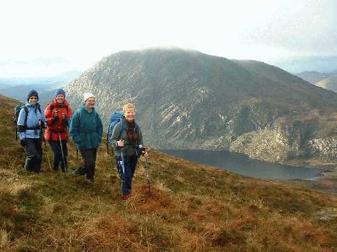
Gallery for Knocklomena (Cnoc an Mheannáin) and surrounds
Summary
for Knocklomena (Cnoc an Mheannáin):
Out on its own
Summary created by jackill
2010-10-14 07:53:58
Park at a little layby at A (V80532 77882) room for 3 or 4 cars . Walked up the road
a short distance to B (V80608 78026) cross the sheep wire and head up the mountain on a rough track to another fence.
Cross this fence and then follow it all the way to Knocklomenas summit.
This mountain is most closely related to the ridge east of it, extending to Boughil. An easy climb of about 350 metres can be made over grassy slopes from the East. More direct approaches from above the lake not for the faint-hearted. Descent to the south is feasible with caution. Photo 2 shows Mullaganattin seen from the summit in a 180mm equivalent lens. Photo 3 is remarkable in that in combines a clear-air view of the Reeks with a Brocken Spectre. Unique in my experience (29-12-03.) Linkback: mountainviews.ie/summit/208/comment/799/
Read Less
Read More
sbender on Knocklomena
by sbender
8 Jun 2009
Yes it's the obvious gully. It's a real scramble. You can stay in the gully for first 1/3, here you'll meet a very slippery rockface. I went south from gully to get around this. Up higher, I crossed the gully to the north after I got stuck. I was on my own, but if you would go with more people and ropes, you be able to complete the climb. Good luck!! Linkback: mountainviews.ie/summit/208/comment/3830/
Read Less
Read More
Easier descent route available
by glencree
25 Jun 2021
Followed Jackill's suggested ascent by the sheep fence (B (V80608 78026)), which is a stiff climb but does not require scrambling - there are wonderful views of the nearby summits on the way up and eastwards to Beara and the Kenmare river from the summit. On the descent, it's much easier to come down the grassy slope parallel to the fence and about 20m east. This leads down to the grassy track which can be followed back to the entry point. Linkback: mountainviews.ie/summit/208/comment/23176/
Climbed Knocklomena today as part of a ring walk (not exactly a horse shoe). Approached from the west side of Lough Fadda, up the gully. Got up as far as 3/4 had to divert then to the north. Too much steep rock (overhanging in places). It was worth the try though! you would have to bring ropes to complete the last part. Linkback: mountainviews.ie/summit/208/comment/3827/
Use of MountainViews is governed by conditions and a privacy policy.
Read general information about the site. Opinions in material here are not necessarily endorsed by MountainViews.
Hillwalking is a risk sport. Information in comments, walks, shared GPS tracks or about starting places may
not be accurate for example as regards safety or access permission. You are responsible for your safety and your permission to walk.
See the credits and list definitions.


 Our Facebook page.