Members and Supporters, the MountainViews Committee requests your help to meet the costs of the website and of other activities such as insured events or publications.
Starting Places (16) in area South East Midlands: Ballinvarry West, Clodiagh Church, Coolnahau, Coppanagh Wood South, Freney's Well, Glynn, Gorlough Wood, Hill of Allen, Inistioge, Killamery Wood East, Kylebeg Wood, Lingaun River, Mount Alto Wood, Mullenbeg Wood South, Newtown Upper School, Slievenamon Walk Head
Summits & other features in area South East Midlands: E: Barrow: Clogrennan Hill 336m, Newtown Hill 208m N Cen: Timahoe Hills: Ballaghmore Hill 268m, Cullenagh Mountain 317m, Fossy Mountain 332m, Hewson Hill 261m N: Croghan: Croghan Hill 234m N: Newbridge Hills: Dunmurry Hill 233m, Hill of Allen 219m S: Mullinavat: Coolnahau Hill 265m, Corbally Hill 285m, Mount Alto 276m, Tory Hill 292m S: Slievenamon: Knockahunna 502.8m, Sheegouna 553.5m, Slievenamon 720.2m, Slievenamon North-West Top 564m S: Windgap: Carricktriss Gorse 314m, Carrigadoon Hill 296.9m, Faranaree Hill 283m SE: Brandon Hill: Brandon Hill 515m, Coppanagh 365m, Croghan 365m W Cen: Durrow: Ballynalacken Hill 314m, Caponellan Hill 253m, Knockmannon Hill 315m W Cen: Slieveardagh: Clomantagh Hill 349m, Knocknamuck 340m, Monabrogue 284m W: Horse & Jockey: Kill Hill 241m, Killough 235m
Note: this list of places may include island features such as summits, but not
islands as such.
Croghan, 365mHill
Place Rating ..
, Kilkenny County in Leinster province, in Binnion Lists, Croghan is the 1028th highest place in Ireland. Croghan is the third highest point in county Kilkenny.
Grid Reference S66346 45538,
OS 1:50k mapsheet 68 Place visited by: 23members, recently by: John.geary, Beti13, dregish, melohara, ceadeile, finkey86, Nakoz, conormcbandon, Barry28213, Pepe, bbarry2015, bryanjbarry, GoldCircle, frankmc04, simon3
I visited this place: NO (You need to be a logged-in member for this.)
Short or GPS IDs, 6 char: Crg366, 10 char: Croghan Linkback: https://mountainviews.ie/summit/1086/
Gallery for Croghan and surrounds
Summary
for Croghan :
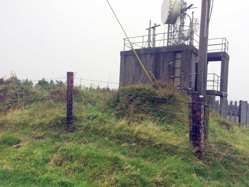
Wooded summit with a few good views and large telecoms installations.
Summary created by simon3
2014-09-08 11:03:11
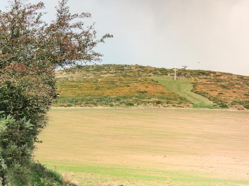
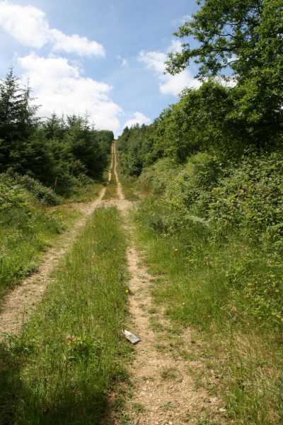
Picture: View of the summit from the south.
This is a mainly wooded summit with an extensive telecoms setup at the top. There are some views. Park at the forest entrance around A (S6711 4589). The shortest way up is to walk back along the road to B (S6694 4570) where there is a steep vehicle track leading directly to the summit.
It is also possible to walk along a forest road to the summit from the forest entrance. Enter the forest and take the first turn left. This route goes round the NW ridge that extends from the summit before reaching the top. Do not attempt to take any tempting short cut through the trees because there is extensive wind damage with blown-over trees sometimes covered in brambles.
Parking at the entrance to the Coillte forest which also is the main access to the masts.Following the main track uphill allows you to reach the summit without the need to enter private lands.Nice views to Brandon Hill.
Round trip time: around 30 to 40 mins. Linkback: mountainviews.ie/summit/1086/comment/17504/
Read Less
Read More
Picture: Summit area Croghan KIlkenny
A pleasant 6 kms walk on good forest tracks
by ceadeile
6 Oct 2019
Plenty of parking at C (S67033 45777).
The shortest way up is from B (S6694 4570) where there is a steep vehicle track leading directly to the summit but as one nears the summit this track has become overgrown with gorse and briars. It is also quite steep and slippery in places One can overcome these difficulties if sufficiently determined or stubborn but a more pleasant walk is available over good forest tracks as follows.
Enter forest at D (S67108 45895). After around 60 metres , at E (S67075 45937), turn SW (left) and walk for 200m to where the track swings round NW. Keep following the track for 1725 metres to a junction at F (S65483 46245).
Turn SE (left) and follow track for 1150m to the summit.
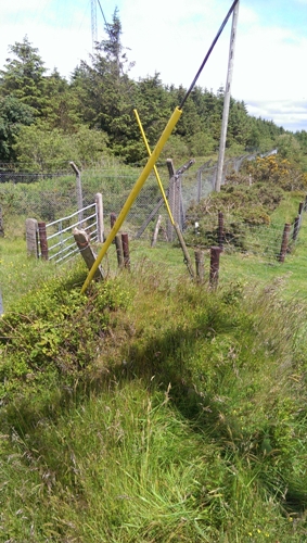
The highest point seems to be between two electricity supply poles Linkback: mountainviews.ie/summit/1086/comment/20662/
Read Less
Read More
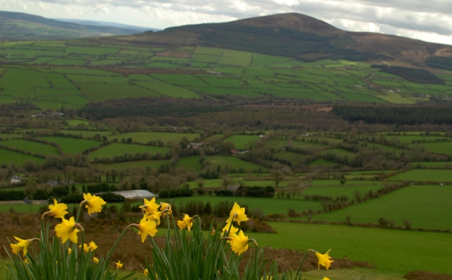
Picture: View to Brandon Hill from Croghan
Nice views from Cross
by eamonoc
5 Apr 2014
Climbed Friday 4/4/2014, started at G (S66395 44840), take the R703 Thomastown road out of Graiguenamanagh, at Coppenagh gap crossroads take right onto Dungarvan road, there is a 1798 monument at this crossroads. Croghan is clearly visible from here, after large two story house on the right take a right turn and drive uphill with Croghan to the left until a white bungalow with a black surrounding fence is reached, just across the road from this there is a metal gate giving acces to a really green grassy field with a white cross above in a prominent position uphill. Head steeply up to cross, pass it and onto higher ground, A vast array on communication masts are visible to the NE head towards them over some rough ground to summit area. Total time from car to car 25mins, and a distance of approx 1.5km Linkback: mountainviews.ie/summit/1086/comment/15967/
Read Less
Read More
Straightforward short walk
by katekat
30 Jun 2014
Following the way up according to sandman, very straigtforward walk up and down to the summit masts. Loved the views of Blackstairs Mts. and Brandon Hill, wow. Linkback: mountainviews.ie/summit/1086/comment/17522/
Use of MountainViews is governed by conditions and a privacy policy.
Read general information about the site. Opinions in material here are not necessarily endorsed by MountainViews.
Hillwalking is a risk sport. Information in comments, walks, shared GPS tracks or about starting places may
not be accurate for example as regards safety or access permission. You are responsible for your safety and your permission to walk.
See the credits and list definitions.


 Our Facebook page.