Donation Request 2024

DONATE
Members and Supporters, the MountainViews Committee requests your help to meet the costs of the website and of other activities such as insured events or publications.

You do not have to be logged in to donate.

Welcome to MountainViews
If you want to use the website often please enrol (quick and free) at top right.
Overview
Detail
Zoom: ??
For more map options click on any overview map area or any detail map feature.
Find Suggested Walks
Find hill, mountain, island, coastal feature.
Videos


Recent Contributions
Get Notifications

Carran NE Top: Approach via wind farm tracks

Lobawn Loop - Clockwise avoids any steep ascent! Easy stream crossing.

Long Island: No sign of the Great Gatsby

Walk on tracks above Glendalough

Knockree: Reasonably clear path to summit

Circumnavigation of Tawny Rower

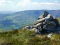
Little Sugar Loaf: Windy at the top

Aganny Top: Approach from SW

Near Church Mountain, Wicklow (Ireland)

Keeloges: Go and enjoy.

Keeloges-Aganny loop

Ireland's County Second Summits

Conditions and Info
Use of MountainViews is governed by conditions and a privacy policy.
Read general information about the site.
Opinions in material here are not necessarily endorsed by MountainViews.
Hillwalking is a risk sport. Information in comments, walks, shared GPS tracks or about starting places may not be accurate for example as regards safety or access permission. You are responsible for your safety and your permission to walk.
See the credits and list definitions.
Suggested Walks Starting on the detail map above. Hopefully useful.
Choose type(s)
Important Note: Walks presented here are members shared tracks shown in the hope that they may be useful to you but with no guarantee. You need to determine whether any given track is appropriate for you and your party as per these conditions.
Video display
Dublin Area   S: Kippure & Kilbride Subarea
Place count in area: 18, OSI/LPS Maps: 43, 50, 56, AWW, EW-DM, EW-WE, EW-WW 
Highest place:
Kippure, 757m
Maximum height for area: 757 metres,     Maximum prominence for area: 262 metres,

Note: this list of places includes island features such as summits, but not islands as such.
Rating graphic.
Seefingan Mountain Suí Fingain A name in Irish, also Suí Fionnagáin, also Shankill Mountain an extra EastWest name in English (Ir. Suí Fingain [OSNB*], 'Fingan's seat') Dublin/ Wicklow County in Leinster Province, in Arderin, Vandeleur-Lynam, Irish Highest Hundred Lists, Fine-grained granodiorite to granite Bedrock

Height: 722.9m OS 1:50k Mapsheet: 56 Grid Reference: O08667 16980
Place visited by 701 members. Recently by: rhw, Courin, KateLeckie, MeabhTiernan, knightsonhikes, Deirdreb, taramatthews, davidrenshaw, Prem, Magic, Carolineswalsh, Nailer1967, ElaineM76, MarionP, Tommer504
I have visited this place: NO (You need to be a logged-in member to change this.)

Longitude: -6.374931, Latitude: 53.192444 , Easting: 308668, Northing: 216981 Prominence: 101.45m,  Isolation: 1.5km
ITM: 708593 717010,   GPS IDs, 6 char: Sfngn, 10 char: Seefingan
Bedrock type: Fine-grained granodiorite to granite, (Type 1 granodiorite)

Seefingan, like Seefin and Seahan, has a large megalithic cairn on its summit.   Seefingan is the second highest mountain in the Dublin area and the 96th highest in Ireland. Seefingan is the second highest point in county Dublin.

Linkback: https://mountainviews.ie/summit/92/
COMMENTS for Seefingan (Suí Fingain) 1 2 3 Next page >>  
Follow this place's comments
MountainViews.ie Picture about mountain Seefingan (<i>Suí Fingain</i>) in area Dublin, Ireland
Picture: Seefingan from the north ridge.
 
Boggy cairned summit at crossroads of a few routes in NW Wicklow
Short Summary created by markmjcampion, simon3  3 May 2023
Seefingan sits at the meeting of three boggy ridges: Corrig to the N, Seefin to SW and Kippure to the E. The route to Kippure can be particularly boggy after rain. Around 400m W of the summit is an impressive collapsed megalithic tomb. A particular hazard here is that to the NW of the summit is Kilbride Camp with an actively used rifle range. Shown on the OS 1:50k, OSM maps (but not the OSI 1:10k, as on MV) this should be avoided. Great views of the Blessington Lakes, the other hills of the West Wicklow range, south to Mullaghcleevaun and E to Kippure and Sugarloaf.
The going in these hills can be v soft after prolonged rain.

W. Usually Seefingan would be reached at part of a longer walk eg. starting from O06299 16818 starA, going over Seefin to Seefingan and possibly further. Allow 90 mins to top.

NW. Start at O07338 20095 starB and head for Seahan and Corrig before heading S to Seefingan. ! hr 45mins+ depending on conditions underfoot. Finish by heading for Seefin and then WNW down to the road followed by a 2k roadwalk.

S. Park at the gates of the Kippure Estate and follow the track across the road. This eventually leads into heavy forest with a lot of deeply rutted tracks and felled trees. The best option is to head to the river bank (Athdown Brook) and climb up along the left side bank of it. 1.5 hrs

SW. Follow forest tracks to Seefin from O06819 14480 starC and head NE to Seefingan from here. 2 hrs

Notable tracks – the circular track/2846, track/2493 and track/2924 Linkback: https://mountainviews.ie/summit/92/comment/4852/
 
MountainViews.ie Picture about mountain Seefingan (<i>Suí Fingain</i>) in area Dublin, Ireland
Picture: Towards Mullaghcleevaun Ridge from Seefingan.
Homerclesse on Seefingan, 2010
by Homerclesse  28 Mar 2010
I encorporated Seefingan as a Circular route of Seefin, Seefingan, Kippure and the Coronation Plantation.
There a couple of approaches. My favourite is to park at the gates of the Kippure Estate and follow the track across the road. This eventually leads into heavy forest with a lot of deeply rutted tracks and felled trees. The best option is to head to the river bank (Athdown Brook) and climb up along the left side bank of it. A nice view behind you to the Coronation Plantation and the Mullaghcleevaun Range. Once you clear the line of trees on the left then it's simply a matter of heading a little north of west to the summit Seefin. Alternatively, head straight up the side of the summit till you reach Seefingan marked by a very interesting Cairn. Great views of the Blessington Lakes, the other hills of the West Wicklow range, south to Mullaghcleevaun and east to Kippure and Sugar Loaf. If you want it's possible to head to Kippure easily visible to the east with it's huge aerial and then head roughly 220 degrees back down following the Sraghoe Brook, to the Sally Gap and back to the car.

An alternative route is to park on the west side of Seefin at the gates and go straight up the Forest track. Although it will be a up and down walk to your car this way. Linkback: https://mountainviews.ie/summit/92/comment/4546/
Your Score: Very useful <<  >>Average
 
MountainViews.ie Picture about mountain Seefingan (<i>Suí Fingain</i>) in area Dublin, Ireland
 
simon3 on Seefingan, 2002
by simon3  23 Dec 2002
This icy view appeared en-route from Seefingan to Seefin one cold December day. The hill to the right of the first post is Sorrell Hill. Starting on the skyline to the right of Sorrell there is Slievecorragh (418m - beside Hollywood), below that is Lugnagun (446m) a spur of Sorrell. The rising ground to the right of the picture is Seefin. Linkback: https://mountainviews.ie/summit/92/comment/249/
Your Score: Very useful <<  >>Average
 
MountainViews.ie Picture about mountain Seefingan (<i>Suí Fingain</i>) in area Dublin, Ireland
csd on Seefingan, 2003
by csd  6 Jul 2003
Seefingan in summer. Picture shows the summit cairn and trig pillar, with Sorrell Hill in the background. The route up from Athdown brook was made almost unbearable by the flies - the price we pay for nice summer weather I suppose! Linkback: https://mountainviews.ie/summit/92/comment/578/
Your Score: Very useful <<  >>Average
 
MountainViews.ie Picture about mountain Seefingan (<i>Suí Fingain</i>) in area Dublin, Ireland
Picture: Pillar atop the cairn on Seefingan
 
paulocon on Seefingan, 2009
by paulocon  16 Dec 2009
A pretty handy walk across from Seefin with only a small amount of boggy land to be encountered on the lowest point between the two hills. The cairn is a similar size to that on Seefin and while it doesn't contain a passage, an indentation to the East hints that perhaps it did at some stage. The cairn is actually positioned away from the summit proper and it would appear this was done to make it visible from around the valley. The summit proper is a short trot across some very boggy land to the east and is marked by a triangular Military Range sign. Linkback: https://mountainviews.ie/summit/92/comment/4295/
Your Score: Very useful <<  >>Average
 
MountainViews.ie Picture about mountain Seefingan (<i>Suí Fingain</i>) in area Dublin, Ireland
Picture: atop the cairn on Seefingan
Hilltop 2 on Kilbride range loop
by markod  30 Dec 2014
As part of the looped walk (Kilbride military range) this was the second top, the walk across benefitted from the hard frosts of the previous nights.. This could be quite boggy in places(descending from Seefin) although on the accent to the top it's not too bad. Another fine cairn of circa 5000 years ago.... Linkback: https://mountainviews.ie/summit/92/comment/17779/
Your Score: Very useful <<  >>Average
 
COMMENTS for Seefingan (Suí Fingain) 1 2 3 Next page >>
(End of comment section for Seefingan (Suí Fingain).)

OSi logo OSNI/LPS logo
Some mapping:
Open Street Map
(Various variations used.)
British summit data courtesy:
Database of British & Irish Hills
(Creative Commons Licence)
MountainViews.ie, a Hill-walking Website for the island of Ireland. 2400 Summiteers, 1480 Contributors, maintainer of lists: Arderins, Vandeleur-Lynams, Highest Hundred, County Highpoints etc